Category:Routeburn Track
Jump to navigation
Jump to search
English: The Routeburn Track is a world-renowned hiking track found on the South Island of New Zealand. The track is usually completed by starting on the Queenstown side of the Southern Alps, at the northern end of Lake Wakatipu, and finishing on the Te Anau side, at The Divide near Hollyford valley, several kilometres from the Homer Tunnel to Milford Sound. DoC docu
world-renowned tramping (hiking) 32 km track found in the South Island of New Zealand  | |||||
| Upload media | |||||
| Instance of | |||||
|---|---|---|---|---|---|
| Located in protected area | |||||
| Location |
| ||||
| Length |
| ||||
| Terminus | |||||
| official website | |||||
 | |||||
Subcategories
This category has the following 6 subcategories, out of 6 total.
E
- Earland Falls (New Zealand) (11 F)
F
- Forge Flat (2 F)
K
- Key Summit (13 F)
L
- Lake Harris (9 F)
X
- Mount Xenicus (9 F)
Media in category "Routeburn Track"
The following 19 files are in this category, out of 19 total.
-
 Fern clearning (6706369493).jpg 4,000 × 3,000; 5.28 MB
-
 Fern clearning (6706370519).jpg 4,000 × 3,000; 5.39 MB
-
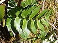 Gingidia montana PC230173.jpg 4,000 × 3,000; 2.24 MB
-
 Gingidia montana PC230175.jpg 4,000 × 3,000; 2.44 MB
-
 Grassy flat (6706373369).jpg 4,000 × 3,000; 2.97 MB
-
 Harris Saddle Routeburn Track New Zealand (152474867).jpeg 2,048 × 879; 864 KB
-
 Humboldt Mountains, South Island, New Zealand.jpg 1,000 × 669; 151 KB
-
 Lake Howden on the Routeburn Track.jpg 4,896 × 3,264; 6.77 MB
-
 New Zealand - Flickr - GregTheBusker.jpg 3,072 × 2,304; 2.02 MB
-
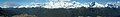
 Panoramic mountain view from the Routeburn Track.jpg 5,542 × 894; 2.29 MB
-
 Pass Creek Track Fiordland National Park.jpg 3,456 × 4,608; 7.5 MB
-
 Pass Creek Track.jpg 3,456 × 4,608; 7.67 MB
-
 Routeburn Classic 2013 finish line.jpg 2,592 × 1,728; 1.52 MB
-
 Routeburn Track (Key Summit) 2 (261409029).jpg 1,280 × 960; 210 KB
-
 Routeburn Track banner Panoramic Mountain View.jpg 4,905 × 701; 1.64 MB
-
 Routeburn Track bridge.jpg 4,000 × 3,000; 5.41 MB
-
 Routeburn Track sign.jpg 2,048 × 1,536; 665 KB
-
 Routeburn-Track-Profile.png 2,500 × 700; 887 KB
-
 Sugarloaf Track Rockburn Track Sign.jpg 3,456 × 4,608; 7.12 MB


.jpg)
.jpeg)


_2_(261409029).jpg)


.jpg)
.jpg)