Category:Route nationale 10F (Luxembourg)
Jump to navigation
Jump to search
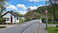
.jpg) D'N10F vun der Bréck aus a Richtung Bëttel gekuckt  | |||||
| Upload media | |||||
| Instance of | |||||
|---|---|---|---|---|---|
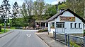
| Location | Tandel, Canton of Vianden, Luxembourg | ||||
| Maintained by |
| ||||
| Length |
| ||||
 | |||||
Subcategories
This category has only the following subcategory.
B
Media in category "Route nationale 10F (Luxembourg)"
The following 4 files are in this category, out of 4 total.
-
 Bettel, route nationale 10F (101).jpg 3,911 × 2,201; 2.62 MB
-
 Bettel, route nationale 10F (102).jpg 3,911 × 2,201; 3.26 MB
-
 Bettel, route nationale 10F (103).jpg 4,032 × 2,268; 4.9 MB
-
 N10F Luxembourg.svg 512 × 344; 1 KB
.jpg)
.jpg)