Category:Route 478 (Japan)
Jump to navigation
Jump to search
road in Kyoto prefecture, Japan | |||||
| Upload media | |||||
| Instance of | |||||
|---|---|---|---|---|---|
| Location | Kyoto Prefecture, Japan | ||||
| Transport network | |||||
| Connects with |
| ||||
| Maintained by |
| ||||
| Start time |
| ||||
| Length |
| ||||
| Terminus |
| ||||
| Said to be the same as | Kyoto-Jukan Expressway | ||||
| Partially coincident with |
| ||||
 | |||||
日本語: 日本の国道478号に関するカテゴリ。
Subcategories
This category has the following 3 subcategories, out of 3 total.
K
M
Media in category "Route 478 (Japan)"
The following 9 files are in this category, out of 9 total.
-
Japanese National Route Sign 0478.svg 455 × 435; 11 KB
-
Kumiyama-Yodo IC 2.jpg 2,088 × 1,496; 211 KB
-
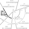
Location map of Kyoto Daini Soto Kanjo Road.png 1,600 × 1,600; 74 KB
-
R171-161.jpg 2,485 × 1,398; 412 KB
-
R372-010.jpg 1,500 × 843; 326 KB
-
R478Onigiri.jpg 2,592 × 1,944; 844 KB
-
Ujigawa River from train of Keihan Main Line 2.jpg 3,870 × 2,903; 2.32 MB
-
Ujigawa River from train of Keihan Main Line 3.jpg 3,938 × 2,954; 2.3 MB
-
Ujigawa River from train of Keihan Main Line.jpg 3,869 × 2,902; 1.98 MB


