Category:Route 34 (Japan)
Jump to navigation
Jump to search
road in Japan   | |||||
| Upload media | |||||
| Instance of | |||||
|---|---|---|---|---|---|
| Location | |||||
| Transport network | |||||
| Connects with |
| ||||
| Maintained by | |||||
| Start time |
| ||||
| Length |
| ||||
| Terminus | |||||
| Partially coincident with |
| ||||
 | |||||
English: Category for the National Route 34 of Japan
日本語: 国道34号に関するカテゴリ
Subcategories
This category has the following 4 subcategories, out of 4 total.
H
- Hotarujaya Station (11 F)
S
- Shindaiku-machi Station (3 F)
- Shinnakagawa-machi Station (2 F)
- Suwa-jinja Shrine Station (10 F)
Media in category "Route 34 (Japan)"
The following 51 files are in this category, out of 51 total.
-
 Azalea Valley in Mifuneyama Garden 6.jpg 4,032 × 3,024; 4.02 MB
-
 E34 NAGASAKI-EXP TosuIC for Route34 Entrance.jpg 2,048 × 1,152; 1.87 MB
-
 Enchoji Sluice on Ushizuegawa River.jpg 3,954 × 2,966; 3.03 MB
-
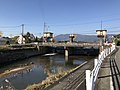
 Ezugaribashi Bridge on Ushizuegawa River.jpg 4,032 × 3,024; 2.95 MB
-
 Hokubu bypass of Japan route 34 in Hyogo-kita Saga.JPG 3,200 × 2,400; 678 KB
-
 Hot air balloons are flying over Kase Ohashi and Chiyosuzume Shuzo 2016-11-05.jpg 4,842 × 3,632; 7.56 MB
-
 Japan National Route 34 in front of Mifuneyama Garden 2.jpg 3,873 × 2,905; 4.96 MB
-
 Japan National Route 34 in front of Mifuneyama Garden.jpg 4,032 × 3,024; 2.67 MB
-
 Japan National Route 34 near Kurumebunki Crossroads 2.jpg 4,032 × 3,024; 2.96 MB
-
 Japan National Route 34 near Kurumebunki Crossroads.jpg 4,032 × 3,024; 2.64 MB
-
 Japan National Route 34 near Rokubeiyama Crossroads 2.jpg 4,032 × 3,024; 2.77 MB
-
 Japan National Route 34 near Rokubeiyama Crossroads.jpg 4,002 × 3,002; 3.3 MB
-
 Japan National Route 34 near Tashiro Park Crossroads.jpg 4,032 × 3,024; 3.1 MB
-
 Japan National Route 34 near Yoshinogari-Koen Station.jpg 3,912 × 2,934; 2.95 MB
-
 Japan National Route 34 near Yoshinogaricho-Tade Crossroads.jpg 4,003 × 3,002; 3.41 MB
-
 Japanese National Route Sign 0034.svg 455 × 435; 10 KB
-
 Kanzaki Bridge of National Route No.34.jpg 4,000 × 2,000; 4.13 MB
-
 Nagasaki Higashisonogi - Saga Ureshino border.jpg 3,264 × 2,448; 1.3 MB
-
 Nagasaki tramway (213) 20160508.jpg 1,008 × 1,500; 1.32 MB
-
 R034-011.jpg 1,647 × 926; 468 KB
-
 R034-091.jpg 1,500 × 844; 286 KB
-
 R034-124.jpg 1,600 × 901; 210 KB
-
 R034-126.jpg 1,500 × 844; 190 KB
-
 R034-189.jpg 2,736 × 1,536; 1.09 MB
-
 R034-235.jpg 1,600 × 901; 293 KB
-
 R034-255.jpg 1,500 × 844; 283 KB
-
 R034-284.jpg 1,800 × 1,013; 257 KB
-
 R034-301.jpg 2,736 × 1,536; 1.24 MB
-
 R034-370.jpg 1,500 × 844; 231 KB
-
 R034-378.jpg 1,600 × 900; 271 KB
-
 R034-397.jpg 1,600 × 900; 235 KB
-
 R034-428.jpg 1,500 × 844; 239 KB
-
 R034-439.jpg 2,736 × 1,536; 947 KB
-
 R203-008.jpg 1,975 × 1,111; 427 KB
-
 Route 34 in Nabeshima, Saga.jpg 4,842 × 3,632; 1.84 MB
-
 Route 34 Kohoku bypass near Shuku intersection.jpg 5,280 × 3,520; 10.3 MB
-
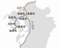 Route34 ja.png 500 × 402; 51 KB
-
 Route34 Nagasaki City Office Street.jpg 1,440 × 810; 508 KB
-
 Route34 Omura Kubara 01.jpg 1,440 × 810; 361 KB
-
 Saga Ureshino - Nagasaki Higashisonogi border.jpg 3,264 × 2,448; 1.34 MB
-
 Sagakita Police Station Intersection in 2022.jpg 3,900 × 2,600; 6.03 MB
-
 Sunrise Street 2023-08.jpg 3,900 × 2,600; 2.59 MB
-
 Takeo Bypass commercial street.jpg 2,400 × 1,800; 1.24 MB
-
 Takeo Bypass in front of Takeo Onsen Bussankan.jpg 3,300 × 2,200; 1.87 MB
-
 Ushizuegawa River near Takayanagibashi Bridge 1.jpg 3,975 × 2,982; 2.91 MB
-
 Utagakinohashi of Route 34 in Takeo.jpg 2,800 × 1,867; 1.03 MB
-
 View from Azalea Valley in Mifuneyama Garden 1.jpg 4,032 × 3,024; 4.92 MB
-
 View from Azalea Valley in Mifuneyama Garden 2.jpg 4,006 × 3,005; 4.81 MB
-
 View of Takeo Post Office.jpg 3,958 × 2,969; 3.2 MB
-
 Yushuku Intersection, Ureshino.jpg 4,032 × 2,688; 2.7 MB
-
 武雄市木ノ元西交差点付近 - panoramio.jpg 1,600 × 1,200; 596 KB


_20160508.jpg)


