Category:Rousham
Jump to navigation
Jump to search
village and civil parish in West Oxfordshire, England  | |||||
| Upload media | |||||
| Instance of | |||||
|---|---|---|---|---|---|
| Location | West Oxfordshire, Oxfordshire, South East England, England | ||||
| Population |
| ||||
 | |||||
English: Rousham is a village and civil parish beside the River Cherwell in Oxfordshire. The village is about north of Kidlington. The parish is bounded by the River Cherwell in the east, the A4260 main road between Oxford and Banbury in the west, partly by the B4030 in the north, and by field boundaries with Tackley parish in the south.
Subcategories
This category has the following 3 subcategories, out of 3 total.
Media in category "Rousham"
The following 75 files are in this category, out of 75 total.
-
 Arable field by the A4260 - geograph.org.uk - 2565349.jpg 640 × 480; 77 KB
-
 Arable field near Rousham - geograph.org.uk - 3950207.jpg 1,500 × 999; 181 KB
-
 Arable field near Rousham - geograph.org.uk - 4078361.jpg 1,500 × 999; 238 KB
-
 Arable field near Rousham - geograph.org.uk - 4078363.jpg 1,500 × 999; 256 KB
-
 Banbury Road approaching Hopcroft's Holt - geograph.org.uk - 6730888.jpg 1,565 × 1,041; 1.34 MB
-
 Banbury Road by Maiden Bower - geograph.org.uk - 4057824.jpg 1,500 × 999; 217 KB
-
 Banbury Road by Maiden Bower - geograph.org.uk - 4078358.jpg 1,500 × 999; 254 KB
-
 Banbury Road by Rousham Gap - geograph.org.uk - 6730887.jpg 1,664 × 1,109; 743 KB
-
 Banbury Road to Deddington - geograph.org.uk - 4057827.jpg 1,500 × 999; 165 KB
-
 Banbury Road to Oxford - geograph.org.uk - 4078360.jpg 1,500 × 999; 259 KB
-
 Barn at Park Farm - geograph.org.uk - 5259736.jpg 1,024 × 683; 160 KB
-
 Barn beside road at Park Farm - geograph.org.uk - 5259759.jpg 1,024 × 683; 145 KB
-
 Benchmark on barn at Park Farm - geograph.org.uk - 5259723.jpg 1,024 × 662; 286 KB
-
 Benchmark on roadside barn at Park Farm - geograph.org.uk - 5259747.jpg 662 × 1,024; 292 KB
-
 Benchmark on Rousham Park gatepost - geograph.org.uk - 4921921.jpg 658 × 1,024; 312 KB
-
 Benchmark on St James's Church - geograph.org.uk - 5259808.jpg 683 × 1,024; 328 KB
-
 Benchmark on stone stile - geograph.org.uk - 4919024.jpg 1,024 × 683; 185 KB
-
 Cattle looking out of Rousham Park - geograph.org.uk - 3950229.jpg 1,500 × 942; 173 KB
-
 Field of rape near Rousham - geograph.org.uk - 3950204.jpg 1,500 × 999; 216 KB
-
 Field of rape near Rousham - geograph.org.uk - 3950208.jpg 1,500 × 999; 277 KB
-
 Garden Cottages (geograph 6964893).jpg 1,600 × 1,200; 579 KB
-
 Gates along the edge of Rousham Park - geograph.org.uk - 4522939.jpg 1,024 × 776; 316 KB
-
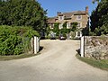
 Gateway into Rousham Park - geograph.org.uk - 4921972.jpg 1,024 × 678; 260 KB
-
 Home Farm Cottages in Rousham - geograph.org.uk - 4522875.jpg 1,024 × 794; 264 KB
-
 Home Farm in the Cherwell valley - geograph.org.uk - 4522868.jpg 1,024 × 716; 210 KB
-
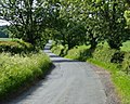
 Lane along the edge of Rousham Park - geograph.org.uk - 4522950.jpg 1,024 × 669; 303 KB
-
 Lane in the village of Rousham - geograph.org.uk - 4522889.jpg 1,024 × 867; 409 KB
-
 Lane near Home Farm Cottages in Rousham - geograph.org.uk - 4522882.jpg 1,024 × 803; 309 KB
-
 Lane through woodland - geograph.org.uk - 5192723.jpg 640 × 480; 284 KB
-
 Lane to the Astons - geograph.org.uk - 5192719.jpg 640 × 480; 192 KB
-
 Lodge with cowhouse (geograph 6965866).jpg 1,600 × 1,200; 613 KB
-
 Lower Heyford - geograph.org.uk - 31588.jpg 600 × 450; 120 KB
-
 Minor road to Rousham - geograph.org.uk - 3950213.jpg 1,500 × 999; 192 KB
-
 Oxford Canal - geograph.org.uk - 125266.jpg 640 × 480; 103 KB
-
-
 Road west from Lower Heyford - geograph.org.uk - 2565341.jpg 640 × 480; 113 KB
-
 Rousham Gap - geograph.org.uk - 4114148.jpg 3,860 × 2,792; 2.31 MB
-
 Rousham House - geograph.org.uk - 2481899.jpg 2,000 × 1,481; 598 KB
-
 Rousham House - geograph.org.uk - 3950228.jpg 1,500 × 999; 250 KB
-
 Rousham House and Park - geograph.org.uk - 4522925.jpg 1,024 × 796; 351 KB
-
 Rousham Park Farmland - geograph.org.uk - 6239283.jpg 1,600 × 1,067; 685 KB
-
 Rousham Park views - geograph.org.uk - 98838.jpg 640 × 480; 98 KB
-
 Signpost on a T junction - geograph.org.uk - 3950211.jpg 1,500 × 999; 299 KB
-
 St James's Church - geograph.org.uk - 5259824.jpg 1,024 × 697; 161 KB
-
 Stone barn at Park Farm - geograph.org.uk - 3950227.jpg 1,500 × 999; 185 KB
-
 Tackley Road to Tackley - geograph.org.uk - 3950206.jpg 1,500 × 999; 177 KB
-
 Temple of Echo (geograph 6963873).jpg 1,200 × 1,600; 626 KB
-
 The B4030 on the bridge over the River Cherwell - geograph.org.uk - 2484347.jpg 2,000 × 1,489; 976 KB
-
 The Dower House, Rousham (geograph 6965856).jpg 1,600 × 1,200; 611 KB
-
 The Holt Hotel - geograph.org.uk - 3950231.jpg 1,500 × 999; 194 KB
-
 The Pyramid House (geograph 6963850).jpg 1,200 × 1,600; 634 KB
-

-
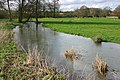
 The River Cherwell - geograph.org.uk - 2484362.jpg 2,000 × 1,500; 1.09 MB
-
 The River Cherwell - geograph.org.uk - 2484366.jpg 2,000 × 1,500; 1.45 MB
-
 The River Dorn near Buswell's Thicket - geograph.org.uk - 358709.jpg 640 × 427; 127 KB
-
 The tree lined Tackley Road - geograph.org.uk - 4522853.jpg 1,024 × 822; 400 KB
-
 Two stiles for footpath towards Rousham - geograph.org.uk - 4919032.jpg 1,024 × 683; 315 KB
-
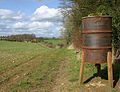 Bird feeder near Buswell's Thicket - geograph.org.uk - 358703.jpg 640 × 490; 130 KB
-
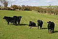 Cattle in field near Tackley - geograph.org.uk - 358721.jpg 640 × 431; 101 KB
-
 Cold Harbor - geograph.org.uk - 647273.jpg 640 × 480; 96 KB
-
 Farmland near Tittenford Bridge - geograph.org.uk - 370366.jpg 640 × 480; 137 KB
-
 Farmland, Rousham - geograph.org.uk - 370360.jpg 640 × 480; 148 KB
-
 Farmland, Rousham - geograph.org.uk - 370361.jpg 640 × 480; 158 KB
-
 Field near Letchmere Cottage - geograph.org.uk - 385443.jpg 640 × 425; 188 KB
-
 Flooded footpath near Tackley - geograph.org.uk - 358717.jpg 640 × 450; 111 KB
-
 Floods near Tittenford Bridge - geograph.org.uk - 358713.jpg 640 × 473; 125 KB
-
 Hillside above Tittenford Bridge - geograph.org.uk - 370367.jpg 640 × 480; 119 KB
-
 Home Farm Cottages - geograph.org.uk - 385448.jpg 640 × 425; 221 KB
-
 Meadow beside the River Dorn - geograph.org.uk - 370364.jpg 640 × 480; 140 KB
-
 Road descending to Tittenford Bridge - geograph.org.uk - 370368.jpg 640 × 480; 162 KB
-
 Road near the Lanket - geograph.org.uk - 358697.jpg 640 × 446; 85 KB
-
 Rousham Gap - geograph.org.uk - 398572.jpg 640 × 480; 130 KB
-
 Steep Hill - geograph.org.uk - 370363.jpg 640 × 480; 147 KB
-
 Steep Hill - geograph.org.uk - 370365.jpg 640 × 480; 168 KB
-
 Stubble near Hopcroft's Holt - geograph.org.uk - 370359.jpg 640 × 480; 163 KB


.jpg)


.jpg)


.jpg)

.jpg)

.jpg)


