Category:Roston, Derbyshire
Jump to navigation
Jump to search
hamlet in Derbyshire, United Kingdom  | |||||
| Upload media | |||||
| Instance of | |||||
|---|---|---|---|---|---|
| Location | Norbury and Roston, Derbyshire Dales, Derbyshire, East Midlands, England | ||||
 | |||||
Media in category "Roston, Derbyshire"
The following 16 files are in this category, out of 16 total.
-
 Bag Lane leaving Lid Lane at Roston - geograph.org.uk - 2947038.jpg 640 × 425; 115 KB
-
 Bag Lane meeting The Hollow at Roston - geograph.org.uk - 2947056.jpg 640 × 425; 107 KB
-
 Can Alley - geograph.org.uk - 366142.jpg 640 × 480; 104 KB
-
 Convert chapel - geograph.org.uk - 380976.jpg 640 × 480; 111 KB
-
 Converted Chapel at Roston - geograph.org.uk - 366139.jpg 640 × 480; 73 KB
-
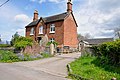
 Cottage for sale - geograph.org.uk - 380979.jpg 640 × 480; 68 KB
-
 Derelict barn in The Hollow at Roston - geograph.org.uk - 2945529.jpg 640 × 425; 114 KB
-
 Disused barn - geograph.org.uk - 380971.jpg 640 × 480; 74 KB
-
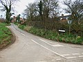
 Left,right or middle - geograph.org.uk - 380968.jpg 640 × 480; 106 KB
-
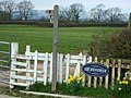
 New House Farm, Mill Lane, Roston - geograph.org.uk - 2945537.jpg 640 × 425; 78 KB
-
 Red Brick Buildings in Roston - geograph.org.uk - 2943980.jpg 640 × 425; 76 KB
-
 Roston and Norbury Derbyshire.jpg 640 × 480; 144 KB
-
 Roston near Norbury Derbyshire.jpg 1,600 × 1,200; 467 KB
-
 Small Reservoir - geograph.org.uk - 380965.jpg 640 × 480; 72 KB
-
 Telecommunications Mast at Roston - geograph.org.uk - 366131.jpg 480 × 640; 65 KB
-
 Village Street at Roston - geograph.org.uk - 2947077.jpg 640 × 425; 70 KB


