Category:Rossie Island
Jump to navigation
Jump to search
English: Rossie Island is a former island in the council area of Angus, Scotland.
settlement and former island in Angus, Scotland, UK | |||||
| Upload media | |||||
| Instance of | |||||
|---|---|---|---|---|---|
| Location | Angus, Scotland | ||||
 | |||||
Media in category "Rossie Island"
The following 57 files are in this category, out of 57 total.
-
 A line of sea defences on the coast of Rossie Island - geograph.org.uk - 6250397.jpg 3,264 × 2,448; 1.34 MB
-
 Alongside Ferryden - geograph.org.uk - 6516060.jpg 4,000 × 2,999; 1.65 MB
-
 Another View of Montrose Basin - geograph.org.uk - 647921.jpg 640 × 480; 64 KB
-
 Beach by the 'White Hoose' on Rossie Island - geograph.org.uk - 6247621.jpg 5,472 × 3,648; 5.35 MB
-
 Beached boats at low tide, Rossie Island - geograph.org.uk - 5816645.jpg 3,264 × 2,448; 2.3 MB
-
 Beached boats by Mops Pool - geograph.org.uk - 5430769.jpg 3,264 × 2,448; 4.37 MB
-
 Binny Bank viewed through the spans of the South Esk viaduct - geograph.org.uk - 6243735.jpg 5,472 × 3,648; 4.34 MB
-
 Boats anchored by the Trout Shot - geograph.org.uk - 6247672.jpg 5,472 × 3,648; 4.11 MB
-
 Bus garage, Rossie Island - geograph.org.uk - 1512156.jpg 640 × 480; 73 KB
-
 Damaged footpath - geograph.org.uk - 5030670.jpg 4,303 × 3,227; 4.93 MB
-
 Erosion of bank near the South Esk Viaduct - geograph.org.uk - 6251211.jpg 3,264 × 2,448; 1.3 MB
-

-
 Grey heron on a mud-bank in Montrose Basin - geograph.org.uk - 6254215.jpg 5,472 × 3,648; 2.54 MB
-
 Heron taking flight from the waters of the Trout Shot - geograph.org.uk - 6251550.jpg 5,472 × 3,648; 4.28 MB
-

-
 Light reflection, by the Trout Shot, in Montrose Basin - geograph.org.uk - 6248517.jpg 5,472 × 3,648; 4.32 MB
-
 Montrose Basin (1) - geograph.org.uk - 5030656.jpg 4,283 × 3,211; 2.64 MB
-
 Montrose Basin (2) - geograph.org.uk - 5030661.jpg 4,320 × 3,240; 3.15 MB
-
 Montrose Basin - geograph.org.uk - 4891204.jpg 3,264 × 2,448; 2.05 MB
-
 Montrose Basin - geograph.org.uk - 5839228.jpg 1,024 × 769; 105 KB
-
 Montrose Basin - geograph.org.uk - 6295249.jpg 1,600 × 1,200; 335 KB
-
 Montrose Harbour - geograph.org.uk - 5274472.jpg 1,600 × 1,200; 353 KB
-
 Montrose Road Bridge - geograph.org.uk - 1093894.jpg 640 × 427; 34 KB
-
 Montrose Viaduct - geograph.org.uk - 5558754.jpg 1,024 × 683; 334 KB
-
 Montrose's bridges (1) - geograph.org.uk - 5029560.jpg 4,229 × 3,171; 2.36 MB
-
 Montrose's bridges (3) - geograph.org.uk - 5029571.jpg 4,273 × 3,205; 2.66 MB
-
 Montrose's bridges (4) - geograph.org.uk - 5029580.jpg 4,263 × 3,197; 2.93 MB
-
 Montrose's bridges (5) - geograph.org.uk - 5029585.jpg 4,320 × 3,240; 2.83 MB
-
 Montrose's bridges (6) - geograph.org.uk - 5029590.jpg 4,320 × 3,240; 3 MB
-
 Montrose's bridges (7) - geograph.org.uk - 5029660.jpg 4,195 × 3,145; 2.69 MB
-
 Montrose's bridges (8) - geograph.org.uk - 5029663.jpg 4,261 × 3,195; 1.98 MB
-
 Mops Pool, Montrose Basin - geograph.org.uk - 6066082.jpg 5,066 × 3,801; 2.77 MB
-
 New Bridge - geograph.org.uk - 5509130.jpg 857 × 579; 77 KB
-
 New Road Bridge over River South Esk - geograph.org.uk - 115656.jpg 640 × 427; 108 KB
-
 Repairs, Montrose Viaduct - geograph.org.uk - 5558757.jpg 1,024 × 683; 213 KB
-
 Rossie Island Coastal Path - geograph.org.uk - 5809310.jpg 3,264 × 2,448; 2.37 MB
-
 Rossie Island shoreline showing a division of surfaces - geograph.org.uk - 6245009.jpg 5,472 × 3,648; 6.7 MB
-
 Sandbanks and Bridges - geograph.org.uk - 5138194.jpg 4,067 × 2,711; 2.2 MB
-
 Ships in Montrose Harbour - geograph.org.uk - 5809334.jpg 3,264 × 2,448; 2.74 MB
-
 South Esk viaduct between Rossie Island and Montrose - geograph.org.uk - 6244402.jpg 5,472 × 3,648; 4.61 MB
-
 Southbound train crossing the South Esk Viaduct by Montrose - geograph.org.uk - 5100725.jpg 3,264 × 2,448; 2.53 MB
-
 Southesk Railway Bridge, Montrose - geograph.org.uk - 5146994.jpg 5,184 × 3,888; 5.93 MB
-
 Sun's reflections on wet mud, Montrose Basin - geograph.org.uk - 5821258.jpg 5,472 × 3,648; 5.74 MB
-
 The railway bridge at Montrose - geograph.org.uk - 5487345.jpg 5,184 × 3,888; 5.1 MB
-
 Tide Out - geograph.org.uk - 5140827.jpg 4,239 × 2,827; 4.59 MB
-
 Train crossing the South Esk Viaduct, Montrose - geograph.org.uk - 5815800.jpg 3,264 × 2,448; 3.01 MB
-
 Tree-lined bank on Rossie Island by the New Bridge - geograph.org.uk - 6245852.jpg 3,264 × 2,448; 1.36 MB
-
 Trout Shot - geograph.org.uk - 406759.jpg 640 × 480; 64 KB
-
 Trout Shot viewed from the shore of Rossie Island - geograph.org.uk - 6246646.jpg 5,417 × 3,611; 5.24 MB
-
 Trout Shot, in Montrose Basin - geograph.org.uk - 6245898.jpg 3,264 × 2,448; 1.53 MB
-
 Underneath the South Esk Viaduct on Rossie Island - geograph.org.uk - 6251491.jpg 3,648 × 5,472; 5.08 MB
-
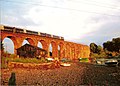 Viaduct at Rossie Island with train.jpg 1,024 × 731; 191 KB
-
 View from Rossie Island beach toward Rossie Spit - geograph.org.uk - 6252376.jpg 5,472 × 3,648; 3.99 MB
-

-
 Wading Birds - geograph.org.uk - 5140927.jpg 4,272 × 2,848; 2.78 MB
-
 Waiting for the Tide - geograph.org.uk - 5140851.jpg 3,868 × 2,578; 2 MB
-
 Wooden posts in the beach by the South Esk Viaduct - geograph.org.uk - 6250442.jpg 3,264 × 2,448; 1.57 MB


_-_geograph.org.uk_-_5030656.jpg)
_-_geograph.org.uk_-_5030661.jpg)


_-_geograph.org.uk_-_5029560.jpg)
_-_geograph.org.uk_-_5029571.jpg)
_-_geograph.org.uk_-_5029580.jpg)
_-_geograph.org.uk_-_5029585.jpg)
_-_geograph.org.uk_-_5029590.jpg)
_-_geograph.org.uk_-_5029660.jpg)
_-_geograph.org.uk_-_5029663.jpg)


