Category:Rooms-Katholieke Begraafplaats Gouda
Jump to navigation
Jump to search
| Object location | | View all coordinates using: OpenStreetMap |
|---|
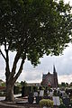
cemetery in Gouda, Netherlands  | |||||
| Upload media | |||||
| Instance of | |||||
|---|---|---|---|---|---|
| Location | Gouda, South Holland, Netherlands | ||||
| Located on street | |||||
 | |||||
| Address |
|
Subcategories
This category has only the following subcategory.
G
Media in category "Rooms-Katholieke Begraafplaats Gouda"
The following 17 files are in this category, out of 17 total.
-
 Gedenksteen voor Belgische vluchtelingen in Gouda.jpg 2,028 × 2,163; 1.38 MB
-
 Graaf Florisweg 126, Gouda. Woonhuis.jpg 2,665 × 2,131; 1.31 MB
-
 Oorlogsgraf Abraham de Korte (detail).jpg 4,032 × 2,268; 2.36 MB
-
 Oorlogsgraf Abraham de Korte.jpg 2,075 × 3,387; 5.89 MB
-
 Oorlogsgraf Johannes Antonius Snoeij.jpg 2,432 × 3,901; 5.63 MB
-
 Rooms-Katholieke Begraafplaats Gouda 01.JPG 4,288 × 2,848; 3.05 MB
-
 Rooms-Katholieke Begraafplaats Gouda 03.JPG 2,848 × 4,288; 3.07 MB
-
 Rooms-Katholieke Begraafplaats Gouda 04.JPG 4,288 × 2,848; 3.09 MB
-
 Rooms-Katholieke Begraafplaats Gouda 05.JPG 4,288 × 2,848; 2.96 MB
-
 Rooms-Katholieke Begraafplaats Gouda 06.JPG 4,288 × 2,848; 3.42 MB
-
 Rooms-Katholieke Begraafplaats Gouda 07.JPG 4,288 × 2,848; 3 MB
-
 Rooms-Katholieke Begraafplaats Gouda 08.JPG 4,288 × 2,848; 2.98 MB
-
 Rooms-Katholieke Begraafplaats Gouda 10.JPG 2,848 × 4,288; 3.01 MB
-
 Rooms-Katholieke Begraafplaats Gouda 12.JPG 2,848 × 4,288; 3.08 MB
-
 Rooms-Katholieke Begraafplaats Gouda 13.JPG 2,848 × 4,288; 3.08 MB
-
 Rooms-Katholieke Begraafplaats Gouda 14.JPG 4,288 × 2,848; 3.36 MB
-
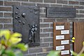
 Tinnen plaatje, Gemeentelijk Oorlogsgraf (Gouda).jpg 1,204 × 1,217; 1.19 MB


.jpg)


.jpg)