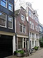
Category:Roomolenstraat 15, Amsterdam
Jump to navigation
Jump to search
| Object location | | View all coordinates using: OpenStreetMap |
|---|
house in Amsterdam, Netherlands  | |||||
| Upload media | |||||
| Instance of | |||||
|---|---|---|---|---|---|
| Location | Amsterdam, North Holland, Netherlands | ||||
| Street address |
| ||||
| Located on street | |||||
| Heritage designation |
| ||||
 | |||||
|
This is a category about rijksmonument number 5038
|
| Address |
|
Media in category "Roomolenstraat 15, Amsterdam"
The following 4 files are in this category, out of 4 total.
-
 Einde, overzicht - Amsterdam - 20020601 - RCE.jpg 807 × 1,200; 149 KB
-
 Voorgevel - Amsterdam - 20020600 - RCE.jpg 806 × 1,200; 181 KB
-
 WLM - andrevanb - amsterdam, roomolenstraat 15 - detail.jpg 1,200 × 757; 403 KB
-
 WLM - andrevanb - roomolenstraat 15.jpg 900 × 1,200; 461 KB


