Category:Rooksdown
Jump to navigation
Jump to search
village in the United Kingdom  | |||||
| Upload media | |||||
| Instance of | |||||
|---|---|---|---|---|---|
| Location | Basingstoke and Deane, Hampshire, South East England, England | ||||
| Population |
| ||||
| official website | |||||
 | |||||
Subcategories
This category has the following 3 subcategories, out of 3 total.
B
P
- Park Prewett Hospital (44 F)
Media in category "Rooksdown"
The following 200 files are in this category, out of 512 total.
(previous page) (next page)-
 'The Deane' sales boards - geograph.org.uk - 659481.jpg 640 × 456; 70 KB
-
 A fence around the construction site - geograph.org.uk - 6493040.jpg 640 × 480; 146 KB
-
 A fence around the construction site - geograph.org.uk - 6493057.jpg 640 × 480; 142 KB
-
 A new agency to me - geograph.org.uk - 2828498.jpg 640 × 480; 90 KB
-
 A pair of marketing suites - geograph.org.uk - 658284.jpg 640 × 454; 67 KB
-
 A Pile of Rubble - geograph.org.uk - 817061.jpg 640 × 468; 59 KB
-
 A vacant unit - geograph.org.uk - 6493083.jpg 640 × 480; 105 KB
-
 A vacant unit - geograph.org.uk - 6493085.jpg 640 × 480; 111 KB
-
 A vacant unit - geograph.org.uk - 6493089.jpg 640 × 480; 112 KB
-

-
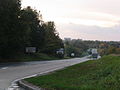
 A339 - looking towards Basingstoke - geograph.org.uk - 701715.jpg 640 × 477; 105 KB
-
 A339 at Basingstoke boundary - geograph.org.uk - 3105425.jpg 640 × 480; 69 KB
-
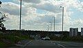
 A340 - Basingstoke approach - geograph.org.uk - 4891581.jpg 1,024 × 750; 131 KB
-
 A340 - geograph.org.uk - 4820439.jpg 640 × 359; 42 KB
-
 A340 near the North Hampshire Hospital.jpg 640 × 480; 67 KB
-
 A340, southbound - geograph.org.uk - 4820437.jpg 640 × 368; 36 KB
-
 A340, southbound - geograph.org.uk - 4820438.jpg 640 × 410; 37 KB
-
 Access for new housing construction - geograph.org.uk - 5509255.jpg 640 × 480; 116 KB
-

-
 Access to new housing - geograph.org.uk - 6495808.jpg 640 × 480; 113 KB
-
 Access to new housing - geograph.org.uk - 6495810.jpg 640 × 480; 108 KB
-
 Access to Nightingale Gardens - geograph.org.uk - 1746525.jpg 640 × 480; 103 KB
-
 Access to the A340 - geograph.org.uk - 2997932.jpg 640 × 480; 79 KB
-
 Advancing housing - geograph.org.uk - 2426767.jpg 640 × 480; 73 KB
-
 Aldermaston Road - geograph.org.uk - 1748095.jpg 640 × 480; 128 KB
-
 Aldermaston Road - geograph.org.uk - 4769916.jpg 1,539 × 1,057; 568 KB
-
 Aldermaston Road - geograph.org.uk - 657378.jpg 640 × 482; 69 KB
-
 All change by the hospital - geograph.org.uk - 4769905.jpg 1,488 × 1,127; 657 KB
-
 Almost hidden - geograph.org.uk - 1264553.jpg 640 × 474; 55 KB
-
 Always rubbish here^ - geograph.org.uk - 3093095.jpg 640 × 480; 82 KB
-
-
 Applying the finishing touches - geograph.org.uk - 3856729.jpg 1,600 × 1,063; 292 KB
-
 Approaching the A339 - geograph.org.uk - 701710.jpg 640 × 454; 73 KB
-
 Ark Conference Centre - geograph.org.uk - 5513122.jpg 640 × 480; 129 KB
-
 Avenue of trees - geograph.org.uk - 657403.jpg 640 × 478; 120 KB
-
 Avenue of trees - geograph.org.uk - 658160.jpg 640 × 474; 130 KB
-
 Avon House - The Square - geograph.org.uk - 6547505.jpg 640 × 480; 129 KB
-
 Back of Basingstoke Hospital - geograph.org.uk - 5513124.jpg 640 × 480; 117 KB
-
 Back of Fairway House - geograph.org.uk - 6495806.jpg 640 × 480; 142 KB
-
 Balsan Close - geograph.org.uk - 3856737.jpg 1,600 × 1,063; 291 KB
-
 Balsan Close at the end of the day - geograph.org.uk - 1541701.jpg 640 × 466; 52 KB
-
 Basswood Drive - geograph.org.uk - 1709484.jpg 800 × 600; 101 KB
-
 Basswood Drive - geograph.org.uk - 1709503.jpg 800 × 598; 86 KB
-
 Bend in the lane - Worting Road Farm - geograph.org.uk - 2313299.jpg 640 × 480; 58 KB
-
 Beware of golf balls - geograph.org.uk - 6495788.jpg 640 × 480; 188 KB
-
 Blocked access - geograph.org.uk - 5513148.jpg 640 × 480; 148 KB
-
 Blocked field access - geograph.org.uk - 2479957.jpg 640 × 480; 82 KB
-

-
 Bridleway to Whitedown - geograph.org.uk - 4933939.jpg 3,264 × 1,840; 1.84 MB
-
 Broken Fence - geograph.org.uk - 817138.jpg 640 × 451; 73 KB
-
 Building at Park Prewett - geograph.org.uk - 2389269.jpg 640 × 427; 188 KB
-
 Building site entrance - geograph.org.uk - 2326736.jpg 640 × 456; 67 KB
-
 Building Site Entrance - geograph.org.uk - 817037.jpg 640 × 463; 50 KB
-
 Building Site Fence - geograph.org.uk - 899358.jpg 640 × 465; 72 KB
-
 Building Site Offices - geograph.org.uk - 817007.jpg 640 × 455; 60 KB
-
 Byway heading towards Basingstoke - geograph.org.uk - 3093074.jpg 640 × 480; 104 KB
-
 Byway heading towards Basingstoke - geograph.org.uk - 3093079.jpg 640 × 480; 104 KB
-
 Byway meets footpath - geograph.org.uk - 3093072.jpg 640 × 480; 110 KB
-
 Byway near country lane - geograph.org.uk - 3093092.jpg 640 × 432; 85 KB
-
 Byway to Whitedown - geograph.org.uk - 686400.jpg 640 × 456; 70 KB
-
 Candover Clinic ^ Radiotherapy Unit - geograph.org.uk - 6547457.jpg 640 × 480; 106 KB
-
 Castle Hill Primary School - geograph.org.uk - 6495209.jpg 640 × 466; 111 KB
-
 Cemetery focal point - geograph.org.uk - 701727.jpg 640 × 458; 86 KB
-
 Cereal crop approaching maturity - geograph.org.uk - 3093080.jpg 640 × 480; 106 KB
-
 Cereal crop approaching maturity - geograph.org.uk - 3093093.jpg 640 × 480; 106 KB
-
 Cleared demolition site - geograph.org.uk - 2997912.jpg 640 × 480; 95 KB
-
 Closed end to Rooksdown Lane - geograph.org.uk - 1747307.jpg 640 × 480; 128 KB
-
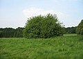
 Clump of trees - geograph.org.uk - 1746812.jpg 640 × 480; 106 KB
-
 Concrete and Grass - geograph.org.uk - 817064.jpg 640 × 458; 83 KB
-
 Construction phase - Limes Park - geograph.org.uk - 1709529.jpg 800 × 560; 101 KB
-
 Construction site fencing - geograph.org.uk - 5509257.jpg 640 × 480; 92 KB
-
 Construction work at Park Prewett - geograph.org.uk - 6495302.jpg 640 × 480; 101 KB
-
 Construction work at Park Prewett - geograph.org.uk - 6495304.jpg 640 × 480; 85 KB
-
 Countryside and rubble - geograph.org.uk - 781696.jpg 640 × 410; 83 KB
-
 Countryside and Rubble - geograph.org.uk - 817055.jpg 640 × 464; 69 KB
-
 Cross in hospital cemetery - geograph.org.uk - 4374505.jpg 640 × 480; 141 KB
-
 Crossing the A339 - geograph.org.uk - 2992736.jpg 640 × 480; 66 KB
-
 Crossing The Avenue - geograph.org.uk - 6493062.jpg 640 × 480; 99 KB
-
 Cycle path to Rooksdown estate - geograph.org.uk - 1746479.jpg 640 × 480; 73 KB
-
 Demolition of Firdale - geograph.org.uk - 6495251.jpg 640 × 480; 112 KB
-

-
 Dever House - geograph.org.uk - 6547500.jpg 640 × 480; 111 KB
-
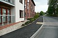
 Dinwoodie Drive - geograph.org.uk - 6547476.jpg 640 × 480; 137 KB
-
 Dinwoodie Drive - The Avenue - geograph.org.uk - 6494014.jpg 640 × 480; 119 KB
-
 Disused track - geograph.org.uk - 6495122.jpg 640 × 480; 145 KB
-
 Disused track - geograph.org.uk - 6495176.jpg 640 × 480; 167 KB
-
 Diversion End - Road Closed^ - geograph.org.uk - 3856747.jpg 4,912 × 3,264; 5.97 MB
-
 Divvy Up - geograph.org.uk - 817032.jpg 480 × 640; 61 KB
-
 Downside Close - geograph.org.uk - 3856731.jpg 1,600 × 1,063; 324 KB
-
 East of Wootton St Lawrence - geograph.org.uk - 4395742.jpg 2,560 × 1,920; 2.07 MB
-
 Edge of development - geograph.org.uk - 659507.jpg 640 × 480; 143 KB
-
 Elder Road - geograph.org.uk - 658459.jpg 640 × 469; 44 KB
-
 Elder Road - geograph.org.uk - 816820.jpg 640 × 456; 60 KB
-
 Elder Road - Park Prewett site - geograph.org.uk - 6494044.jpg 640 × 480; 102 KB
-
 Elder Road - Park Prewett site - geograph.org.uk - 6494074.jpg 640 × 480; 110 KB
-
 Electricity Pole - Park Prewett Road - geograph.org.uk - 817157.jpg 493 × 640; 70 KB
-

-
 Emerging New Homes - geograph.org.uk - 816964.jpg 640 × 461; 61 KB
-
 End of Balsan Close - geograph.org.uk - 1541694.jpg 640 × 480; 71 KB
-
 End of Highpath Way - geograph.org.uk - 1541684.jpg 640 × 480; 69 KB
-
 End of Hollies Court - geograph.org.uk - 816853.jpg 640 × 470; 100 KB
-
 End of Nightingale Gardens - geograph.org.uk - 2828488.jpg 640 × 480; 66 KB
-
 Entrance gates to Rooksdown cemetery - geograph.org.uk - 701730.jpg 640 × 480; 137 KB
-
 Entrance to Julius Close - geograph.org.uk - 3856740.jpg 1,600 × 1,038; 555 KB
-
 Entrance to Parklands Hospital - geograph.org.uk - 6493095.jpg 640 × 480; 105 KB
-
 Entrance to Parklands Hospital - geograph.org.uk - 657372.jpg 640 × 459; 61 KB
-
 Entrance to Somerville Gardens - geograph.org.uk - 4891559.jpg 1,024 × 753; 206 KB
-
 Entrance to Weybrook Park golf club - geograph.org.uk - 2389222.jpg 640 × 427; 176 KB
-
 Evening sun on the A340 - geograph.org.uk - 1264526.jpg 640 × 474; 109 KB
-
 Exit on to Aldermaston Road - geograph.org.uk - 817183.jpg 640 × 472; 86 KB
-
 Exiting on to the Aldermaston Road - geograph.org.uk - 817186.jpg 640 × 470; 52 KB
-
 Exiting the Rooksdown estate - geograph.org.uk - 3190979.jpg 640 × 480; 79 KB
-
 Fairway House - geograph.org.uk - 6495777.jpg 640 × 480; 86 KB
-
 Fairway House - geograph.org.uk - 6495783.jpg 640 × 480; 105 KB
-
 Fairway House - geograph.org.uk - 817049.jpg 640 × 458; 76 KB
-
 Fairway House - NHS - geograph.org.uk - 781690.jpg 640 × 452; 87 KB
-
 Field in Wootton St Lawrence - geograph.org.uk - 4395743.jpg 2,304 × 1,728; 829 KB
-
 Fine new homes - geograph.org.uk - 2828207.jpg 640 × 480; 56 KB
-
 Firvale - geograph.org.uk - 781701.jpg 640 × 455; 77 KB
-
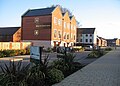
 Flats on Greenlands Road - geograph.org.uk - 2992753.jpg 640 × 480; 65 KB
-
 Flats on Park Prewett Road - geograph.org.uk - 2992484.jpg 640 × 480; 77 KB
-

-
 Florence Way - geograph.org.uk - 1746482.jpg 640 × 480; 79 KB
-
 Florence Way - geograph.org.uk - 1746515.jpg 640 × 480; 82 KB
-
 Flytipping by the byway - geograph.org.uk - 2993018.jpg 640 × 480; 68 KB
-

-
 Footpath at Parklands - geograph.org.uk - 2379582.jpg 640 × 628; 397 KB
-
 Footpath near Kingsclere Road A339 - geograph.org.uk - 4933931.jpg 3,264 × 1,840; 2.29 MB
-
 Footpath ^ hedgeline - geograph.org.uk - 6494287.jpg 640 × 480; 119 KB
-
 Former break between fairways - geograph.org.uk - 1746876.jpg 640 × 480; 107 KB
-
 Former cricket field - geograph.org.uk - 2828218.jpg 640 × 480; 71 KB
-
 Former golf course - geograph.org.uk - 1746822.jpg 640 × 480; 108 KB
-
 Former golf course - geograph.org.uk - 6494086.jpg 640 × 480; 112 KB
-
 Former golf course - geograph.org.uk - 6495099.jpg 640 × 480; 129 KB
-
 Former golf course - geograph.org.uk - 6495160.jpg 640 × 480; 92 KB
-
 Former golf course - geograph.org.uk - 6495163.jpg 640 × 480; 106 KB
-
 Former golf course - geograph.org.uk - 6495168.jpg 640 × 480; 107 KB
-
 Former Golf Course - geograph.org.uk - 817069.jpg 640 × 457; 60 KB
-
 Former Golf Course - geograph.org.uk - 817128.jpg 640 × 456; 58 KB
-
 Former Golf Course - geograph.org.uk - 817135.jpg 640 × 453; 62 KB
-
 Former hospital reception - geograph.org.uk - 2992723.jpg 640 × 480; 106 KB
-
 Former Park Prewett Hospital Chapel, Basingstoke - geograph.org.uk - 3416628.jpg 3,309 × 2,480; 1.35 MB
-
 Former route of the Aldermaston Road - geograph.org.uk - 657380.jpg 640 × 479; 77 KB
-
 Former sports pavilion - geograph.org.uk - 657412.jpg 640 × 466; 69 KB
-

-
 Gate on Rooksdown Lane - geograph.org.uk - 1746548.jpg 640 × 480; 93 KB
-
 Genesis of Bucklebury Way - geograph.org.uk - 6493029.jpg 640 × 480; 98 KB
-
 Genesis of Bucklebury Way - geograph.org.uk - 6493031.jpg 640 × 480; 99 KB
-
 Genesis of Woolhampton Drive houses - geograph.org.uk - 6493052.jpg 640 × 480; 121 KB
-
 Giant Skips - geograph.org.uk - 817013.jpg 640 × 462; 53 KB
-
 Gillies Drive - geograph.org.uk - 3856746.jpg 1,600 × 1,037; 479 KB
-
 Girl Power - geograph.org.uk - 6547426.jpg 640 × 480; 112 KB
-
 Girl Power - geograph.org.uk - 6547432.jpg 640 × 480; 128 KB
-
 Girl Power - geograph.org.uk - 6547434.jpg 640 × 480; 140 KB
-
 Girl Power - geograph.org.uk - 6547439.jpg 640 × 480; 127 KB
-
 Golf Club access only - geograph.org.uk - 2828491.jpg 640 × 480; 86 KB
-
 Green space off Highpath Way - geograph.org.uk - 3856733.jpg 1,600 × 1,063; 293 KB
-

-

-
 Harness House - geograph.org.uk - 1706301.jpg 800 × 600; 135 KB
-
 Harness House - geograph.org.uk - 816855.jpg 640 × 455; 70 KB
-
 Hedge row marks the footpath - geograph.org.uk - 686395.jpg 640 × 467; 80 KB
-
 Here come the new builds - geograph.org.uk - 3692170.jpg 640 × 473; 122 KB
-
 Hidden view of Parklands Hospital - geograph.org.uk - 2997920.jpg 640 × 480; 86 KB
-
 Highpath Way - geograph.org.uk - 1541667.jpg 640 × 465; 55 KB
-
 Highpath Way - geograph.org.uk - 658422.jpg 640 × 448; 57 KB
-
 Highpath Way - the early days - geograph.org.uk - 3856727.jpg 4,912 × 3,264; 4.63 MB
-
 Hines Court - geograph.org.uk - 1706292.jpg 1,024 × 730; 161 KB
-
 Hines Court apartment block - geograph.org.uk - 1706289.jpg 800 × 574; 100 KB
-
 Hobbs Court - geograph.org.uk - 816799.jpg 640 × 461; 77 KB
-
 Hobbs Court - geograph.org.uk - 816813.jpg 640 × 455; 49 KB
-
 Hobbs Court - geograph.org.uk - 816815.jpg 640 × 464; 70 KB
-
 Hobbs Court - geograph.org.uk - 816863.jpg 640 × 470; 68 KB
-
 Hobbs Court - North Facade - geograph.org.uk - 817151.jpg 640 × 459; 72 KB
-
 Hole in the hedge - geograph.org.uk - 686405.jpg 640 × 452; 49 KB
-
 Hollies Court - geograph.org.uk - 816785.jpg 640 × 467; 53 KB
-
 Homefield House - Shaw Healthcare - geograph.org.uk - 6495781.jpg 640 × 480; 114 KB
-
 Homefield House - Shaw Healthcare - geograph.org.uk - 781693.jpg 640 × 471; 82 KB
-
 Hospital access road - geograph.org.uk - 5513127.jpg 640 × 480; 128 KB
-
 Hospital access road - geograph.org.uk - 5513131.jpg 640 × 480; 101 KB
-
 Hospital access road - geograph.org.uk - 5513132.jpg 640 × 480; 106 KB
-
 Hospital access road - geograph.org.uk - 5513134.jpg 640 × 480; 101 KB
-
 Hospital access road - geograph.org.uk - 5513136.jpg 640 × 480; 118 KB
-
 Hospital access road - geograph.org.uk - 5513143.jpg 640 × 480; 136 KB
-
 Hospital and Homes - geograph.org.uk - 659483.jpg 640 × 480; 112 KB
-
 Hospital out building - Headway Place - geograph.org.uk - 781687.jpg 640 × 479; 120 KB
-

-
 House at Park Prewett - geograph.org.uk - 2389243.jpg 640 × 427; 217 KB
-
 House at Park Prewett - geograph.org.uk - 2389273.jpg 640 × 459; 191 KB
-
 House building at Park Prewett - geograph.org.uk - 2389249.jpg 640 × 426; 132 KB
-
 Houses at Park Prewett - geograph.org.uk - 2389258.jpg 576 × 640; 210 KB
-
 Houses by Greatfield Farm - geograph.org.uk - 6493075.jpg 640 × 480; 108 KB
-
 Houses in Barron Place - geograph.org.uk - 3650179.jpg 640 × 476; 98 KB
-
 Houses in Barron Place - geograph.org.uk - 3650181.jpg 640 × 476; 76 KB
-
 Houses in Florence Way - geograph.org.uk - 1746486.jpg 640 × 480; 101 KB
-
 Houses in Florence Way - geograph.org.uk - 3190956.jpg 640 × 480; 59 KB
-
 Houses in Gander Drive - geograph.org.uk - 3650160.jpg 640 × 464; 76 KB
-
 Houses in Gander Drive - geograph.org.uk - 3650165.jpg 640 × 480; 89 KB
-
 Houses in Gander Drive - geograph.org.uk - 3650167.jpg 640 × 473; 85 KB
-
 Houses in Gander Drive - geograph.org.uk - 3650176.jpg 640 × 478; 87 KB


_near_Wootton_St_Lawrence_-_geograph.org.uk_-_4152559.jpg)


