Category:Rooks County Record building (Stockton, Kansas)
Jump to navigation
Jump to search
| Object location | | View all coordinates using: OpenStreetMap |
|---|
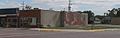
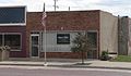
Building removed or demolished by September 14, 2014, when site photographed.
Media in category "Rooks County Record building (Stockton, Kansas)"
The following 4 files are in this category, out of 4 total.
-
 Stockton, Kansas 501 Main from N 1.JPG 2,531 × 850; 366 KB
-
 Stockton, Kansas 501 Main from NW 1.JPG 2,551 × 809; 420 KB
-
 Stockton, Kansas 501 Main from NW 2.JPG 2,045 × 1,578; 501 KB
-
 Stockton, Kansas 503 Main.JPG 2,531 × 1,479; 677 KB

