Category:Roodkerkje
Jump to navigation
Jump to search
| Object location | | View all coordinates using: OpenStreetMap |
|---|
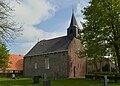
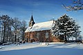
church building in Dantumadiel, Netherlands  | |||||
| Upload media | |||||
| Instance of | |||||
|---|---|---|---|---|---|
| Location | Readtsjerk, Dantumadiel, Friesland, Netherlands | ||||
| Street address |
| ||||
| Located on street |
| ||||
| Heritage designation |
| ||||
| Inception |
| ||||
| official website | |||||
 | |||||
|
This is a category about rijksmonument number 11696
|
| Address |
|
Media in category "Roodkerkje"
The following 27 files are in this category, out of 27 total.
-

-
 20210720 kerkje Readtsjerk1.jpg 5,184 × 3,456; 4.22 MB
-
 20210720 kerkje Readtsjerk2.jpg 4,032 × 3,024; 2.58 MB
-
 20210720 sarcofaagdeksel bij kerkje Readtsjerk.jpg 3,456 × 5,184; 3.91 MB
-
 De hervormde kerk van Roodkerk.JPG 3,456 × 4,608; 3.13 MB
-
 Detail aanwezig in het Fries Museum in Leeuwarden - Roodkerk - 20190595 - RCE.jpg 1,195 × 1,200; 345 KB
-
 Detail in kerkmuseum in Janum - Roodkerk - 20190596 - RCE.jpg 942 × 1,200; 311 KB
-
 Exterieur, noordgevel - Roodkerk - 20190591 - RCE.jpg 953 × 1,200; 282 KB
-
 Exterieur, noordgevel - Roodkerk - 20190592 - RCE.jpg 1,200 × 960; 311 KB
-

-
 Interieur detail kuip van de preekstoel - Roodkerk - 20190601 - RCE.jpg 1,200 × 1,200; 346 KB
-
 Interieur detail rooster plafond - Roodkerk - 20190602 - RCE.jpg 1,200 × 1,200; 267 KB
-

-
 Interieur naar het oosten - Roodkerk - 20190590 - RCE.jpg 1,200 × 837; 135 KB
-
 Interieur, aanzicht westgevel met orgel - Roodkerk - 20370655 - RCE.jpg 872 × 1,200; 146 KB
-
 Interieur, zijaanzicht orgel met klaviatuur - Roodkerk - 20370656 - RCE.jpg 1,200 × 1,200; 164 KB
-
 Kerkje Roodkerk.jpg 1,600 × 1,067; 535 KB
-
 Overzicht - Roodkerk - 20190600 - RCE.jpg 1,200 × 1,193; 463 KB
-
 Readtsjerk, it "Readtsjerkje".jpg 5,091 × 3,635; 9.65 MB
-
 Readtsjerk, noarlike muorre fan it Readtsjerkje.jpg 5,025 × 3,589; 8.15 MB
-
 Readtsjerk, súdlike muorre Readtsjerkje.jpg 5,117 × 3,656; 10.42 MB
-
 Rouwbord - Roodkerk - 20190593 - RCE.jpg 970 × 1,200; 180 KB
-
 Rouwbord - Roodkerk - 20190594 - RCE.jpg 962 × 1,200; 181 KB
-

-
 Tsjerke fan Readtsjerk.jpg 3,836 × 2,560; 5.63 MB
-
 Zuid en noordgevel - Roodkerk - 20190588 - RCE.jpg 1,200 × 825; 212 KB
-
 Zuid en noordgevel - Roodkerk - 20190589 - RCE.jpg 1,200 × 827; 221 KB


