Category:Romsley, Shropshire
Jump to navigation
Jump to search
Cymraeg: Pentref yn Swydd Amwythig, Gorllewin Canolbarth Lloegr, Lloegr ydy Romsley, Swydd Amwythig.
English: Romsley (grid reference SO783826) is a hamlet and civil parish in southeast Shropshire, England. It is bounded on the north and west by Alveley and on the south by Upper Arley in Worcestershire. On its short eastern boundary it meets Compton on Kinver. It is a dispersed settlement and there is no church in the parish. The parish is mainly a farming community, comprising only 36 houses in 1961.
Polski: Romsley – wieś w Anglii, w hrabstwie Shropshire. Leży 42 km na południowy wschód od miasta Shrewsbury i 184 km na północny zachód od Londynu.
village in Shropshire, United Kingdom  | |||||
| Upload media | |||||
| Instance of | |||||
|---|---|---|---|---|---|
| Location | Shropshire, West Midlands, England | ||||
| Population |
| ||||
 | |||||
Media in category "Romsley, Shropshire"
The following 31 files are in this category, out of 31 total.
-
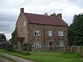 A house called Stoneacre - geograph.org.uk - 884220.jpg 640 × 480; 270 KB
-
 A442 enters Shropshire - geograph.org.uk - 3501663.jpg 640 × 480; 68 KB
-
 Bridleway at Howlett Hall - geograph.org.uk - 3181778.jpg 640 × 480; 177 KB
-
 Entrance to Shatterford Wood - geograph.org.uk - 1621888.jpg 640 × 473; 150 KB
-
 Farmland adjoining Beacon Lane - geograph.org.uk - 1490890.jpg 640 × 480; 78 KB
-

-

-
 Growing cereals - geograph.org.uk - 884198.jpg 640 × 480; 318 KB
-
 Howlet Hall farmhouse - geograph.org.uk - 3065309.jpg 979 × 734; 412 KB
-
 Lane junction at the county boundary - geograph.org.uk - 1074487.jpg 640 × 480; 133 KB
-
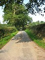 Lowe Lane, near Romsley, Shropshire - geograph.org.uk - 3619929.jpg 758 × 1,024; 277 KB
-
 Mill Gazebo - geograph.org.uk - 3610418.jpg 600 × 800; 203 KB
-
 Mobile 'phone mast at Romsley - geograph.org.uk - 1074445.jpg 640 × 480; 87 KB
-
 Pond, Romsley - geograph.org.uk - 6423406.jpg 1,024 × 683; 356 KB
-
-
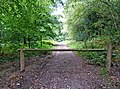
 Public bridleway to Shatterford Wood - geograph.org.uk - 1621845.jpg 640 × 480; 143 KB
-
 Public bridleway to Shatterford Wood - geograph.org.uk - 1621861.jpg 640 × 480; 151 KB
-
 Re-roofed stone barn at Howlet Hall - geograph.org.uk - 3064858.jpg 979 × 734; 423 KB
-
 Red Lion Inn, near Shatterford - geograph.org.uk - 119591.jpg 640 × 480; 163 KB
-
 Red Lion View - geograph.org.uk - 447234.jpg 640 × 480; 91 KB
-
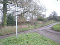
 Road junction fingerpost in Romsley, Shropshire, England.jpg 640 × 480; 114 KB
-
 Romsley, UK - panoramio (2).jpg 3,264 × 2,448; 1.58 MB
-
 Shatterford Wood - geograph.org.uk - 1621955.jpg 640 × 476; 103 KB
-

-
 Staffs, Worcs, Shropshire - geograph.org.uk - 866910.jpg 640 × 480; 118 KB
-

-
 The Mill Hotel - geograph.org.uk - 3610397.jpg 800 × 600; 145 KB
-
 The Mill Pool - geograph.org.uk - 3610388.jpg 800 × 600; 218 KB
-
 The path is getting rough - geograph.org.uk - 884219.jpg 640 × 480; 445 KB
-
 The Red Lion Inn - geograph.org.uk - 1074429.jpg 640 × 480; 97 KB
-
 Woodland near Arley Wood - geograph.org.uk - 1622100.jpg 640 × 469; 160 KB


.jpg)


