Category:Rombergparkteich
Jump to navigation
Jump to search
| Object location | | View all coordinates using: OpenStreetMap |
|---|
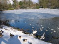
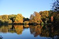
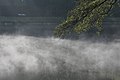
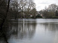
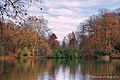
Deutsch: Der rund 280 m lange Parkteich im Rombergpark wird gespeist vom Wasser der Schondelle bzw. des von ihr abgezweigten „Wiesenbachs“.
Media in category "Rombergparkteich"
The following 23 files are in this category, out of 23 total.
-
 003-Rombergpark.27022005.JL.JPG 2,272 × 1,704; 687 KB
-
 DO-Rombergparkteich Herbst.jpg 5,152 × 3,864; 6.07 MB
-
 Dortmund - Rombergpark - Teich 01 ies.jpg 5,616 × 3,744; 12.77 MB
-
 Dortmund - Rombergpark - Teich 02 ies.jpg 5,616 × 3,744; 10.6 MB
-
 Dortmund - Rombergpark - Teich 03 ies.jpg 5,616 × 3,744; 15.96 MB
-
 Dortmund - Rombergpark - Teich 04 ies.jpg 5,616 × 3,744; 11.04 MB
-
 DortmundRombergparkHerbst2007-1.JPG 3,456 × 2,304; 5.76 MB
-
 Herbst am Teich - panoramio.jpg 2,246 × 1,498; 1.81 MB
-
 Herbst im Rombergpark - panoramio (11).jpg 5,184 × 3,456; 9.38 MB
-
 Herbst im Rombergpark - panoramio (12).jpg 5,184 × 3,456; 7.76 MB
-
 Rombergpark 3.jpg 2,000 × 1,500; 1,019 KB
-
 Rombergpark Herbst 2011 - panoramio (1).jpg 5,184 × 3,456; 11.3 MB
-
 Rombergpark Herbst 2011 - panoramio (2).jpg 5,184 × 3,456; 5.31 MB
-
 Rombergpark, 08.03.14 - panoramio (4).jpg 3,072 × 2,304; 3.98 MB
-
 Rombergpark, 08.03.14 - panoramio (5).jpg 3,072 × 2,304; 3.25 MB
-
 Rombergpark, 08.03.14 - panoramio (6).jpg 3,072 × 2,304; 5.06 MB
-
 Rombergpark-100330-11442-Hauptweg.jpg 3,618 × 2,421; 5.6 MB
-
 Rombergpark-100330-11443-Teich.jpg 3,586 × 2,428; 6.14 MB
-
 Rombergpark-DSCN3874.JPG 2,048 × 1,536; 3.2 MB
-
 Rombergpark-IMG 1495.JPG 2,816 × 2,112; 6.26 MB
-
 Rombergpark-IMG 1497.JPG 2,112 × 2,816; 6.11 MB
-
 ROMBERGPARK.JPG 2,272 × 1,704; 1.87 MB
-
 Teich im Rombergpark 2014.jpg 5,999 × 3,999; 35.02 MB


.jpg)
.jpg)

.jpg)
.jpg)
.jpg)
.jpg)
.jpg)


