Category:Rokin 18, Amsterdam
Jump to navigation
Jump to search
| Object location | | View all coordinates using: OpenStreetMap |
|---|
 | |||||
| Upload media | |||||
| Instance of |
| ||||
|---|---|---|---|---|---|
| Location | Amsterdam, North Holland, Netherlands | ||||
| Street address |
| ||||
| Located on street | |||||
| Heritage designation |
| ||||
 | |||||
|
This is a category about rijksmonument number 5001
|
| Address |
|
Media in category "Rokin 18, Amsterdam"
The following 5 files are in this category, out of 5 total.
-
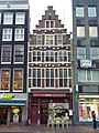 Amsterdam - Rokin 18.JPG 2,736 × 3,648; 3.76 MB
-
 J.H. Schaefer, Afb PBKD00346000028.jpg 1,793 × 1,162; 191 KB
-
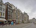
 Overzicht Rokin - Amsterdam - 20329989 - RCE.jpg 1,183 × 1,200; 271 KB
-
 Rokin location of the Hotel Polen fire.jpg 628 × 485; 70 KB
-
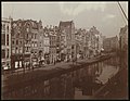 Stadsarchief Amsterdam, Afb ANWO00173000001.jpg 3,444 × 2,676; 1.02 MB


