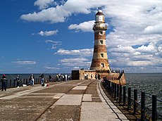
Category:Roker, Sunderland
Jump to navigation
Jump to search
area of Sunderland, England | |||||
| Upload media | |||||
| Instance of | |||||
|---|---|---|---|---|---|
| Location | Sunderland, Tyne and Wear, North East England, England | ||||
| Inception |
| ||||
 | |||||
Subcategories
This category has the following 5 subcategories, out of 5 total.
Media in category "Roker, Sunderland"
The following 53 files are in this category, out of 53 total.
-
(One of the) Roker Rocks (2) - geograph.org.uk - 4627891.jpg 640 × 480; 78 KB
-
(One of the) Roker Rocks - geograph.org.uk - 4619151.jpg 640 × 480; 69 KB
-
(One of the) Roker Rocks - geograph.org.uk - 4619162.jpg 640 × 480; 75 KB
-
(One of the) Roker Rocks - geograph.org.uk - 4628095.jpg 640 × 480; 71 KB
-
Arch to Roker Park - geograph.org.uk - 2394806.jpg 640 × 427; 272 KB
-
Beach at Roker Rocks - geograph.org.uk - 4619165.jpg 640 × 480; 60 KB
-
Beach at Roker Rocks - geograph.org.uk - 4627907.jpg 640 × 480; 97 KB
-
Cafe Bungalow, Roker - geograph.org.uk - 2367862.jpg 3,648 × 2,736; 1.36 MB
-
Café Bungalow, Roker Terrace - geograph.org.uk - 2194304.jpg 1,024 × 768; 173 KB
-
Fishing from the pier - geograph.org.uk - 4325311.jpg 4,272 × 2,060; 1.32 MB
-
Is this the perfect wave^ Probably not. - geograph.org.uk - 3944815.jpg 1,024 × 768; 224 KB
-
Looking back - geograph.org.uk - 2433272.jpg 640 × 480; 121 KB
-
National Cycle Route 1, Sunderland - geograph.org.uk - 5883729.jpg 640 × 480; 51 KB
-
National Cycle Route 1, Sunderland - geograph.org.uk - 5883733.jpg 640 × 480; 57 KB
-
Progress at Roker Pier, 1889 (21301911208).jpg 813 × 648; 390 KB
-
Roker Flats - geograph.org.uk - 139183.jpg 480 × 640; 58 KB
-
Roker Beach - geograph.org.uk - 2392811.jpg 640 × 427; 251 KB
-
Roker beach - geograph.org.uk - 501368.jpg 640 × 480; 80 KB
-
Roker from Roker Pier - geograph.org.uk - 2152451.jpg 1,024 × 768; 162 KB
-
Roker Pier - geograph.org.uk - 4620762.jpg 640 × 480; 47 KB
-
Roker Pier - geograph.org.uk - 4627902.jpg 640 × 480; 72 KB
-
Roker Pier and lighthouse - geograph.org.uk - 5883977.jpg 640 × 480; 58 KB
-
Roker Pier Lighthouse - geograph.org.uk - 2368008.jpg 903 × 1,339; 223 KB
-
Roker Pier on a sunny July day - geograph.org.uk - 6915144.jpg 4,000 × 2,250; 3.44 MB
-
Roker Pier, Sunderland - geograph.org.uk - 2152447.jpg 1,024 × 768; 156 KB
-
Roker Pier, Sunderland - geograph.org.uk - 4293873.jpg 640 × 480; 51 KB
-
Roker Pier, Sunderland Harbour - geograph.org.uk - 2433047.jpg 480 × 640; 87 KB
-
Roker Pier, Sunderland Harbour - geograph.org.uk - 2433065.jpg 640 × 480; 91 KB
-
Roker Rocks (2) - geograph.org.uk - 4619141.jpg 640 × 480; 77 KB
-
Roker Rocks (3) - geograph.org.uk - 4627879.jpg 640 × 481; 84 KB
-
Roker Rocks - geograph.org.uk - 2459225.jpg 640 × 480; 66 KB
-
Roker Rocks - geograph.org.uk - 4619137.jpg 640 × 480; 67 KB
-
Roker Rocks from Roker Pier - geograph.org.uk - 4619146.jpg 640 × 480; 89 KB
-
Roker Rocks from Roker Pier - geograph.org.uk - 4619155.jpg 640 × 480; 85 KB
-
RokerBeach2020.jpg 4,000 × 3,000; 6.06 MB
-
Rough seas at Roker Pier, Sunderland - geograph.org.uk - 6489837.jpg 1,799 × 1,199; 308 KB
-
Sunderland lighthouse - geograph.org.uk - 4068804.jpg 1,024 × 756; 101 KB
-
Sunderland lighthouse - geograph.org.uk - 4068806.jpg 1,024 × 535; 79 KB
-
Sunderland south pier - geograph.org.uk - 4293875.jpg 640 × 480; 38 KB
-
Sunderland VLB Watch House.jpg 1,364 × 909; 248 KB
-
Surfing by Roker Pier - geograph.org.uk - 3944803.jpg 1,024 × 768; 153 KB
-
Surfing gone wrong - geograph.org.uk - 3944810.jpg 1,024 × 768; 193 KB
-
Tall Ship entering the River Wear - geograph.org.uk - 5842944.jpg 1,600 × 1,064; 169 KB
-
Tall Ship leaving the Wear - geograph.org.uk - 5849287.jpg 1,600 × 1,064; 232 KB
-
The lighthouse on Roker Pier - geograph.org.uk - 2854510.jpg 1,500 × 983; 197 KB
-
View along A183, Roker, Sunderland (June 2009).jpg 1,280 × 960; 452 KB
-
Yacht Passing New South Pier - geograph.org.uk - 2394813.jpg 427 × 640; 227 KB


