Category:Rokeby
Jump to navigation
Jump to search
village and civil parish in County Durham, England  | |||||
| Upload media | |||||
| Instance of | |||||
|---|---|---|---|---|---|
| Location | County Durham, North East England, England | ||||
| Population |
| ||||
 | |||||
Subcategories
This category has the following 4 subcategories, out of 4 total.
Media in category "Rokeby"
The following 81 files are in this category, out of 81 total.
-
 2021 Clarendon nipaluna.jpg 3,897 × 1,292; 794 KB
-
 A66 at Cross Lanes - geograph.org.uk - 1868389.jpg 640 × 480; 50 KB
-
 A66 at entrance to Tutta Beck Farm - geograph.org.uk - 3078872.jpg 640 × 424; 61 KB
-
 A66 at Thorpe Grange - geograph.org.uk - 1868404.jpg 640 × 480; 50 KB
-
 A66 near Boldron - geograph.org.uk - 1868393.jpg 640 × 480; 49 KB
-
 A66 near Greta Bridge - geograph.org.uk - 1868402.jpg 640 × 480; 61 KB
-
 A66 near North Bitts - geograph.org.uk - 3118996.jpg 640 × 430; 47 KB
-
 A66 near Street Side Farm - geograph.org.uk - 3114586.jpg 640 × 487; 49 KB
-
 A66 passing Church Plantation - geograph.org.uk - 3078877.jpg 640 × 393; 89 KB
-
 A66, Cross Lanes - geograph.org.uk - 3118991.jpg 640 × 430; 37 KB
-
 A66, Rokeby Park turning - geograph.org.uk - 3114557.jpg 640 × 430; 47 KB
-
 A66, westbound - geograph.org.uk - 3114571.jpg 640 × 430; 50 KB
-
 A66, westbound - geograph.org.uk - 3118987.jpg 640 × 495; 52 KB
-
 Access Lane by Tees View - geograph.org.uk - 1570099.jpg 640 × 480; 122 KB
-
 Approaching end of dual carriageway - geograph.org.uk - 3078867.jpg 640 × 372; 44 KB
-
 Barn at Mortham - geograph.org.uk - 4407722.jpg 3,264 × 2,448; 3.53 MB
-
 Barnard Castle (road) at Rokeby Park - geograph.org.uk - 4699847.jpg 1,600 × 1,126; 560 KB
-
 Cross Lanes car park - geograph.org.uk - 6677791.jpg 4,606 × 3,454; 5.47 MB
-

-
 Cross Lanes organic farm shop and café - geograph.org.uk - 3470295.jpg 1,024 × 768; 136 KB
-
 Cross Lanes Organic Farm Shop ^ Cafe - geograph.org.uk - 6677786.jpg 4,598 × 3,444; 6.03 MB
-
 Dairy Bridge over the River Greta (geograph 7024322).jpg 1,600 × 1,200; 1,018 KB
-
 Dent House, above Tutta Beck - geograph.org.uk - 4480924.jpg 1,024 × 768; 135 KB
-
 Dwelling at Cross Lanes - geograph.org.uk - 4052102.jpg 3,035 × 1,694; 2.45 MB
-
 Eastbound lane of the A66 - geograph.org.uk - 2507047.jpg 640 × 480; 114 KB
-
 Farm Buildings, Mortham (geograph 7109094).jpg 1,024 × 768; 272 KB
-
 Farm track to Ewebank - geograph.org.uk - 3114565.jpg 640 × 430; 44 KB
-
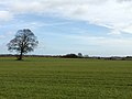
 Farmland, Rokeby - geograph.org.uk - 2809128.jpg 640 × 480; 186 KB
-
 Farmland, Rokeby - geograph.org.uk - 2809134.jpg 640 × 480; 204 KB
-
 Field on the South Bank of the Tees - geograph.org.uk - 339511.jpg 640 × 426; 102 KB
-
 Field with barley - geograph.org.uk - 6526978.jpg 2,000 × 1,065; 1.73 MB
-
 Footpath to Manyfold Beck Bridge - geograph.org.uk - 5768090.jpg 1,024 × 768; 230 KB
-
 Footpath to St, Mary's church, Rokeby - geograph.org.uk - 5762466.jpg 1,024 × 720; 188 KB
-
 Footpath to St. Mary's Rokeby - geograph.org.uk - 5768060.jpg 1,024 × 768; 229 KB
-
 Grassland north of Greta Bridge - geograph.org.uk - 4407730.jpg 3,264 × 2,448; 1.6 MB
-
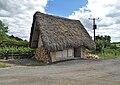
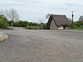 Heather-roofed building at Cross Lanes - geograph.org.uk - 4480916.jpg 1,024 × 768; 122 KB
-
 Hedgerow oak in winter sun, North Bitts - geograph.org.uk - 2231410.jpg 4,320 × 3,240; 1.77 MB
-
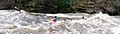 Hell Cauldron, River Greta - geograph.org.uk - 2237475.jpg 2,560 × 720; 474 KB
-
 Houses at Greta Bridge, A66 - geograph.org.uk - 4699840.jpg 1,600 × 1,153; 463 KB
-
 Lane east of minor road - geograph.org.uk - 3494487.jpg 1,500 × 996; 2.17 MB
-
 Lone Tree, near Rokeby - geograph.org.uk - 4016730.jpg 2,465 × 1,643; 1.95 MB
-
 Minor road leading to the A66 - geograph.org.uk - 4698690.jpg 1,600 × 1,109; 619 KB
-
 New hedging north of Cross Lanes - geograph.org.uk - 2227376.jpg 3,240 × 4,320; 1.98 MB
-
 Old Boundary Marker on Tutta Bridge - geograph.org.uk - 6472847.jpg 960 × 720; 379 KB
-
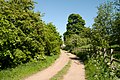
 Old track, Rokeby - geograph.org.uk - 5768079.jpg 1,024 × 722; 151 KB
-
 Organic farm shop to be ^ - geograph.org.uk - 1575691.jpg 640 × 480; 113 KB
-
 Over fields to Dent House Farm - geograph.org.uk - 6677869.jpg 4,596 × 3,440; 5.11 MB
-
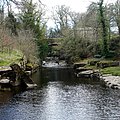
 River Greta - geograph.org.uk - 3120517.jpg 3,680 × 2,592; 2.46 MB
-
 River Greta from the Dairy Bridge - geograph.org.uk - 4016717.jpg 2,000 × 3,000; 3.75 MB
-
 River Greta from the Dairy Bridge - geograph.org.uk - 4016720.jpg 3,000 × 2,000; 4.17 MB
-
 River Tees near Rokeby - geograph.org.uk - 4407695.jpg 3,264 × 2,448; 3.31 MB
-
 Rokeby , A66 - geograph.org.uk - 6691272.jpg 6,000 × 4,000; 6.29 MB
-
 Rokeby , A66 - geograph.org.uk - 6691275.jpg 6,000 × 4,000; 5.99 MB
-
 Rokeby , A66 - geograph.org.uk - 6691281.jpg 6,000 × 4,000; 7.67 MB
-
 Rokeby , Field - geograph.org.uk - 6691256.jpg 6,000 × 4,000; 7.27 MB
-
 Rokeby , Garden House Entrance - geograph.org.uk - 6691268.jpg 5,825 × 3,883; 5.88 MB
-
 Rokeby , Grassy Field - geograph.org.uk - 6691276.jpg 6,000 × 4,000; 7.88 MB
-
 Rokeby , Road - geograph.org.uk - 6691261.jpg 6,000 × 4,000; 5.88 MB
-
 Rokeby , Road - geograph.org.uk - 6691263.jpg 6,000 × 4,000; 7.86 MB
-
 Rokeby Grange - geograph.org.uk - 3120510.jpg 3,888 × 2,592; 1.88 MB
-
 Rokeby Grove - geograph.org.uk - 3120513.jpg 3,241 × 2,592; 1.13 MB
-
 Rokeby Park (21) (geograph 7309072).jpg 4,261 × 3,196; 1.81 MB
-
 Rokeby Postbox - geograph.org.uk - 1529091.jpg 480 × 640; 103 KB
-
 Roman Fort at Greta Bridge (geograph 6747820).jpg 1,600 × 900; 998 KB
-
 Roman Milestone, Rokeby Park (geograph 5790341).jpg 480 × 640; 83 KB
-
 Seating area outside Cross Lanes farm shop - geograph.org.uk - 3470300.jpg 1,024 × 768; 182 KB
-
 St Mary's Parish Church Rokeby - geograph.org.uk - 6677877.jpg 2,278 × 1,668; 1,007 KB
-
 Teesdale Way East of Mortham Tower - geograph.org.uk - 1570118.jpg 640 × 480; 93 KB
-
 Thatched store house at Cross Lanes - geograph.org.uk - 5833593.jpg 5,119 × 3,612; 4.7 MB
-
 The churchyard wall at Rokeby - geograph.org.uk - 5762461.jpg 1,024 × 768; 230 KB
-
 The edge of Mortham Wood - geograph.org.uk - 4407750.jpg 3,264 × 2,448; 4.07 MB
-
 The end of the Greta - geograph.org.uk - 1235546.jpg 640 × 640; 137 KB
-
 The former school at Rokeby - geograph.org.uk - 5768053.jpg 1,024 × 768; 235 KB
-
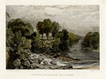 The Junction of the Greta and Tees at Rokeby Pye.JPG 600 × 445; 280 KB
-
 The Meeting of the Waters - geograph.org.uk - 4016724.jpg 2,868 × 1,912; 2.92 MB
-
 The Street - geograph.org.uk - 3120512.jpg 3,888 × 2,592; 1.47 MB
-
 The Tees Valley at Mortham - geograph.org.uk - 1570105.jpg 640 × 480; 74 KB
-

-
 Trees beyond sown field - geograph.org.uk - 3353928.jpg 1,500 × 999; 1.48 MB
-
 Turn off the A66 near Greta Bridge - geograph.org.uk - 3114552.jpg 640 × 505; 63 KB
-
 Tutta Beck Plantation - geograph.org.uk - 3114576.jpg 640 × 430; 26 KB


_at_Rokeby_Park_-_geograph.org.uk_-_4699847.jpg)


.jpg)


.jpg)


_(geograph_7309072).jpg)

.jpg)
.jpg)


