Category:Rogue River (Oregon)
Jump to navigation
Jump to search
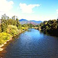
- The Rogue River — a National Wild and Scenic River in southern Oregon.
- Flowing westward from the Cascade Range in Crater Lake National Park, through the Klamath Mountains, to the Pacific Ocean at Gold Beach.
- A long portion flows through the Rogue River – Siskiyou National Forest.
city in Oregon, USA | |||||
| Upload media | |||||
| Instance of | |||||
|---|---|---|---|---|---|
| Location | Jackson County, Oregon | ||||
| Inception |
| ||||
| Population |
| ||||
| Area |
| ||||
| Elevation above sea level |
| ||||
| official website | |||||
 | |||||
Subcategories
This category has the following 23 subcategories, out of 23 total.
A
B
- Bear Creek (Oregon) (7 F)
C
- Caveman Bridge (12 F)
D
- Depot Street Bridge (13 F)
G
- Gold Ray Dam (4 F)
- Zane Grey Cabin (40 F)
I
- Isaac Lee Patterson Bridge (69 F)
L
N
R
- Robert Deniston Hume (6 F)
- Rogue River Gorge (12 F)
- Rogue River Wars (7 F)
- Rogue Wild and Scenic River (1 P, 135 F)
- Rogue-Umpqua Scenic Byway (24 F)
S
- Savage Rapids Dam (4 F)
T
Pages in category "Rogue River (Oregon)"
This category contains only the following page.
Media in category "Rogue River (Oregon)"
The following 200 files are in this category, out of 591 total.
(previous page) (next page)-
Roguerivermap.png 954 × 623; 1.09 MB
-
Rogue river access map.png 958 × 1,923; 577 KB
-
Alder Creek Wild and Scenic River Map.jpg 2,736 × 2,196; 1,005 KB
-
Anna Creek Wild and Scenic River Map.jpg 2,736 × 2,196; 1 MB
-
Bailey Creek Wild and Scenic River Map.jpg 2,736 × 2,196; 1 MB
-
Below lost creek dam.jpg 4,288 × 2,848; 3.9 MB
-
Big Windy Creek Wild and Scenic River Map.jpg 2,736 × 2,196; 1 MB
-
BLM Medford Backcountry Byway Dedication (1991) (22347929353).jpg 1,920 × 1,080; 83 KB
-
BLM picture of Lower Table Rock.jpg 466 × 317; 77 KB
-
Boat Ramp Sign on the Wild and Scenic Rogue River (34022688763).jpg 4,396 × 1,891; 5.56 MB
-
Booze Creek Wild and Scenic River Map.jpg 2,736 × 2,196; 1 MB
-
Bronco Creek Wild and Scenic River Map.jpg 2,736 × 2,196; 1 MB
-
Bunker Creek Wild and Scenic River Map.jpg 2,736 × 2,196; 1 MB
-
Rogue River Watershed; water supply outlook (IA CAT11099805001).pdf 1,139 × 1,529, 6 pages; 543 KB
-
Cattle near grants pass.jpg 4,160 × 2,520; 2.61 MB
-
Copsey Creek Wild and Scenic River Map.jpg 2,736 × 2,196; 1 MB
-
Corral Creek Wild and Scenic River Map.jpg 2,736 × 2,196; 1 MB
-
Cowley Creek Wild and Scenic River Map.jpg 2,736 × 2,196; 1 MB
-
Crater Lake Fairwell Bend.jpg 2,048 × 3,072; 5.6 MB
-
Crossing the Rogue River.jpg 640 × 640; 126 KB
-
Detailed Rogue River Overview Map (44057348581).jpg 9,900 × 4,467; 4.22 MB
-
Dulog Creek Wild and Scenic River Map.jpg 2,736 × 2,196; 1 MB
-
East Fork Big Windy Creek Wild and Scenic River Map.jpg 2,736 × 2,196; 1.01 MB
-
East Fork Kelsey Creek Wild and Scenic River Map - 49381231763.jpg 2,736 × 2,196; 1 MB
-
East Fork Kelsey Creek Wild and Scenic River Map - 49381694676.jpg 2,736 × 2,196; 1.01 MB
-
East Fork Kelsey Creek Wild and Scenic River Map.jpg 2,736 × 2,196; 1 MB
-
East Fork Rum Creek Wild and Scenic River Map.jpg 2,736 × 2,196; 1 MB
-
Elk Creek Dam.jpg 2,576 × 1,932; 1.91 MB
-
Flounce Rock (16272433259).jpg 1,252 × 1,042; 1.61 MB
-
Flounce Rock (16272433739).jpg 1,920 × 1,080; 2.59 MB
-
Flounce Rock (16432676526).jpg 1,920 × 1,080; 1.96 MB
-
Flounce Rock (16457731622).jpg 1,920 × 1,080; 2.13 MB
-
FMIB 33364 Seining Salmon on Rogue River.jpeg 924 × 599; 117 KB
-
FMIB 34913 Rogue River (Oreg) Hatchery.jpeg 582 × 311; 56 KB
-
Forest Service Footbridge at Angess - NARA - 298252.jpg 3,000 × 1,778; 1.43 MB
-
Francis Creek Wild and Scenic River Map.jpg 2,736 × 2,196; 1 MB
-
Hewitt Creek Wild and Scenic River Map.jpg 2,736 × 2,196; 1,023 KB
-
Hog Creek Sign Rogue River (34151042094).jpg 5,472 × 3,648; 8.81 MB
-
Howard Creek Wild and Scenic River Map.jpg 2,736 × 2,196; 1.04 MB
-
Hume label fix.png 581 × 422; 123 KB
-
Indian Mary 1.jpg 1,932 × 2,576; 1.34 MB
-
Indian Mary 2.jpg 2,576 × 1,932; 1.3 MB
-
Indian Mary 3.jpg 2,576 × 1,932; 1.24 MB
-
Indian Mary Panorama.jpg 8,681 × 992; 4.54 MB
-
Jenny Creek Wild and Scenic River Map from BLM.jpg 2,736 × 2,196; 1,022 KB
-
Little Applegate River Watershed.png 1,047 × 980; 1.51 MB
-
Little Windy Creek Wild and Scenic River Map.jpg 2,736 × 2,196; 1,023 KB
-
Long Gulch Wild and Scenic River Map.jpg 2,736 × 2,196; 1,022 KB
-
Looking up Rogue River-Oregon.jpg 446 × 307; 31 KB
-
Lower Rogue1.jpg 684 × 456; 64 KB
-
Lower Rogue2.jpg 684 × 456; 50 KB
-
Lower Rogue3.jpg 684 × 513; 91 KB
-
Mary D Hume.jpg 2,400 × 1,589; 591 KB
-
Meadow Creek Wild and Scenic River Map.jpg 2,736 × 2,196; 1,022 KB
-
Missouri Creek Wild and Scenic River Map.jpg 2,736 × 2,196; 1,023 KB
-
Montgomery Creek Wild and Scenic River Map.jpg 2,736 × 2,196; 1,022 KB
-
Mule Creek Canyon.jpg 3,072 × 2,048; 4.18 MB
-
Mule Creek Wild and Scenic River Map.jpg 2,736 × 2,196; 1,023 KB
-
My Public Lands Roadtrip (19042377700).jpg 2,000 × 1,333; 1.9 MB
-
National Creek Falls, Douglas Co, OR.jpg 1,836 × 3,264; 1.77 MB
-
National Public Lands Day 2017 at the Rogue River (23628154368).jpg 2,322 × 4,128; 4.77 MB
-
National Public Lands Day 2017 at the Rogue River (23628154908).jpg 716 × 954; 325 KB
-
National Public Lands Day 2017 at the Rogue River (23628155428).jpg 1,272 × 954; 620 KB
-
National Public Lands Day 2017 at the Rogue River (23628155728).jpg 1,280 × 960; 383 KB
-
National Public Lands Day 2017 at the Rogue River (23628156858).jpg 1,280 × 960; 415 KB
-
National Public Lands Day 2017 at the Rogue River (23628159888).jpg 3,264 × 2,448; 3.19 MB
-
National Public Lands Day 2017 at the Rogue River (23628160368).jpg 2,560 × 1,536; 652 KB
-
National Public Lands Day 2017 at the Rogue River (36770917754).jpg 1,280 × 960; 512 KB
-
National Public Lands Day 2017 at the Rogue River (36770918034).jpg 1,280 × 960; 666 KB
-
National Public Lands Day 2017 at the Rogue River (36770919534).jpg 2,560 × 1,536; 597 KB
-
National Public Lands Day 2017 at the Rogue River (36810705173).jpg 1,272 × 954; 244 KB
-
National Public Lands Day 2017 at the Rogue River (36810721663).jpg 4,128 × 2,322; 5.18 MB
-
National Public Lands Day 2017 at the Rogue River (37222410240).jpg 1,280 × 960; 556 KB
-
National Public Lands Day 2017 at the Rogue River (37222411400).jpg 1,536 × 2,560; 834 KB
-
National Public Lands Day 2017 at the Rogue River (37432526296).jpg 2,048 × 1,365; 325 KB
-
OR 49 I5 FHWA 1966 339.jpg 2,628 × 2,039; 854 KB
-
PELICANS BENEATH ROGUE RIVER BRIDGE - NARA - 545187.jpg 2,020 × 3,000; 959 KB
-
Poison Oak on the Rogue River (34837500952).jpg 2,035 × 1,302; 1.73 MB
-
Quail Creek Wild and Scenic River Map.jpg 2,736 × 2,196; 1,022 KB
-
R.D. Hume map.png 2,392 × 3,022; 510 KB
-
Rafters on the Rogue River (34837509612).jpg 2,233 × 2,233; 5.72 MB
-
Rafters on the Rogue River (34869014321).jpg 5,433 × 2,297; 9.05 MB
-
Rafting on the Rogue River (34869015681).jpg 5,472 × 3,648; 20.67 MB
-
Rafting the Rogue Wild & Scenic River (34874594925).jpg 1,920 × 1,080; 229 KB
-
Rainie Falls Overlook (34836030932).jpg 5,397 × 3,598; 14.96 MB
-
Rainie Falls Trail (34837501922).jpg 5,024 × 3,245; 17.03 MB
-
Rainie Falls Trail (34961245676).jpg 5,445 × 3,185; 17.11 MB
-
Rainie Falls Trailhead (34190427473).jpg 5,397 × 2,543; 7.08 MB
-
Rainine Falls Trail on the Rogue River (34836029322).jpg 5,397 × 3,143; 16.15 MB
-
River Scenes - Oregon - DPLA - cec205b58c42d33c44cff63716c52488.jpg 4,727 × 3,833; 2.69 MB
-
Rock point bridge - Flickr - Slideshow Bruce.jpg 1,600 × 1,200; 364 KB
-
Rogue at Grants Pass.jpg 4,288 × 2,848; 3.3 MB
-
Rogue from Table Rock 1.jpg 2,576 × 1,932; 820 KB
-
Rogue from Table Rock 2.jpg 2,576 × 1,932; 1.2 MB
-
Rogue from Table Rock 3.jpg 2,576 × 1,932; 1.18 MB
-
Rogue from Table Rock Pano 1.jpg 4,699 × 1,023; 1.83 MB
-
Rogue from Table Rock Pano 2.jpg 3,738 × 1,208; 2.6 MB
-
Rogue National Wild and Scenic River (34446242450).jpg 5,472 × 2,286; 11.68 MB
-
Rogue Prospect diversion dam.jpg 4,288 × 2,848; 3.27 MB
-
Rogue River & Rainie Falls Trail (34837504142).jpg 5,472 × 3,481; 15.05 MB
-
Rogue River & Rainie Falls Trail (34837505522).jpg 5,472 × 3,494; 14.34 MB
-
Rogue River & Rainie Falls Trail (34869011251).jpg 5,472 × 3,404; 14.77 MB
-
Rogue River & Rainie Falls Trail (34869012501).jpg 5,472 × 3,648; 20.37 MB
-
Rogue River (16964280210).jpg 3,072 × 2,048; 4.73 MB
-
Rogue River (16984711734).jpg 1,500 × 1,000; 764 KB
-
Rogue River (16984719964).jpg 1,500 × 1,000; 693 KB
-
Rogue River (16984721234).jpg 1,500 × 1,000; 549 KB
-
Rogue River (16984724794).jpg 1,500 × 1,194; 826 KB
-
Rogue River (16984725554).jpg 1,500 × 1,038; 646 KB
-
Rogue River (16984726604).jpg 1,500 × 1,000; 669 KB
-
Rogue River (16984727494).jpg 1,000 × 1,500; 392 KB
-
Rogue River (16984729164).jpg 1,500 × 1,000; 584 KB
-
Rogue River (16984731974).jpg 1,500 × 1,000; 679 KB
-
Rogue River (16986854433).jpg 1,500 × 1,000; 792 KB
-
Rogue River (16986870393).jpg 1,500 × 958; 723 KB
-
Rogue River (16986876123).jpg 1,500 × 1,094; 920 KB
-
Rogue River (16986877513).jpg 1,500 × 1,000; 509 KB
-
Rogue River (16986879473).jpg 1,500 × 1,000; 972 KB
-
Rogue River (16986882913).jpg 1,500 × 881; 560 KB
-
Rogue River (16986886253).jpg 1,500 × 1,152; 734 KB
-
Rogue River (16986895843).jpg 1,500 × 1,000; 569 KB
-
Rogue River (17419368218).jpg 1,500 × 979; 680 KB
-
Rogue River (17419390368).jpg 1,000 × 1,500; 826 KB
-
Rogue River (17419397548).jpg 1,500 × 1,000; 680 KB
-
Rogue River (17419404658).jpg 1,500 × 1,053; 501 KB
-
Rogue River (17419661020).jpg 1,500 × 1,000; 708 KB
-
Rogue River (17420890589).jpg 1,500 × 1,171; 844 KB
-
Rogue River (17420891799).jpg 1,500 × 996; 505 KB
-
Rogue River (17420894819).jpg 1,500 × 1,167; 763 KB
-
Rogue River (17420907709).jpg 1,500 × 1,000; 475 KB
-
Rogue River (17420915739).jpg 1,500 × 1,000; 752 KB
-
Rogue River (17580890266).jpg 1,500 × 1,000; 523 KB
-
Rogue River (17580910856).jpg 1,500 × 1,000; 712 KB
-
Rogue River (17580917006).jpg 1,500 × 1,000; 973 KB
-
Rogue River (17580923616).jpg 1,500 × 1,051; 794 KB
-
Rogue River (17580951856).jpg 1,500 × 1,000; 860 KB
-
Rogue River (17604850492).jpg 1,500 × 1,000; 808 KB
-
Rogue River (17604881042).jpg 1,500 × 1,000; 753 KB
-
Rogue River (17604888262).jpg 1,000 × 1,500; 189 KB
-
Rogue River (17607214875).jpg 1,500 × 1,000; 672 KB
-
Rogue River (17607225681).jpg 1,500 × 1,000; 506 KB
-
Rogue River (17607225921).jpg 1,500 × 1,000; 869 KB
-
Rogue River (17607227211).jpg 1,500 × 1,329; 868 KB
-
Rogue River (17607234705).jpg 1,500 × 1,074; 991 KB
-
Rogue River (17607235225).jpg 1,500 × 1,000; 719 KB
-
Rogue River (17607236625).jpg 1,500 × 1,256; 733 KB
-
Rogue River (17607243261).jpg 1,500 × 984; 595 KB
-
Rogue River (17607247315).jpg 1,000 × 1,500; 733 KB
-
Rogue River (17607249395).jpg 1,500 × 1,000; 764 KB
-
Rogue River (17607251635).jpg 1,500 × 1,000; 619 KB
-
Rogue River (17607251995).jpg 1,000 × 1,500; 186 KB
-
Rogue River (17607252805).jpg 1,500 × 1,007; 508 KB
-
Rogue River (17607254745).jpg 1,000 × 1,500; 668 KB
-
Rogue River (17607257511).jpg 1,500 × 1,000; 609 KB
-
Rogue River (17607264681).jpg 1,500 × 1,000; 920 KB
-
Rogue River (17607266601).jpg 1,000 × 1,500; 724 KB
-
Rogue River (17607269401).jpg 1,500 × 922; 725 KB
-
Rogue River (4223520975).jpg 2,832 × 2,128; 2.43 MB
-
Rogue River (4223521257).jpg 2,128 × 2,832; 1.91 MB
-
Rogue River (4223521873).jpg 2,128 × 2,832; 1.95 MB
-
Rogue River (4223522175).jpg 2,832 × 2,128; 1.8 MB
-
Rogue River (4224287076).jpg 2,832 × 2,128; 2.02 MB
-
Rogue River (4224287986).jpg 2,832 × 2,128; 1.85 MB
-
Rogue River (8515994375).jpg 1,122 × 1,122; 1.43 MB
-
Rogue River (8515994805).jpg 1,116 × 1,116; 735 KB
-
Rogue River (8515995133).jpg 1,038 × 1,038; 1.47 MB
-
Rogue River (8515995419).jpg 1,239 × 1,239; 1.39 MB
-
Rogue River (8517109528).jpg 858 × 858; 968 KB
-
Rogue River (8517109620).jpg 1,155 × 1,155; 995 KB
-
Rogue River (8517109836).jpg 1,194 × 1,194; 1.36 MB
-
Rogue River (8517110074).jpg 1,186 × 1,186; 1.29 MB
-
Rogue River (8517110236).jpg 923 × 923; 812 KB
-
Rogue River (8517110392).jpg 1,180 × 1,180; 1.95 MB
-
Rogue River (8517110634).jpg 1,161 × 1,161; 1.13 MB
-
Rogue River (Jackson County, Oregon scenic images) (jacDA0023a).jpg 324 × 488; 34 KB
-
Rogue River (Jackson County, Oregon scenic images) (jacDA0033b).jpg 324 × 488; 43 KB
-
Rogue River (Jackson County, Oregon scenic images) (jacDA0034).jpg 488 × 324; 53 KB
-
Rogue River (Josephine County, Oregon scenic images) (josD0057).jpg 324 × 488; 40 KB
-
Rogue River (Josephine County, Oregon scenic images) (josD0059).jpg 488 × 324; 61 KB
-
Rogue River (Josephine County, Oregon scenic images) (josDA0126).jpg 324 × 488; 37 KB
-
Rogue River (Josephine County, Oregon scenic images) (josDA0127).jpg 488 × 324; 36 KB
-
Rogue River (Josephine County, Oregon scenic images) (josDA0136).jpg 324 × 488; 31 KB
-
Rogue River 4831.JPG 4,272 × 2,848; 6.92 MB
-
Rogue River 5026.JPG 4,272 × 2,848; 6.1 MB
-
Rogue River 5029.JPG 4,272 × 2,848; 5.64 MB
-
Rogue River 5030.JPG 4,272 × 2,848; 5.05 MB
-
Rogue River 5034.JPG 4,272 × 2,848; 7.32 MB
-
Rogue River 5034s.JPG 2,936 × 5,442; 10.26 MB
-
Rogue River 5035.JPG 4,272 × 2,848; 8.05 MB


