Category:Roggestraat 1, Doesburg
Jump to navigation
Jump to search
| Object location | | View all coordinates using: OpenStreetMap |
|---|
 | |||||
| Upload media | |||||
| Instance of |
| ||||
|---|---|---|---|---|---|
| Location | Doesburg, Gelderland, Netherlands | ||||
| Street address |
| ||||
| Located on street | |||||
| Heritage designation |
| ||||
 | |||||
|
This is a category about rijksmonument number 13051
|
| Address |
|
Media in category "Roggestraat 1, Doesburg"
The following 5 files are in this category, out of 5 total.
-
 Doesburg, Netherlands - panoramio (12).jpg 2,048 × 1,375; 568 KB
-
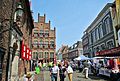
 Doesburg, Roggestraat 1-5.jpg 2,048 × 1,536; 789 KB
-

-
 Overzicht van gevelwand - Doesburg - 20424634 - RCE.jpg 1,200 × 752; 177 KB
-
 Voor- en zijgevel - Doesburg - 20058331 - RCE.jpg 801 × 1,200; 171 KB
.jpg)


