Category:Roding Valley tube station
Jump to navigation
Jump to search
London Underground station  | |||||
| Upload media | |||||
| Instance of | |||||
|---|---|---|---|---|---|
| Location |
| ||||
| Transport network | |||||
| Date of official opening |
| ||||
| Connecting line | |||||
| Adjacent station | |||||
 | |||||
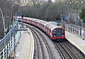
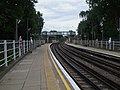
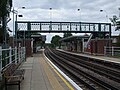
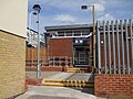
English: Roding Valley is a London Underground station situated directly on the border between the Epping Forest district of Essex and the London Borough of Redbridge. The station is between Chigwell and Woodford stations. It is located in Station Way and Cherry Tree Rise (off Buckhurst Way). Since 2 January 2007, the station is in Travelcard Zone 4.
العربية: رودينغ فالي هي إحدى محطات مترو أنفاق لندن. تقع على خط سينترال أفتتحت في المنطقة (Zone) رقم 4 أفتتحت في 3 فبراير 1936، 21 نوفمبر 1948.
Deutsch: Roding Valley ist eine oberirdische Station der London Underground im Stadtbezirk London Borough of Redbridge. Sie liegt in der Travelcard-Tarifzone 4 am Buckhurst Way, unmittelbar an der Außengrenze von Greater London. Im Jahr 2004 nutzten 0,198 Millionen Fahrgäste die von der Central Line bediente Station.
(This summary was created using Commons SumItUp)
Subcategories
This category has only the following subcategory.
Media in category "Roding Valley tube station"
The following 34 files are in this category, out of 34 total.
-
 A Central line train at Roding Valley station - geograph.org.uk - 5274148.jpg 4,000 × 3,000; 4.72 MB
-
 A Central line train at Roding Valley station - geograph.org.uk - 5274152.jpg 4,000 × 3,000; 4.98 MB
-
 CLIP first run 2023-11-24 - 49.jpg 4,032 × 3,024; 11.16 MB
-
 CLIP first run 2023-11-24 - 50.jpg 4,032 × 3,024; 10.1 MB
-
 CLIP first run 2023-11-24 - 51.jpg 4,032 × 3,024; 9.46 MB
-
 Looking east from Roding Valley station - geograph.org.uk - 5274155.jpg 4,000 × 3,000; 4.78 MB
-
 Looking east from Roding Valley station - geograph.org.uk - 5274158.jpg 4,000 × 3,000; 4.65 MB
-
 1992 Stock Roding Valley.jpg 2,987 × 2,058; 3.09 MB
-
 Roding Valley building.jpg 1,280 × 960; 252 KB
-
 Roding Valley entr south.JPG 960 × 1,280; 443 KB
-
 Roding Valley station 20170129 121625 (49386178283).jpg 5,312 × 2,988; 2.27 MB
-
 Roding Valley station 20170129 121634 (49386660146).jpg 5,312 × 2,988; 2.69 MB
-
 Roding Valley station 20170129 121653 (49386197118).jpg 5,312 × 2,988; 2.08 MB
-
 Roding Valley station 20170129 121659 (49386176073).jpg 5,312 × 2,988; 2.64 MB
-
 Roding Valley station 20170129 121754 (49386664766).jpg 5,312 × 2,988; 3.22 MB
-
 Roding Valley station 20170129 121804 (49386851962).jpg 5,312 × 2,988; 2.9 MB
-
 Roding Valley station 20170129 121841 (49386838567).jpg 5,312 × 2,988; 2.39 MB
-
 Roding Valley Station.jpg 5,350 × 3,567; 13.3 MB
-
 Roding Valley stn building.JPG 1,600 × 1,200; 484 KB
-
 Roding Valley stn east.JPG 1,280 × 960; 344 KB
-
 Roding Valley stn high eastbound.JPG 1,600 × 1,200; 471 KB
-
 Roding Valley stn high eastbound2.JPG 1,600 × 1,200; 435 KB
-
 Roding Valley stn high westbound.JPG 1,600 × 1,200; 616 KB
-
 Roding Valley stn high westbound2.JPG 1,600 × 1,200; 589 KB
-
 Roding Valley stn look east.JPG 1,600 × 1,200; 474 KB
-
 Roding Valley stn look east2.JPG 1,600 × 1,200; 480 KB
-
 Roding Valley stn look west.JPG 1,600 × 1,200; 534 KB
-
 Roding Valley stn look west2.JPG 1,600 × 1,200; 548 KB
-
 Roding Valley stn southern entrance.JPG 1,600 × 1,200; 452 KB
-
 Roding Valley stn west.JPG 1,280 × 960; 337 KB
-
 Roding Valley underground station - geograph.org.uk - 2381989.jpg 4,320 × 3,240; 4.27 MB
-
 Roding Valley underground station - geograph.org.uk - 2381991.jpg 4,320 × 3,240; 3.99 MB
-
 Roding Valley underground station - geograph.org.uk - 2381994.jpg 4,320 × 3,240; 4.68 MB
-
 Roding Valley underground station - geograph.org.uk - 2382000.jpg 4,320 × 3,240; 4.04 MB


.jpg)
.jpg)
.jpg)
.jpg)
.jpg)
.jpg)
.jpg)


