Category:Rodd, Nash and Little Brampton
Jump to navigation
Jump to search

civil parish in Herefordshire, England | |||||
| Upload media | |||||
| Instance of | |||||
|---|---|---|---|---|---|
| Location | Herefordshire, West Midlands, England | ||||
| Population |
| ||||
 | |||||
Subcategories
This category has the following 3 subcategories, out of 3 total.
Media in category "Rodd, Nash and Little Brampton"
The following 38 files are in this category, out of 38 total.
-

-
-
 Rodd, Nash & Little Brampton, Ordnance Survey Herefordshire X.SE 1886.jpg 1,650 × 1,688; 3.11 MB
-

-

-

-

-
 B4355 - geograph.org.uk - 5515273.jpg 1,024 × 683; 475 KB
-
 B4355, Presteigne to Kington road - geograph.org.uk - 5515263.jpg 1,024 × 683; 438 KB
-
 Bridge across Hindwell brook at ford, Knill - geograph.org.uk - 1924346.jpg 4,288 × 2,848; 2.93 MB
-
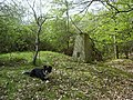
 Cairn, Nash Wood - geograph.org.uk - 5515450.jpg 1,024 × 683; 552 KB
-
 Field of oats, Nash - geograph.org.uk - 5995272.jpg 1,024 × 683; 376 KB
-
 Field, Ashley - geograph.org.uk - 5995291.jpg 1,024 × 683; 313 KB
-
 Fields near Nash - geograph.org.uk - 5515279.jpg 1,024 × 683; 352 KB
-
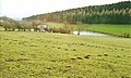
 Grassland Pasture and Woodland at Nash - geograph.org.uk - 4373444.jpg 1,799 × 1,200; 1.09 MB
-
 Green lane, Nash - geograph.org.uk - 5995282.jpg 1,024 × 683; 511 KB
-
 Green lane, Nash - geograph.org.uk - 5995286.jpg 1,024 × 683; 478 KB
-
 Green lane, Nash - geograph.org.uk - 5995288.jpg 1,024 × 683; 432 KB
-
 Kington and Presteigne railway - geograph.org.uk - 5995290.jpg 1,024 × 683; 466 KB
-
 Narrow bridge near Presteigne - geograph.org.uk - 2891407.jpg 640 × 480; 117 KB
-
 Nash Ford - geograph.org.uk - 4294434.jpg 3,872 × 2,592; 4.89 MB
-
 Nash Wood - geograph.org.uk - 5515310.jpg 1,024 × 683; 462 KB
-
 Nash Wood - geograph.org.uk - 5515323.jpg 1,024 × 683; 506 KB
-
 Nash Wood - geograph.org.uk - 5516896.jpg 1,024 × 683; 457 KB
-
 Old railway trackbed near Ashley - 2 - geograph.org.uk - 903798.jpg 640 × 480; 124 KB
-
 Overgrown track junction near Nash - geograph.org.uk - 821671.jpg 640 × 480; 105 KB
-
 Path and depression, Nash Wood - geograph.org.uk - 5515335.jpg 1,024 × 683; 513 KB
-
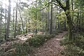 Path, Nash Wood - geograph.org.uk - 5515319.jpg 1,024 × 683; 435 KB
-
 Reflection in the brook - geograph.org.uk - 2502766.jpg 3,115 × 2,266; 4.84 MB
-
 Rodd Hurst 2008 - geograph.org.uk - 821664.jpg 640 × 480; 67 KB
-
 Rodd junction or road junction 2008 - geograph.org.uk - 821661.jpg 640 × 482; 74 KB
-
 Summit path, Nash Wood - geograph.org.uk - 5516875.jpg 1,024 × 683; 552 KB
-
 The track bends right - 2008 - geograph.org.uk - 821720.jpg 640 × 480; 95 KB
-
 Trig points. - geograph.org.uk - 1838450.jpg 640 × 480; 167 KB
-
 Turnips, Rodd Hurst - geograph.org.uk - 5515267.jpg 1,024 × 683; 358 KB
-

-
 Under Burcher Wood - geograph.org.uk - 5515258.jpg 1,024 × 683; 446 KB
-
 View down Sheepwalk to The Kennels at Eywood - geograph.org.uk - 4345597.jpg 1,186 × 709; 874 KB


_p110.jpg)


_p152.jpg)