Category:Rockbourne
Jump to navigation
Jump to search
village in the United Kingdom  | |||||
| Upload media | |||||
| Instance of | |||||
|---|---|---|---|---|---|
| Location | New Forest, Hampshire, South East England, England | ||||
| Population |
| ||||
| Said to be the same as | Rockbourne (Wikimedia duplicated page, civil parish) | ||||
 | |||||
English: Rockbourne is a village and civil parish in the English county of Hampshire, close to Fordingbridge.
Subcategories
This category has the following 5 subcategories, out of 5 total.
Media in category "Rockbourne"
The following 172 files are in this category, out of 172 total.
-
 "Old Timbers" - geograph.org.uk - 1921820.jpg 640 × 480; 146 KB
-
 14th Century Manor House - geograph.org.uk - 1921799.jpg 640 × 480; 135 KB
-
 Approach to Rockbourne - geograph.org.uk - 2459400.jpg 640 × 480; 94 KB
-
 Bench Mark, Rockbourne - geograph.org.uk - 2118571.jpg 480 × 640; 65 KB
-
 Bench Mark, Rockstead Farm - geograph.org.uk - 2331113.jpg 480 × 640; 105 KB
-
 Benchmark on the bridge - geograph.org.uk - 2834434.jpg 733 × 800; 342 KB
-
 Black Hill, bird feeder - geograph.org.uk - 3484999.jpg 1,024 × 768; 320 KB
-
 Black Hill, bridleway - geograph.org.uk - 3484982.jpg 1,024 × 768; 217 KB
-
 Black Hill, farm track - geograph.org.uk - 3484989.jpg 1,024 × 768; 257 KB
-
 Bridge carrying minor road across stream - geograph.org.uk - 3005271.jpg 1,024 × 760; 316 KB
-
 Bridleway beside Rockborne Manor - geograph.org.uk - 6750685.jpg 640 × 426; 110 KB
-
 Bridleway going to Whitsbury - geograph.org.uk - 6750694.jpg 1,600 × 1,064; 497 KB
-
 Bridleway near Rockbourne - geograph.org.uk - 739530.jpg 640 × 480; 160 KB
-
 Bus shelter, Rockbourne - geograph.org.uk - 2331000.jpg 640 × 483; 76 KB
-
 Bus shelter, Rockbourne - geograph.org.uk - 2856387.jpg 640 × 480; 88 KB
-
 Byway to Tidpit - geograph.org.uk - 2826102.jpg 640 × 480; 82 KB
-
 Common Dog Violet (Viola riviniana) - geograph.org.uk - 739554.jpg 480 × 640; 147 KB
-
 Cottage and blossom in Rockbourne - geograph.org.uk - 420097.jpg 640 × 480; 93 KB
-
 Cricket at Rockbourne - geograph.org.uk - 4102747.jpg 640 × 427; 59 KB
-
 Crossing Sweatfords Water - geograph.org.uk - 2834395.jpg 800 × 600; 196 KB
-
 Cultivator in field of stubble - geograph.org.uk - 117770.jpg 640 × 480; 176 KB
-
 Damerham, footpath - geograph.org.uk - 3500025.jpg 768 × 1,024; 318 KB
-
 Damerham, gate and stile - geograph.org.uk - 3500048.jpg 1,024 × 768; 244 KB
-
 Damerham, woodland track - geograph.org.uk - 3500059.jpg 1,024 × 768; 328 KB
-
 Date stone, Rockbourne - geograph.org.uk - 2856641.jpg 640 × 441; 83 KB
-
 Drive, Cranway Farm - geograph.org.uk - 2826118.jpg 640 × 480; 92 KB
-
 Enclosed footpath, Rockbourne - geograph.org.uk - 740375.jpg 640 × 480; 170 KB
-
 Entrance to Down Farm - geograph.org.uk - 2972588.jpg 3,385 × 2,347; 1.4 MB
-
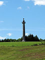 Eyre Coote's Monument - geograph.org.uk - 2042332.jpg 480 × 640; 60 KB
-
 Farm track near Rockbourne - geograph.org.uk - 4393433.jpg 640 × 427; 114 KB
-

-
 Field edge near Rockbourne - geograph.org.uk - 4393435.jpg 640 × 427; 85 KB
-
 Field near Whitsbury Cross - geograph.org.uk - 4102577.jpg 640 × 427; 90 KB
-
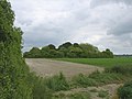
 Fields near Rockbourne - geograph.org.uk - 4102784.jpg 640 × 427; 67 KB
-
 Footpath approaching Rockborne - geograph.org.uk - 6750672.jpg 640 × 426; 126 KB
-
 Footpath beside cob wall, Rockbourne - geograph.org.uk - 739239.jpg 640 × 480; 102 KB
-
 Footpath going to Rockbourne - geograph.org.uk - 6750593.jpg 640 × 426; 112 KB
-
 Footpath near Rockbourne - geograph.org.uk - 4102596.jpg 640 × 427; 128 KB
-
 Footpath Rockbourne Hampshire - geograph.org.uk - 932434.jpg 426 × 640; 97 KB
-
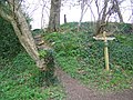
 Footpath sign, Rockbourne - geograph.org.uk - 740361.jpg 640 × 480; 131 KB
-
 Footpath to Brookheath - geograph.org.uk - 160749.jpg 640 × 481; 178 KB
-
 Footpath to Manor Farm - geograph.org.uk - 740339.jpg 640 × 480; 162 KB
-
 Footpath to Rockbourne - geograph.org.uk - 739570.jpg 640 × 498; 119 KB
-

-
 Footpath to the Church - geograph.org.uk - 739212.jpg 640 × 480; 131 KB
-
 Footpath to Whitsbury - geograph.org.uk - 739545.jpg 640 × 480; 138 KB
-
 Footpath to Whitsbury - geograph.org.uk - 739571.jpg 640 × 480; 95 KB
-
 Footpath, Rockbourne - geograph.org.uk - 2136956.jpg 480 × 640; 93 KB
-
 Gate and footpath, Rockbourne - geograph.org.uk - 740350.jpg 640 × 480; 140 KB
-
 Gatehouse, Rockbourne - geograph.org.uk - 2118563.jpg 640 × 480; 73 KB
-
 Guinea Fowl, Drove Barn - geograph.org.uk - 739687.jpg 640 × 442; 86 KB
-
 Headstones, St Andrew's Churchyard - geograph.org.uk - 2136965.jpg 640 × 480; 81 KB
-
 Hedge cutting near Rockbourne - geograph.org.uk - 2785869.jpg 640 × 480; 112 KB
-
 House by the bourne, Rockbourne - geograph.org.uk - 4102741.jpg 427 × 640; 103 KB
-
 Impressive Topiary - geograph.org.uk - 1921804.jpg 640 × 480; 172 KB
-
 It ain't exactly Pompeii - geograph.org.uk - 2042345.jpg 640 × 480; 120 KB
-
 Junction of un-named lanes east of Rockbourne Roman Villa - geograph.org.uk - 2971263.jpg 3,322 × 2,320; 1.53 MB
-
 Laid hedge - geograph.org.uk - 6750651.jpg 1,600 × 1,064; 586 KB
-
 Laid hedge - geograph.org.uk - 6750660.jpg 1,600 × 1,064; 634 KB
-
 Local residents, Rockbourne - geograph.org.uk - 740324.jpg 640 × 428; 63 KB
-
 Lodges at the gates of West Park, Rockbourne - geograph.org.uk - 2970103.jpg 1,024 × 759; 242 KB
-
 Manor Farm Barn at Rockbourne - geograph.org.uk - 2515583.jpg 1,128 × 1,423; 357 KB
-
 Meadow cranesbill near Rockbourne - geograph.org.uk - 2499540.jpg 640 × 481; 76 KB
-
 Minor road near Rochbourne - geograph.org.uk - 2331081.jpg 640 × 480; 80 KB
-
 Minty's Hill bridge at Rockbourne - geograph.org.uk - 4102743.jpg 640 × 427; 148 KB
-
 Mushroom Farm Rockbourne Hampshire - geograph.org.uk - 932414.jpg 640 × 426; 136 KB
-
 Notice board, Rockbourne - geograph.org.uk - 2331036.jpg 480 × 640; 89 KB
-
 One of my titled relatives.... - geograph.org.uk - 2739673.jpg 480 × 640; 57 KB
-
 Peas growing near Whitsbury - geograph.org.uk - 2499506.jpg 640 × 481; 80 KB
-
 Pillar box and house at Rockbourne - geograph.org.uk - 4102727.jpg 640 × 427; 106 KB
-
 Plump sheep Rockbourne Hampshire - geograph.org.uk - 932403.jpg 640 × 426; 111 KB
-
 Postbox, Rockbourne - geograph.org.uk - 885840.jpg 480 × 640; 144 KB
-
 Rockbourne Cottage - geograph.org.uk - 620653.jpg 640 × 441; 159 KB
-
 Rockbourne Down, byway - geograph.org.uk - 3484802.jpg 1,024 × 768; 123 KB
-
 Rockbourne Down, grassland - geograph.org.uk - 3485215.jpg 1,024 × 768; 151 KB
-
 Rockbourne Down, power lines - geograph.org.uk - 3484808.jpg 768 × 1,024; 143 KB
-
 Rockbourne junction - geograph.org.uk - 2207374.jpg 480 × 640; 82 KB
-
 Rockbourne Lane - geograph.org.uk - 3486932.jpg 1,024 × 768; 209 KB
-
 Rockbourne Recreation Ground - geograph.org.uk - 1823328.jpg 1,024 × 768; 135 KB
-
 Rockbourne Roman Villa - geograph.org.uk - 2042336.jpg 640 × 480; 105 KB
-
 Rockbourne Village - geograph.org.uk - 1921827.jpg 640 × 480; 104 KB
-
 Rockbourne village - geograph.org.uk - 2042360.jpg 640 × 480; 85 KB
-
 Rockbourne Village Hall - geograph.org.uk - 1823339.jpg 1,024 × 768; 260 KB
-
 Rockbourne, barns - geograph.org.uk - 3486979.jpg 1,024 × 768; 225 KB
-
 Rockbourne, barrier - geograph.org.uk - 3484781.jpg 1,024 × 768; 238 KB
-
 Rockbourne, bridges - geograph.org.uk - 1823475.jpg 1,600 × 1,200; 648 KB
-
 Rockbourne, byway - geograph.org.uk - 3484791.jpg 1,024 × 768; 177 KB
-
 Rockbourne, cottages - geograph.org.uk - 3485249.jpg 1,024 × 754; 128 KB
-
 Rockbourne, cropland - geograph.org.uk - 3499965.jpg 1,024 × 768; 245 KB
-
 Rockbourne, donkeys - geograph.org.uk - 1823349.jpg 800 × 600; 197 KB
-
 Rockbourne, Duck's Nest - geograph.org.uk - 3485237.jpg 1,024 × 768; 112 KB
-
 Rockbourne, farm access road - geograph.org.uk - 3484786.jpg 1,024 × 768; 274 KB
-
 Rockbourne, farm track - geograph.org.uk - 3487012.jpg 1,024 × 768; 190 KB
-
 Rockbourne, field boundary - geograph.org.uk - 3485227.jpg 1,024 × 768; 152 KB
-
 Rockbourne, field boundary - geograph.org.uk - 3486995.jpg 768 × 1,024; 287 KB
-
 Rockbourne, footpath - geograph.org.uk - 3484848.jpg 768 × 1,024; 245 KB
-
 Rockbourne, footpath - geograph.org.uk - 3486953.jpg 1,024 × 768; 242 KB
-
 Rockbourne, footpath - geograph.org.uk - 3499924.jpg 1,024 × 768; 245 KB
-
 Rockbourne, footpath - geograph.org.uk - 3499958.jpg 1,024 × 768; 338 KB
-
 Rockbourne, gate - geograph.org.uk - 3499935.jpg 1,024 × 768; 299 KB
-
 Rockbourne, horses grazing - geograph.org.uk - 1823317.jpg 800 × 600; 143 KB
-
 Rockbourne, lodges - geograph.org.uk - 1823508.jpg 1,024 × 768; 257 KB
-
 Rockbourne, oil-seed rape - geograph.org.uk - 3484796.jpg 1,024 × 768; 178 KB
-
 Rockbourne, postbox № SP6 285 - geograph.org.uk - 3387359.jpg 480 × 640; 134 KB
-

-
 Rockbourne, primary school - geograph.org.uk - 1823491.jpg 800 × 600; 117 KB
-
 Rockbourne, restricted byway - geograph.org.uk - 3485221.jpg 1,024 × 768; 135 KB
-
 Rockbourne, roadbridge - geograph.org.uk - 1822459.jpg 1,024 × 768; 406 KB
-
 Rockbourne, shepherd - geograph.org.uk - 1823503.jpg 1,024 × 768; 150 KB
-
 Rockbourne, stables - geograph.org.uk - 3487040.jpg 1,024 × 768; 169 KB
-
 Rockbourne, stile - geograph.org.uk - 3499998.jpg 1,024 × 768; 305 KB
-
 Rockbourne, stream - geograph.org.uk - 1822634.jpg 1,600 × 1,200; 431 KB
-
 Rockbourne, sunbathing sheep - geograph.org.uk - 3487053.jpg 1,024 × 768; 192 KB
-
 Rockbourne, Sweatfords Water - geograph.org.uk - 3486948.jpg 768 × 1,024; 348 KB
-
 Rockbourne, topiary - geograph.org.uk - 1823423.jpg 1,600 × 1,200; 676 KB
-
 Rockbourne, trig point - geograph.org.uk - 3499980.jpg 1,024 × 768; 197 KB
-
 Rockbourne, war memorial - geograph.org.uk - 1823463.jpg 1,024 × 768; 312 KB
-
 Rockbourne, winterbourne - geograph.org.uk - 1823312.jpg 1,024 × 768; 364 KB
-
 Rockbourne, winterbourne - geograph.org.uk - 1823451.jpg 1,024 × 768; 268 KB
-

-
 Roe deer near Brookheath - geograph.org.uk - 739438.jpg 640 × 480; 107 KB
-
 Steep drop, Sagles Spring - geograph.org.uk - 740238.jpg 640 × 480; 161 KB
-

-
 Stream, Rockbourne - geograph.org.uk - 738987.jpg 640 × 480; 134 KB
-
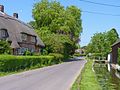
 Street Scene, Rockbourne - geograph.org.uk - 738970.jpg 640 × 480; 103 KB
-
 Summit of lane by Rockstead Copse - geograph.org.uk - 4102587.jpg 640 × 427; 117 KB
-

-
 Sweatford's Water - geograph.org.uk - 2972569.jpg 3,648 × 2,736; 2.78 MB
-
 Telephone box, Rockbourne - geograph.org.uk - 1578942.jpg 640 × 480; 179 KB
-
 Thatched Cottage with Cordyline - geograph.org.uk - 1921814.jpg 640 × 480; 129 KB
-
 Thatched cottages at Rockbourne - geograph.org.uk - 4102752.jpg 640 × 427; 84 KB
-
 Tidpit, farm road - geograph.org.uk - 3500186.jpg 1,024 × 768; 190 KB
-
 Track going from Rockborne to Whitsbury - geograph.org.uk - 6750666.jpg 640 × 426; 115 KB
-
 Trackways converge north of Cranway Farm - geograph.org.uk - 2972596.jpg 3,648 × 2,736; 1.51 MB
-
 Trentham Cottage - Rockbourne - geograph.org.uk - 620654.jpg 640 × 443; 175 KB
-
 Turnips - geograph.org.uk - 116657.jpg 640 × 480; 196 KB
-
 Un-named lane enters Rockbourne - geograph.org.uk - 2971271.jpg 3,536 × 2,659; 1.65 MB
-
 Un-named lane northwest of Glebe Farm - geograph.org.uk - 2972582.jpg 3,539 × 2,470; 1.94 MB
-
 Un-named road east of West Park Farm - geograph.org.uk - 2971257.jpg 3,648 × 2,736; 2.45 MB
-

-
 View into field near Rockbourne - geograph.org.uk - 4102756.jpg 640 × 427; 113 KB
-
 View towards Rockbourne - geograph.org.uk - 4102600.jpg 640 × 427; 81 KB
-

-
 Water meadows near Marsh Farm - geograph.org.uk - 740309.jpg 640 × 480; 87 KB
-
 Way to Down Farm - geograph.org.uk - 2459375.jpg 640 × 480; 127 KB
-
 West Park gatehouses - geograph.org.uk - 2042353.jpg 640 × 480; 107 KB
-
 Wheat field near Tidpit - geograph.org.uk - 2499531.jpg 640 × 482; 98 KB
-
 Whitsbury Down, restricted byway - geograph.org.uk - 3485197.jpg 1,024 × 768; 148 KB
-

-
 Beech avenue on the track to Knoll Farm - geograph.org.uk - 117788.jpg 640 × 480; 219 KB
-
 Brook Heath - geograph.org.uk - 291601.jpg 640 × 480; 123 KB
-
 Duck's Nest long barrow, Rockbourne - geograph.org.uk - 25430.jpg 640 × 480; 395 KB
-
 Dunn Cottage at Brook Heath - geograph.org.uk - 291603.jpg 640 × 480; 181 KB
-
 Earthworks of ancient settlement - geograph.org.uk - 117850.jpg 640 × 480; 193 KB
-
 Farm Track, North of Rockbourne - geograph.org.uk - 186985.jpg 640 × 481; 121 KB
-
 Farmland near Brookheath - geograph.org.uk - 740174.jpg 640 × 443; 89 KB
-
 Farmland, south of Rockbourne - geograph.org.uk - 162109.jpg 640 × 481; 110 KB
-
 Field beside Drove Barn - geograph.org.uk - 739676.jpg 640 × 480; 110 KB
-
 Fishery, Rockbourne - geograph.org.uk - 162106.jpg 640 × 481; 145 KB
-
 Footpath from Green Lane - geograph.org.uk - 740134.jpg 640 × 480; 147 KB
-
 Footpath junction, Sagles Spring - geograph.org.uk - 740259.jpg 640 × 480; 149 KB
-
 Footpath towards Marsh Farm - geograph.org.uk - 740301.jpg 640 × 480; 87 KB
-
 Footpath towards Rockbourne - geograph.org.uk - 740270.jpg 640 × 480; 155 KB
-
 Footpath towards Rockbourne - geograph.org.uk - 740280.jpg 640 × 480; 147 KB
-
 Northayes Farm, Whitsbury Down - geograph.org.uk - 203099.jpg 640 × 431; 119 KB
-
 Road Junction, south of Rockbourne - geograph.org.uk - 162114.jpg 640 × 481; 113 KB
-
 Rockbourne - geograph.org.uk - 46492.jpg 640 × 427; 120 KB
-
 The Mushroom Farm, Rockbourne - geograph.org.uk - 399741.jpg 640 × 480; 105 KB
-
 Towards Little Toyd Down - geograph.org.uk - 280474.jpg 640 × 480; 87 KB
-
 Track to Knoll Farm - geograph.org.uk - 117777.jpg 640 × 480; 182 KB
-

-
 West of Green Lane - geograph.org.uk - 291608.jpg 640 × 480; 117 KB


_-_geograph.org.uk_-_739554.jpg)


