Category:Rock formations in England
Jump to navigation
Jump to search
Wikimedia category | |||||
| Upload media | |||||
| Instance of | |||||
|---|---|---|---|---|---|
| Category combines topics | |||||
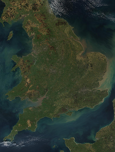
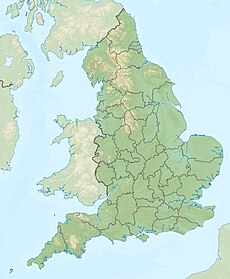
| England | |||||
country in north-west Europe, part of the United Kingdom | |||||
| Spoken text audio | |||||
| Pronunciation audio | |||||
| Instance of | |||||
| Name in native language |
| ||||
| Named after | |||||
| Patron saint | |||||
| Location |
| ||||
| Capital | |||||
| Basic form of government |
| ||||
| Official language | |||||
| Anthem |
| ||||
| Currency | |||||
| Head of state |
| ||||
| Head of government |
| ||||
| Highest point | |||||
| Population |
| ||||
| Area |
| ||||
| Replaces |
| ||||
| Different from | |||||
| official website | |||||
 | |||||
Subcategories
This category has the following 54 subcategories, out of 54 total.
*
A
- Almscliffe Crag (35 F)
B
- Black Rocks, Derbyshire (37 F)
- Bognor Rocks (15 F)
C
- Castle Rock (Nottingham) (19 F)
- Coralline Crag (7 F)
- Cranberry Rock (4 F)
D
- Devils Chair (Stiperstones) (12 F)
- Doubler Stones (9 F)
E
- Egmont Rocks (6 F)
G
H
- Holwick Scars (11 F)
- Humphrey Head (91 F)
L
- Lee Ness Ledge (6 F)
- Lulworth Crumple (4 F)
M
- Manstone Rock (24 F)
- Marsden Rock (30 F)
N
- Nipstone Rock (7 F)
O
- Old Man of Mow (11 F)
P
- Plumpton Rocks (11 F)
R
- Ramshaw Rocks (34 F)
- Rock of Ages (Somerset) (5 F)
S
- Shitlington Crags (7 F)
T
- The Basin Stone (10 F)
W
- Woodhouse Scar (9 F)
- The Wool Packs, Edale (27 F)
Media in category "Rock formations in England"
The following 60 files are in this category, out of 60 total.
-
101 4494 The "Wolf Hole" on Wolf Hole Crag, about 100 yards east of the trig point.jpg 2,576 × 1,716; 1.43 MB
-
Agglestone on the heath.jpg 2,200 × 1,467; 1.92 MB
-
Ashness Bridge and Derwent Water, Lake District.jpg 2,494 × 3,716; 2.41 MB
-
Branscombe Pinnacle.jpg 3,872 × 2,592; 6.35 MB
-
Carron Crag.JPG 480 × 640; 95 KB
-
Cliff polzeath beach.jpg 5,472 × 3,648; 3.36 MB
-
Coralline Crag Suffolk.jpg 1,653 × 1,227; 2.09 MB
-
Cowper Stone Stanage Edge.jpg 2,560 × 1,920; 1.27 MB
-
Crack climb at Ippikin's rock - geograph.org.uk - 689176.jpg 291 × 640; 92 KB
-
Disused railway cutting - geograph.org.uk - 786576.jpg 445 × 640; 119 KB
-
Dovestone reservoir indian head.JPG 3,888 × 2,592; 1.2 MB
-
Eagle-stone.jpg 1,024 × 841; 415 KB
-
Fellgate.jpg 640 × 480; 207 KB
-
Footpath near White Wall End - geograph.org.uk - 2010122.jpg 2,048 × 1,536; 1.79 MB
-
Granite rock bubble.JPG 610 × 320; 19 KB
-
Guise Cliff, Nidderdale - geograph.org.uk - 124309.jpg 582 × 244; 15 KB
-
Hen Stones - geograph.org.uk - 268826.jpg 640 × 480; 80 KB
-
Hen Stones Bank - geograph.org.uk - 268821.jpg 640 × 480; 98 KB
-
Hengistbury Head - rock.jpg 3,194 × 4,812; 4.7 MB
-
High Crag - geograph.org.uk - 147896.jpg 640 × 483; 80 KB
-
Indian Head at Dovestones Reservoir.jpg 3,888 × 2,592; 680 KB
-
Jenny Twigg and her daughter Tib - geograph.org.uk - 319418.jpg 400 × 597; 96 KB
-
Jenny Twigg and her Daughter Tib - geograph.org.uk - 612650.jpg 640 × 480; 76 KB
-
Lindley Moor Trig Pillar - geograph.org.uk - 460062.jpg 640 × 480; 117 KB
-
Little Pock Stones - geograph.org.uk - 147212.jpg 640 × 427; 63 KB
-
Lord's Seat - geograph.org.uk - 508828.jpg 640 × 356; 72 KB
-
Merlin profile.jpg 3,648 × 2,736; 2.02 MB
-
Nicodemus Knob.jpg 1,024 × 627; 514 KB
-
Outcrop - geograph.org.uk - 241982.jpg 640 × 480; 142 KB
-
Parson and Clerk rocks from Sprey Point.jpg 1,024 × 650; 145 KB
-
Pot Scar - geograph.org.uk - 1742401.jpg 640 × 480; 109 KB
-
River Coquet at Morwick Crag - geograph.org.uk - 1174653.jpg 640 × 480; 85 KB
-
Rock formation - geograph.org.uk - 649978.jpg 480 × 640; 87 KB
-
Rock formation in Chew Valley, Oldham, Greater Manchester.JPG 2,592 × 3,888; 1.94 MB
-
Rock formation in Studland.jpg 5,472 × 2,572; 5.82 MB
-
Rock formation near Mow Cop Castle.jpg 5,888 × 3,925; 8.53 MB
-
Rock Formations on Kinder Scout - geograph.org.uk - 2805418.jpg 4,000 × 3,000; 3.6 MB
-
Rock on Barnburgh cliff - geograph.org.uk - 1654489.jpg 480 × 640; 107 KB
-
Rock outcrop in Brotherton Park 1.jpg 5,198 × 3,462; 27.46 MB
-
Rock outcrop in Brotherton Park 2.jpg 5,198 × 3,462; 30.61 MB
-
Rock Outcrops, Kinder Scout - geograph.org.uk - 2525930.jpg 427 × 640; 324 KB
-
Rock port gaverne.jpg 5,472 × 3,648; 4.45 MB
-
Rocks above Jenny's Cove - geograph.org.uk - 73856.jpg 640 × 480; 31 KB
-
Rocks at Hartland point.JPG 2,272 × 1,704; 872 KB
-
Rocks near Lulworth Cove.JPG 1,668 × 2,077; 936 KB
-
ShaldonNessKorr.jpg 1,536 × 1,024; 528 KB
-
Shooters' Nab - geograph.org.uk - 171655.jpg 640 × 466; 121 KB
-
Shooters' Nab - geograph.org.uk - 195377.jpg 640 × 480; 96 KB
-
Slatewall trebarwith strand.jpg 5,472 × 3,648; 4.95 MB
-
StAgnesElephant.JPG 2,304 × 1,728; 2.73 MB
-
Sutton Bank - geograph.org.uk - 445988.jpg 640 × 480; 105 KB
-
The agglestone closeup.jpg 2,816 × 1,877; 3.01 MB
-
The Needle's Eye - geograph.org.uk - 1655830.jpg 531 × 640; 104 KB
-
Trinnacle - geograph.org.uk - 16077.jpg 480 × 640; 116 KB
-
View SE from Mow Cop Castle.jpg 6,000 × 4,000; 9.28 MB
-
Watchetrockforms.jpg 3,264 × 2,448; 2.73 MB
-
Wave Cut Notch, Fairlight Head - geograph.org.uk - 771010.jpg 480 × 640; 121 KB
-
West Nab looking to Meltham Village - geograph.org.uk - 684475.jpg 640 × 480; 91 KB


