Category:Rochdale Road, Halifax
Jump to navigation
Jump to search
Media in category "Rochdale Road, Halifax"
The following 20 files are in this category, out of 20 total.
-
 A58 Rochdale Road - geograph.org.uk - 5823379.jpg 1,024 × 736; 121 KB
-
 A58 Rochdale Road at the closed Wellington Inn - geograph.org.uk - 5824326.jpg 1,024 × 724; 110 KB
-
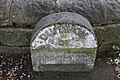
 Benchmark on boundary stone beside Rochdale Road - geograph.org.uk - 5851977.jpg 683 × 1,024; 183 KB
-
 Benchmark on post at Rochdale Road wall angle - geograph.org.uk - 5851860.jpg 683 × 1,024; 252 KB
-
 Benchmark on Rochdale Road wall - geograph.org.uk - 5798160.jpg 1,024 × 683; 337 KB
-

-

-
 Boundary stone at bend in Rochdale Road - geograph.org.uk - 5851994.jpg 1,024 × 683; 211 KB
-
 Entrance to descending steps from Rochdale Road - geograph.org.uk - 5798115.jpg 1,024 × 683; 206 KB
-
 Footpath - Rochdale Road - geograph.org.uk - 3804086.jpg 480 × 640; 104 KB
-
 Junction of Rochdale Road and Woodland Drive - geograph.org.uk - 5851874.jpg 1,024 × 683; 216 KB
-
 Old Boundary Marker by the A58, Rochdale Road, Halifax - geograph.org.uk - 6093854.jpg 1,936 × 1,296; 386 KB
-
 Rochdale Road (A58), Halifax - geograph.org.uk - 2053115.jpg 800 × 600; 98 KB
-

-

-

-

-
 Rochdale Road approaching Green Lane junction - geograph.org.uk - 5798165.jpg 1,024 × 683; 209 KB
-

-
 The Wellington, Rochdale Road - geograph.org.uk - 1845889.jpg 612 × 460; 167 KB


_-_geograph.org.uk_-_5799218.jpg)


,_Halifax_-_geograph.org.uk_-_2053115.jpg)


