Category:Rochdale Canal, Todmorden
Jump to navigation
Jump to search
Subcategories
This category has the following 9 subcategories, out of 9 total.
B
- Baltimore Bridge, Todmorden (2 F)
- Bottomley Lock, Rochdale Canal (10 F)
G
L
- Lane Bottom Bridge (6 F)
- Library Lock (14 F)
- Lobb Mill Lock (4 F)
S
- Shop Lock (Rochdale canal) (8 F)
W
- Warland Upper Lock (7 F)
Media in category "Rochdale Canal, Todmorden"
The following 190 files are in this category, out of 190 total.
-
 1000 crosses the Rochdale Canal at Gauxholme.jpg 1,024 × 768; 424 KB
-
 40118 passes the Rochdale Canal at Gauxholme.jpg 1,024 × 768; 344 KB
-
-

-
 Bacup Road Bridge - geograph.org.uk - 1550706.jpg 640 × 480; 94 KB
-
 Baltimore Marina (22858605237).jpg 3,312 × 2,208; 5.7 MB
-
 Basil, Rochdale Canal, Todmorden, Yorkshire (24719054075).jpg 4,454 × 2,883; 6.56 MB
-
 Below Old Royd Lock, Rochdale Canal - geograph.org.uk - 398952.jpg 640 × 465; 101 KB
-
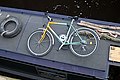 Bike on a narrowboat - geograph.org.uk - 881679.jpg 640 × 429; 94 KB
-
 Birks Hall Bridge - geograph.org.uk - 1354976.jpg 640 × 480; 106 KB
-
 Bridge 29, Rochdale Canal.jpg 2,455 × 1,964; 5.97 MB
-
 Bridge No. 25, Rochdale Canal.jpg 640 × 409; 134 KB
-
 Bridge No. 39, Rochdale Canal.jpg 800 × 543; 176 KB
-
 Bridge over Rochdale Canal - geograph.org.uk - 1284627.jpg 640 × 480; 103 KB
-
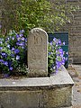 Canal milestone (geograph 3511837).jpg 480 × 640; 109 KB
-
 Closed Lock - geograph.org.uk - 655604.jpg 640 × 480; 84 KB
-
 Cottages at Warland - geograph.org.uk - 280129.jpg 640 × 480; 128 KB
-
 Eastwood, Todmorden.jpg 640 × 480; 149 KB
-
 Gauxholme Warehouse.jpg 800 × 593; 149 KB
-
 Get your kicks on Route 66 - geograph.org.uk - 979033.jpg 640 × 480; 95 KB
-

-

-
 Hollins Lock - geograph.org.uk - 411021.jpg 640 × 480; 113 KB
-

-
 Holmcoat Lock No 14, Rochdale Canal - geograph.org.uk - 404745.jpg 640 × 427; 103 KB
-
 Lightbank Lock - geograph.org.uk - 1235037.jpg 640 × 428; 105 KB
-
 Lightbank Lock - geograph.org.uk - 1235045.jpg 640 × 428; 94 KB
-
 Lightbank Lock, Rochdale Canal - geograph.org.uk - 1235029.jpg 640 × 428; 101 KB
-
 Lob Mill Railway Viaduct - geograph.org.uk - 1269571.jpg 640 × 328; 153 KB
-
 Lobb Mill Bridge - geograph.org.uk - 1125447.jpg 640 × 480; 77 KB
-
 Lock 17, Rochdale Canal.jpg 2,881 × 3,601; 8.38 MB
-
 Lock 20 on the Rochdale Canal.jpg 2,935 × 2,935; 10.09 MB
-
 Lock No. 19, Rochdale Canal.jpg 800 × 601; 146 KB
-
 Lock No. 20, Rochdale Canal.jpg 800 × 600; 139 KB
-
 Lock No. 21, Rochdale Canal.jpg 800 × 501; 138 KB
-
 Lock on the Rochdale Canal at Bacup Road - geograph.org.uk - 1550709.jpg 480 × 640; 108 KB
-
-
 Mileage Sign, Rochdale Canal. - geograph.org.uk - 509256.jpg 640 × 480; 133 KB
-
 Milestone marker on the Rochdale canal at Todmorden Lock number 19.jpg 4,288 × 2,848; 1.45 MB
-
 Nip Square Lock - geograph.org.uk - 411019.jpg 480 × 640; 88 KB
-
 Old milemarker by the Rochdale Canal, Todmorden (geograph 6094623).jpg 600 × 800; 194 KB
-
 Old milemarker by the Rochdale Canal, Todmorden (geograph 6096035).jpg 600 × 800; 175 KB
-

-

-
 Pinnel Lock, Rochdale Canal near Walsden - geograph.org.uk - 274990.jpg 640 × 426; 188 KB
-
 Put your back into it^ - geograph.org.uk - 881666.jpg 640 × 480; 155 KB
-
 Rochdale Canal - 53679016085.jpg 1,776 × 2,960; 4.68 MB
-
 Rochdale Canal - Alma Road - geograph.org.uk - 1199950.jpg 640 × 480; 264 KB
-
 Rochdale Canal - geograph.org.uk - 1125456.jpg 640 × 480; 71 KB
-
 Rochdale Canal - geograph.org.uk - 1250117.jpg 640 × 426; 87 KB
-
 Rochdale Canal - geograph.org.uk - 1250155.jpg 640 × 426; 83 KB
-
 Rochdale Canal - geograph.org.uk - 1250170.jpg 640 × 427; 100 KB
-
 Rochdale Canal - geograph.org.uk - 1342048.jpg 480 × 640; 79 KB
-
 Rochdale Canal - geograph.org.uk - 1346505.jpg 640 × 480; 85 KB
-
 Rochdale Canal - geograph.org.uk - 1354973.jpg 640 × 480; 93 KB
-
 Rochdale Canal - geograph.org.uk - 1354988.jpg 640 × 480; 105 KB
-
 Rochdale Canal - geograph.org.uk - 1355010.jpg 640 × 480; 78 KB
-
 Rochdale Canal - geograph.org.uk - 1355017.jpg 640 × 480; 78 KB
-
 Rochdale Canal - geograph.org.uk - 1355022.jpg 480 × 640; 117 KB
-
 Rochdale Canal - geograph.org.uk - 1461911.jpg 640 × 480; 97 KB
-
 Rochdale Canal - geograph.org.uk - 1461917.jpg 640 × 480; 123 KB
-
 Rochdale Canal - geograph.org.uk - 1740375.jpg 1,024 × 768; 211 KB
-
 Rochdale Canal - geograph.org.uk - 481192.jpg 2,095 × 1,415; 1.02 MB
-
 Rochdale Canal - geograph.org.uk - 500632.jpg 640 × 480; 91 KB
-
 Rochdale Canal - geograph.org.uk - 509189.jpg 640 × 480; 128 KB
-
 Rochdale Canal - geograph.org.uk - 528741.jpg 640 × 480; 87 KB
-
 Rochdale Canal - geograph.org.uk - 983627.jpg 640 × 480; 185 KB
-
 Rochdale Canal - Hollins Road - geograph.org.uk - 1199934.jpg 640 × 480; 315 KB
-
 Rochdale Canal - Key Syke Lane - geograph.org.uk - 1220261.jpg 640 × 440; 186 KB
-
 Rochdale Canal - Key Syke Lane - geograph.org.uk - 1220264.jpg 512 × 640; 225 KB
-
 Rochdale Canal - near Stoodley Lane bridge (geograph 5865144).jpg 1,524 × 1,144; 590 KB
-
 Rochdale Canal - Rochdale Road - geograph.org.uk - 1200069.jpg 640 × 480; 260 KB
-
 Rochdale Canal - Rochdale Road - geograph.org.uk - 1200070.jpg 640 × 480; 279 KB
-
 Rochdale Canal - Rochdale Road - geograph.org.uk - 1200654.jpg 640 × 480; 228 KB
-
 Rochdale Canal - St Peter's Gate - geograph.org.uk - 1199938.jpg 640 × 480; 293 KB
-
 Rochdale Canal - Union Street South - geograph.org.uk - 1201320.jpg 640 × 480; 273 KB
-
 Rochdale Canal - Woodhouse Road bridge (geograph 5864565).jpg 1,600 × 1,200; 554 KB
-
 Rochdale Canal and Woodhouse Mill - geograph.org.uk - 1126877.jpg 640 × 480; 62 KB
-
 Rochdale Canal at Bacup Road - geograph.org.uk - 1550702.jpg 480 × 640; 116 KB
-

-
 Rochdale Canal at Todmorden - geograph.org.uk - 302689.jpg 1,600 × 1,200; 445 KB
-
 Rochdale Canal at Walsden - geograph.org.uk - 274972.jpg 640 × 426; 177 KB
-
 Rochdale Canal at Walsden.jpg 2,784 × 2,784; 5.25 MB
-

-

-
 Rochdale Canal below Shop Lock - geograph.org.uk - 1342035.jpg 640 × 480; 90 KB
-
 Rochdale Canal Bridge - geograph.org.uk - 1462634.jpg 640 × 480; 122 KB
-
 Rochdale Canal Bridge 28 - Key Syke Lane - geograph.org.uk - 1220272.jpg 640 × 446; 199 KB
-

-
 Rochdale Canal Flickr 19 February 2023.jpg 2,604 × 2,083; 4.06 MB
-
 Rochdale Canal Flickr 20 April 2024 2.jpg 2,779 × 2,779; 8.01 MB
-
 Rochdale Canal Flickr 20 April 2024 3.jpg 2,974 × 3,718; 9.68 MB
-
 Rochdale Canal Flickr 20 April 2024.jpg 2,304 × 3,226; 10.11 MB
-
 Rochdale Canal from Alma Road - geograph.org.uk - 1355006.jpg 640 × 480; 89 KB
-
 Rochdale Canal near Lobb Mill - geograph.org.uk - 1229320.jpg 640 × 480; 73 KB
-
 Rochdale Canal near Millwood, Todmorden - geograph.org.uk - 398877.jpg 640 × 495; 107 KB
-
 Rochdale Canal near Todmorden (1434838312).jpg 2,560 × 1,712; 609 KB
-
 Rochdale Canal near Todmorden (2511359507).jpg 2,560 × 1,920; 4.9 MB
-
 Rochdale Canal near Todmorden - geograph.org.uk - 398726.jpg 640 × 515; 111 KB
-
 Rochdale Canal near Todmorden.jpg 3,199 × 3,138; 7.99 MB
-
 Rochdale Canal near Walsden - geograph.org.uk - 5320.jpg 640 × 400; 43 KB
-
 Rochdale Canal Overflow - geograph.org.uk - 1462000.jpg 640 × 480; 125 KB
-

-
 Rochdale Canal Weir - geograph.org.uk - 979053.jpg 480 × 640; 91 KB
-
 Rochdale Canal, between Todmorden and Hebden Bridge.jpg 3,025 × 3,025; 6.97 MB
-
 Rochdale Canal, east of Todmorden Bridge - geograph.org.uk - 398684.jpg 640 × 537; 109 KB
-
 Rochdale Canal, Eastwood - geograph.org.uk - 5298.jpg 640 × 409; 42 KB
-

-

-
 Rochdale Canal, from Dobroyd Road - geograph.org.uk - 1447389.jpg 375 × 500; 104 KB
-

-
 Rochdale Canal, near Halling Place - geograph.org.uk - 1447378.jpg 640 × 480; 104 KB
-
 Rochdale Canal, near Todmorden - geograph.org.uk - 1574304.jpg 640 × 480; 70 KB
-
 Rochdale Canal, Todmorden (1391864897).jpg 2,560 × 1,712; 3.72 MB
-
 Rochdale Canal, Todmorden (1391873981).jpg 2,560 × 1,712; 3.19 MB
-
 Rochdale Canal, Todmorden (15275385780).jpg 2,759 × 4,153; 8.66 MB
-
 Rochdale Canal, Todmorden (23200730451).jpg 3,808 × 2,804; 7.78 MB
-
 Rochdale Canal, Todmorden (24628822530).jpg 1,825 × 2,738; 4.63 MB
-
 Rochdale Canal, Todmorden (24827280592).jpg 2,339 × 2,339; 4.44 MB
-
 Rochdale Canal, Todmorden (26397309722).jpg 3,422 × 3,000; 9.92 MB
-
 Rochdale Canal, Todmorden - 53674579908.jpg 2,123 × 2,123; 5.54 MB
-
 Rochdale Canal, Todmorden - geograph.org.uk - 254920.jpg 640 × 480; 119 KB
-
 Rochdale Canal, Todmorden - geograph.org.uk - 5314.jpg 640 × 400; 42 KB
-
 Rochdale Canal, Todmorden - geograph.org.uk - 569132.jpg 640 × 481; 120 KB
-
 Rochdale Canal, Todmorden - geograph.org.uk - 669831.jpg 640 × 525; 67 KB
-
 Rochdale Canal, Todmorden - geograph.org.uk - 983120.jpg 640 × 480; 158 KB
-
 Rochdale Canal, Todmorden - geograph.org.uk - 983651.jpg 466 × 622; 157 KB
-
 Rochdale Canal, Todmorden.jpg 2,523 × 2,523; 8.73 MB
-
 Rochdale Canal, Walsden - geograph.org.uk - 1235116.jpg 640 × 428; 106 KB
-
 Rochdale Canal, Walsden - geograph.org.uk - 1235459.jpg 428 × 640; 82 KB
-
 Rochdale Canal, Warland - geograph.org.uk - 280134.jpg 640 × 480; 131 KB
-
 Rochdale Road Canal Bridge - geograph.org.uk - 710648.jpg 640 × 480; 84 KB
-
 RochdaleCanal.jpg 4,176 × 2,784; 7.63 MB
-
 Sands Lock - geograph.org.uk - 411017.jpg 640 × 480; 114 KB
-
 Sands Lock No 32, Rochdale Canal - geograph.org.uk - 373727.jpg 640 × 492; 128 KB
-
 Sands Lock, Rochdale Canal - geograph.org.uk - 1234972.jpg 640 × 428; 106 KB
-
 Sands Lock, Rochdale Canal - geograph.org.uk - 5339.jpg 640 × 437; 46 KB
-
 Shade Lock No 2. - geograph.org.uk - 500621.jpg 640 × 480; 139 KB
-
 Shade Lock.jpg 2,848 × 2,136; 1.42 MB
-
 Shaw Wood Road Canal Bridge - geograph.org.uk - 1461998.jpg 640 × 480; 124 KB
-

-

-
 Shawplains Lock No15, Rochdale Canal - geograph.org.uk - 1462002.jpg 640 × 480; 109 KB
-
 Shirley May.jpg 2,269 × 3,404; 5.73 MB
-
 Signs and reflections (2517029868).jpg 2,195 × 1,920; 4.04 MB
-

-

-
 Stoodley Bridge, Rochdale Canal - geograph.org.uk - 404707.jpg 640 × 427; 108 KB
-
 The "Great Wall of Tod" - geograph.org.uk - 1279210.jpg 640 × 426; 122 KB
-
 The "Great Wall of Todmorden" - geograph.org.uk - 825969.jpg 640 × 480; 81 KB
-
 The Rochdale Canal - geograph.org.uk - 279080.jpg 640 × 480; 127 KB
-
 The Rochdale Canal - geograph.org.uk - 411018.jpg 640 × 480; 95 KB
-

-
 Todmorden - 53132745066.jpg 2,875 × 3,594; 8.72 MB
-
 Todmorden - 53135116041.jpg 2,797 × 2,797; 6.1 MB
-
 Todmorden - 53135116071.jpg 2,509 × 2,561; 6.48 MB
-
 Todmorden - geograph.org.uk - 4098.jpg 640 × 480; 77 KB
-

-

-
 Todmorden Bridge, Rochdale Canal - geograph.org.uk - 401954.jpg 640 × 427; 97 KB
-
 Todmorden Flickr 20 April 2024 2.jpg 2,999 × 2,999; 6.79 MB
-
 Todmorden Flickr 20 August 2023 1.jpg 2,914 × 3,563; 6.73 MB
-
 Todmorden Flickr 20 August 2023.jpg 2,761 × 2,761; 9.29 MB
-
 Todmorden Flickr 27 August 2023 2.jpg 2,646 × 2,646; 5.93 MB
-
 Todmorden Flickr 27 August 2023.jpg 3,024 × 3,024; 10.81 MB
-
 Todmorden Service Station, Rochdale Canal - geograph.org.uk - 302685.jpg 640 × 480; 153 KB
-

-

-
 Todmorden, Yorkshire, Lobb Mill Lock No 16, Rochdale Canal - geograph.org.uk - 1733103.jpg 2,496 × 1,664; 3.14 MB
-

-
 Travis Mill Lock - geograph.org.uk - 1354902.jpg 640 × 480; 113 KB
-
 Travis Mill Lock - geograph.org.uk - 915621.jpg 640 × 480; 141 KB
-

-
 Tumzul Cloud.jpg 3,024 × 4,032; 11.34 MB
-

-
 Wadsworth Mill lock Rochdale Canal - geograph.org.uk - 481185.jpg 2,095 × 1,422; 816 KB
-
 Walsden - geograph.org.uk - 4096.jpg 640 × 480; 81 KB
-
 Warland - geograph.org.uk - 4095.jpg 640 × 480; 119 KB
-
 Warland Gate Bridge - geograph.org.uk - 411016.jpg 640 × 474; 129 KB
-
 Warland Gate Bridge - geograph.org.uk - 450497.jpg 640 × 480; 99 KB
-
 Warland Lower Lock on the Rochdale Canal - geograph.org.uk - 10967.jpg 640 × 480; 112 KB
-
 White Heather at Todmorden.jpg 2,405 × 3,141; 5.35 MB
-
 Winterbutlee Lock, Rochdale Canal - geograph.org.uk - 1235077.jpg 640 × 428; 97 KB
-
 Woodhouse Mill - geograph.org.uk - 509262.jpg 640 × 480; 83 KB
-
-
 Woodhouse Mill Bridge - geograph.org.uk - 1012199.jpg 640 × 480; 195 KB
-
 Woodhouse Mill Bridge - geograph.org.uk - 1012217.jpg 640 × 480; 194 KB
-
 Woodhouse Mill, Todmorden - geograph.org.uk - 1012203.jpg 612 × 460; 165 KB
-
 Woodhouse Mill, Todmorden - geograph.org.uk - 1012222.jpg 640 × 480; 150 KB
-
 Woodhouse Road Canal Bridge - geograph.org.uk - 509184.jpg 640 × 480; 137 KB


.jpg)
.jpg)


.jpg)


.jpg)
.jpg)
.jpg)
.jpg)


.jpg)


.jpg)


.jpg)
.jpg)


.jpg)
.jpg)
.jpg)
.jpg)
.jpg)
.jpg)
.jpg)


.jpg)


