Category:Robinson maps of Brooklyn published in 1890
Jump to navigation
Jump to search
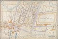
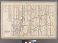
Maps from: Robinson's atlas of Kings County New York. (New York: E. Robinson, 1890), comprising 32 double-page plates including a map of the City of Brooklyn, plus a double-page volume index and a title page.
Online at The New York Public Library Digital Collections website, Robinson's Atlas of Kings County, New York.
Media in category "Robinson maps of Brooklyn published in 1890"
The following 15 files are in this category, out of 15 total.
-
 Outline and Index Map Kings County, New York. NYPL1519716.tiff 6,299 × 4,752; 86.3 MB
-

-

-

-
-

-

-

-

-

-

-
-

-
-
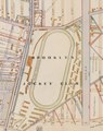
 “INEBRIATES HOME” 1890 map - NYPL1519725 (cropped).tiff 1,167 × 875; 3.58 MB