Category:Roberttown
Jump to navigation
Jump to search
English: Roberttown is a village, in the Township of Liversedge in Kirklees, West Yorkshire, England.
village in West Yorkshire, England, UK  | |||||
| Upload media | |||||
| Instance of | |||||
|---|---|---|---|---|---|
| Location | Kirklees, West Yorkshire, Yorkshire and the Humber, England | ||||
 | |||||
Subcategories
This category has the following 6 subcategories, out of 6 total.
Media in category "Roberttown"
The following 83 files are in this category, out of 83 total.
-
-
 A snow-covered field north of Roberttown, Liversedge - geograph.org.uk - 6345618.jpg 2,000 × 1,133; 1.45 MB
-
 A62 Huddersfield Road at April Court - geograph.org.uk - 5218052.jpg 640 × 480; 49 KB
-
 A62 Leeds Road heading east - geograph.org.uk - 5218050.jpg 640 × 513; 47 KB
-
 Back of Roberttown Lane seen from the park - geograph.org.uk - 6194854.jpg 2,000 × 696; 1.83 MB
-
-
 Boundary stone, Huddersfield Road - geograph.org.uk - 2418401.jpg 1,500 × 2,000; 1.31 MB
-
-
 Commonside - Church Road - geograph.org.uk - 3581016.jpg 640 × 480; 76 KB
-
-

-
 Footpath - Sunny Bank Road, Mirfield - geograph.org.uk - 907266.jpg 640 × 512; 316 KB
-
 Footpath and Stile - Leeds Road - geograph.org.uk - 907313.jpg 640 × 523; 252 KB
-
 Former School - Church Road, Roberttown - geograph.org.uk - 907298.jpg 640 × 533; 252 KB
-
 Garages, John Booth Close - geograph.org.uk - 6212111.jpg 2,000 × 1,476; 2.19 MB
-
 Garden, Commonside, Roberttown, Liversedge - geograph.org.uk - 6250587.jpg 2,000 × 1,575; 3.29 MB
-

-
 Ginnel between houses on Ashby Close, Roberttown - geograph.org.uk - 6425759.jpg 2,000 × 1,384; 3.37 MB
-

-

-
 Ginnel between Sunnyside Avenue and Lumb Lane, Roberttown - geograph.org.uk - 6425752.jpg 1,768 × 2,000; 3.77 MB
-

-
 Harvested Wheat Fields At Moor Top - geograph.org.uk - 938825.jpg 640 × 480; 153 KB
-

-
 Huddersfield Road, Liversedge - geograph.org.uk - 2418407.jpg 2,000 × 1,499; 813 KB
-
 John Booth Close - Child Lane - geograph.org.uk - 1427618.jpg 640 × 480; 239 KB
-
-
 Leeds Road - viewed from Child Lane - geograph.org.uk - 1427764.jpg 640 × 480; 248 KB
-
 Lincoln Avenue - Lumb Lane - geograph.org.uk - 1427597.jpg 640 × 507; 200 KB
-
 Lincoln Avenue - Lumb Lane - geograph.org.uk - 1427604.jpg 640 × 480; 234 KB
-
 Lumb Lane - Roberttown - geograph.org.uk - 907306.jpg 640 × 439; 173 KB
-
 Malham Drive - Melton Way - geograph.org.uk - 1427623.jpg 640 × 480; 245 KB
-
 Meadow Drive - Child Lane - geograph.org.uk - 1427615.jpg 640 × 480; 229 KB
-
 Melton Way - Child Lane - geograph.org.uk - 1427620.jpg 640 × 480; 240 KB
-
 Moor View - Sunny Bank Road - geograph.org.uk - 1427776.jpg 640 × 480; 248 KB
-
 Play area, Springfield Court, Roberttown, Liversedge - geograph.org.uk - 6250574.jpg 1,679 × 2,000; 3.08 MB
-
 Portal Drive - Sunny Bank Road - geograph.org.uk - 1427780.jpg 640 × 480; 256 KB
-
 Roberttown Lane, Roberttown - geograph.org.uk - 169618.jpg 640 × 480; 94 KB
-
 Roberttown Old School Built 1879.jpg 3,024 × 3,246; 3.41 MB
-

-
 School House - Church Road, Roberttown - geograph.org.uk - 907296.jpg 520 × 640; 231 KB
-
 Service station on Leeds Road (A62) - geograph.org.uk - 6409790.jpg 800 × 476; 81 KB
-
 Sunny Bank Road - Huddersfield Road - geograph.org.uk - 1427773.jpg 640 × 480; 221 KB
-

-
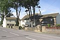
 The Fountain - geograph.org.uk - 3913081.jpg 640 × 480; 57 KB
-
 The Old School, Roberttown - geograph.org.uk - 68931.jpg 640 × 470; 108 KB
-
 The Scout Hut, Roberttown - geograph.org.uk - 6250424.jpg 2,000 × 1,152; 2.02 MB
-
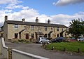
 The Star, Roberttown.jpg 2,847 × 2,278; 3.51 MB
-
 View Down Roberttown Lane - geograph.org.uk - 1046768.jpg 640 × 480; 70 KB
-

-
 Wendron Close - Melton Way - geograph.org.uk - 1427625.jpg 640 × 480; 245 KB
-
 Wheatlands Avenue - Lumb Lane - geograph.org.uk - 1427602.jpg 640 × 480; 251 KB
-
 Whiteley's garden centre - geograph.org.uk - 863706.jpg 480 × 640; 99 KB
-
 Whiteleys Garden Centre - geograph.org.uk - 938810.jpg 640 × 480; 159 KB
-
 Aston Close - Child Lane - geograph.org.uk - 1427613.jpg 640 × 480; 240 KB
-

-

-
 Child Lane - Huddersfield Road - geograph.org.uk - 1427771.jpg 640 × 480; 248 KB
-
 Child Lane - viewed from Lumb Lane - geograph.org.uk - 1427609.jpg 640 × 480; 227 KB
-
 Child Lane - viewed from Lumb Lane - geograph.org.uk - 1427611.jpg 640 × 480; 241 KB
-
 Church Road, Roberttown, Liversedge - geograph.org.uk - 540172.jpg 640 × 472; 90 KB
-
 Clough Lane, Roberttown, Liversedge - geograph.org.uk - 539984.jpg 640 × 468; 67 KB
-
 Commonside, Roberttown, Liversedge - geograph.org.uk - 545050.jpg 640 × 468; 75 KB
-

-

-

-

-

-
 Fountain Drive - Child Lane - geograph.org.uk - 1427628.jpg 640 × 480; 229 KB
-
 Fountain Street - Child Lane - geograph.org.uk - 1427763.jpg 640 × 480; 262 KB
-

-
 Green Lane, Roberttown, Liversedge - geograph.org.uk - 539969.jpg 640 × 474; 97 KB
-

-

-

-

-

-

-

-
 Roberttown village street - geograph.org.uk - 68929.jpg 640 × 429; 70 KB
-

-

-


_-_geograph.org.uk_-_6409790.jpg)


