Category:Roads in the Metropolitan Borough of Stockport
Jump to navigation
Jump to search
Subcategories
This category has the following 3 subcategories, out of 3 total.
*
Media in category "Roads in the Metropolitan Borough of Stockport"
The following 14 files are in this category, out of 14 total.
-
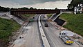 A555 under construction near A6.jpg 3,840 × 2,160; 2.8 MB
-
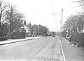
 Compstall Road, Romiley 1905 (2).jpg 660 × 462; 93 KB
-
 Compstall Road, Romiley 1905.jpg 660 × 456; 82 KB
-
 Gatley Road, Cheadle 1908.png 653 × 424; 392 KB
-
 Mill Lane, Hazel Grove c.1901.jpg 653 × 808; 258 KB
-
 Newbridge Lane - geograph.org.uk - 3148515.jpg 640 × 591; 160 KB
-
 North Reddish Intersection - geograph.org.uk - 61090.jpg 640 × 480; 109 KB
-
 Reddish Road bridge over the Stockport-Stalybridge railway line.JPG 4,320 × 3,240; 3.31 MB
-
 South Parade, Bramhall, SK7 3BH - geograph.org.uk - 722853.jpg 640 × 480; 71 KB
-
 Strawberry Gardens, Offerton c.1920.jpg 649 × 471; 129 KB
-
 Styal Road, Gatley 1913.png 655 × 390; 406 KB
-
 Sunup at Offerton Green - geograph.org.uk - 65968.jpg 640 × 480; 119 KB
-
 The Horse and Farrier Public House, Gatley pre-1916.png 659 × 356; 246 KB
-
 The Lodge - geograph.org.uk - 116029.jpg 640 × 480; 67 KB

.jpg)


