Category:Roads in the Borough of Swindon
Jump to navigation
Jump to search
Media in category "Roads in the Borough of Swindon"
The following 22 files are in this category, out of 22 total.
-
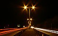 A419 Blunsdon at night - geograph.org.uk - 640150.jpg 640 × 395; 162 KB
-

-
 B4192 east of A419, near Liddington - geograph.org.uk - 499641.jpg 640 × 480; 160 KB
-
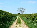
 Bridleway to Overtown Hackpen - geograph.org.uk - 315360.jpg 640 × 480; 109 KB
-
 Burytown Lane, Blunsdon - geograph.org.uk - 1456235.jpg 640 × 480; 110 KB
-
 Droveway Lane - geograph.org.uk - 355306.jpg 640 × 480; 82 KB
-
 Droveway near Castle Eaton, Swindon - geograph.org.uk - 418594.jpg 640 × 480; 120 KB
-
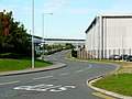 Keypoint distribution centre, South Marston, Swindon-geograph-2100736.jpg 1,440 × 1,080; 694 KB
-
 Lushill, Swindon - geograph.org.uk - 302561.jpg 640 × 431; 75 KB
-

-
 M4 motorway near Swindon, looking southeast (geograph 2018430).jpg 800 × 520; 104 KB
-

-
 Quebec Road, Chiseldon - geograph.org.uk - 700773.jpg 640 × 480; 137 KB
-
 Ridge Way, Chiseldon - geograph.org.uk - 700889.jpg 640 × 480; 122 KB
-
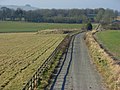
 Road below Barbury Castle - geograph.org.uk - 692524.jpg 640 × 478; 146 KB
-
 Road below Barbury Castle - geograph.org.uk - 701881.jpg 640 × 478; 155 KB
-
 Road below Barbury Castle - geograph.org.uk - 701883.jpg 640 × 480; 131 KB
-
 Station Road, Chiseldon - geograph.org.uk - 700860.jpg 640 × 480; 130 KB
-
 The A346 near Chiseldon - geograph.org.uk - 699912.jpg 640 × 480; 135 KB
-
 The A346 near Chiseldon - geograph.org.uk - 699919.jpg 640 × 480; 135 KB
-
 The A346, Chiseldon - geograph.org.uk - 692519.jpg 640 × 480; 129 KB
-
 Wharf Road, north of Elcombe - geograph.org.uk - 797768.jpg 640 × 480; 140 KB


.jpg)


