Category:Roads in Washington (state)
Jump to navigation
Jump to search
States of the United States: Alabama · Alaska · Arizona · Arkansas · California · Colorado · Connecticut · Delaware · Florida · Georgia · Hawaii · Idaho · Illinois · Indiana · Iowa · Kansas · Kentucky · Louisiana · Maine · Maryland · Massachusetts · Michigan · Minnesota · Mississippi · Missouri · Montana · Nebraska · Nevada · New Hampshire · New Jersey · New Mexico · New York · North Carolina · North Dakota · Ohio · Oklahoma · Oregon · Pennsylvania · Rhode Island · South Carolina · South Dakota · Tennessee · Texas · Utah · Vermont · Virginia · Washington · West Virginia · Wisconsin · Wyoming – District of Columbia: Washington, D.C.
Puerto Rico
Puerto Rico
Wikimedia category | |||||
| Upload media | |||||
| Instance of | |||||
|---|---|---|---|---|---|
| Category combines topics | |||||
| Washington | |||||
state of the United States of America someja satełitar in setenbre .jpg)    | |||||
| Pronunciation audio | |||||
| Instance of | |||||
| Part of | |||||
| Named after | |||||
| Location |
| ||||
| Located in or next to body of water | |||||
| Capital | |||||
| Legislative body | |||||
| Executive body | |||||
| Highest judicial authority | |||||
| Head of government |
| ||||
| Inception |
| ||||
| Highest point | |||||
| Population |
| ||||
| Area |
| ||||
| Elevation above sea level |
| ||||
| Replaces | |||||
| Different from | |||||
| Maximum temperature record |
| ||||
| Minimum temperature record |
| ||||
| official website | |||||
 | |||||
Subcategories
This category has the following 31 subcategories, out of 31 total.
A
- Airport Expressway (Seattle) (4 F)
C
D
- Driveways in Washington (state) (11 F)
F
H
I
M
P
- Pacific Highway (United States) (16 F)
R
- Roadcuts in Washington (state) (19 F)
S
- Skykomish Trail (20 F)
- Sunset Highway (21 F)
U
Y
Media in category "Roads in Washington (state)"
The following 167 files are in this category, out of 167 total.
-
 00-02-31, animal sciences rd - panoramio.jpg 2,058 × 1,400; 2.75 MB
-
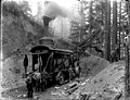
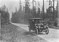
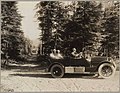 1917 Cadillac on a Washington road, ca 1917 (MOHAI 7190).jpg 700 × 541; 76 KB
-
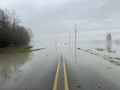 2023 Stanwood WA flood marine drive.png 5,712 × 4,284; 19.9 MB
-

-
 Aerial - Auburn, WA - Northern part of SE Green Valley Rd 01 (9796467786).jpg 4,288 × 2,848; 6 MB
-

-
 Aerial view of Seattle Freeway and Highway 99 cloverleaf in Seattle.jpg 3,264 × 2,448; 6.38 MB
-
 Aerial view of Seattle Freeway crossing Harbor Island.jpg 3,264 × 2,448; 6.06 MB
-
 Alaska-Yukon-Pacific Exposition - Seattle, June 1-October 16, 1909 - Page 13.jpg 2,959 × 4,738; 2.79 MB
-
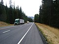
 Along Washington State Highway 14 east of Columbia Gorge (10755166594).jpg 1,115 × 755; 426 KB
-
-

-
 Automobile on scenic highway in forested area, ca 1925 (PICKETT 215).jpg 768 × 611; 140 KB
-

-
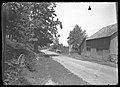
 Automobiles on a country road, ca 1924 (TRANSPORT 10).jpg 768 × 621; 41 KB
-
 Autumn road up the hills (Unsplash).jpg 4,629 × 2,603; 11.68 MB
-
 Back road in Washington State LCCN2011630857.tif 4,500 × 3,578; 46.09 MB
-
 Basalt in Banks Lake area (10508106215).jpg 2,048 × 1,536; 913 KB
-
 Basalt in Banks Lake area (10508126724).jpg 2,048 × 1,536; 1.11 MB
-
 Basalt in Banks Lake area (10508134444).jpg 2,048 × 1,536; 1,000 KB
-
 Blow down area. slide (b77085ec259448af93982d4bb556a604).jpg 2,168 × 1,479; 892 KB
-
 Bothell Road construction, Washington, May 14, 1912 (INDOCC 423).jpg 768 × 602; 95 KB
-
 Brinnon, WA - Bee Mill Road 01.jpg 4,288 × 2,848; 6.45 MB
-
 Brinnon, WA - Bee Mill Road 02.jpg 4,288 × 2,848; 6.37 MB
-
 Brinnon, WA - Bee Mill Road 03.jpg 4,288 × 2,848; 6.29 MB
-
 Burke Farrar Boulevard, ca 1919 (MOHAI 5494).jpg 700 × 563; 64 KB
-
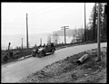
 Car on highway between Seattle and Tacoma, 1916 (MOHAI 2012).jpg 490 × 600; 61 KB
-
 Cars in pullout. Clouds on mtn. 101979. slide (838d87a0681a47aa851cb758b084388b).jpg 2,140 × 1,457; 570 KB
-
 Clearing road, Snohomish County, July 8, 1911 (PICKETT 141).jpeg 768 × 583; 99 KB
-

-
-
 Convertible Mercedes Car Driving On A Highway.jpg 2,832 × 2,128; 1.1 MB
-
 Country road and barn, ca. 1910 - DPLA - a734459c014549fb9b004980b305fb5f.jpg 8,581 × 6,236; 2.75 MB
-
 Country road, ca. 1910 - DPLA - 425a94bcf69115288d55c0a3509349cc.jpg 8,581 × 6,236; 3.18 MB
-

-
 DivisionStreetSpokane.jpg 4,592 × 3,056; 4.19 MB
-
 DivisionStreetSpokane1.jpg 4,592 × 3,056; 5.72 MB
-
 Down the west side of Wauconda Pass (4936818701).jpg 1,024 × 768; 184 KB
-
 Down the west side of Wauconda Pass (4937404438).jpg 1,024 × 768; 263 KB
-
 Downtown North Bend, WA from the northwest 01.jpg 6,000 × 4,000; 9.62 MB
-
 DSC03537 (8080792106).jpg 4,912 × 3,264; 6 MB
-
 Duvall WA bridge 01.jpg 2,592 × 1,944; 1.32 MB
-
 E12001 - DPLA - 2e60e3b91807d6a0db76306a45e9e877.jpg 1,760 × 2,581; 2.34 MB
-
 E4835 - DPLA - 570e7abd59aded5d2017d0f3ed379231.jpg 3,701 × 2,888; 6.73 MB
-
 E4943 - DPLA - 1aed3e20e3fbb3e8e8d29777fc052796.jpg 5,321 × 3,707; 13.34 MB
-
 E4988 - DPLA - b98da925f543a189091b3fbaf2dac036.jpg 3,799 × 2,936; 7 MB
-
 E6939 - DPLA - 71e5f392e05b2e5a604837bee344c41a.jpg 3,702 × 2,873; 6.05 MB
-
 E7577 - DPLA - 9d9084adf6d9356747e747ba669ac949.jpg 3,805 × 2,966; 5.54 MB
-
 E7873 - DPLA - 8fd48ca9a3d5d551375536d84d60d31f.jpg 3,680 × 2,834; 6.43 MB
-
 E8420 - DPLA - 31940333b8cbd6b2be17971538422ace.jpg 5,342 × 3,668; 10.98 MB
-
 East side of Chinook Pass (9572866863).jpg 2,304 × 1,728; 945 KB
-
 FEMA - 26908 - Photograph by Marvin Nauman taken on 11-08-2006 in Washington.jpg 2,896 × 1,944; 3.28 MB
-

-

-
 Golden Tree in Snow - panoramio.jpg 1,173 × 1,600; 795 KB
-
 Grading new county road, Snohomish County, ca 1911 (PICKETT 52).jpeg 768 × 514; 103 KB
-
 Gravel road near Davenport, WA - panoramio.jpg 512 × 384; 21 KB
-
 Great Plains of Washington State near Wilbur (10507897594).jpg 2,048 × 1,536; 914 KB
-
 Heading up Washington Pass from the east (4936819633).jpg 1,024 × 768; 205 KB
-
 Heavy machinery grading a road (fcfb8914-aae8-4d0a-924a-68e283aca61f).tif 2,811 × 2,253; 13.62 MB
-
-

-
-
-

-
 Highway to Mount Rainier, ca 1920 (TRANSPORT 244).jpg 768 × 607; 45 KB
-
 Horse and buggy on rural road, Vashon Island, 1908 (MOHAI 2449).jpg 640 × 575; 65 KB
-
 I-405 Southbound Bellevue.jpg 4,416 × 3,312; 7.85 MB
-
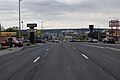
 Interstate 90, Spokane, Washington (50082800753).jpg 4,135 × 1,985; 7.37 MB
-
 Irrigation Canal along old Naches road west of Yakima (3935892669).jpg 1,632 × 1,224; 1.88 MB
-
 Kent, Washington - Frager Road 01.jpg 3,264 × 2,448; 2.18 MB
-
 Kent, Washington - Frager Road gate.jpg 3,264 × 2,448; 2.27 MB
-
 Kirkland farms, 1918 (MOHAI 5122).jpg 700 × 567; 44 KB
-

-

-

-
 Light at the End of the Road - panoramio.jpg 2,304 × 1,220; 3.14 MB
-
 LittleSpokaneRiver&DartfordDrive.jpg 4,592 × 3,056; 6.75 MB
-
-

-
 Middle Fork Snoqualmie River Road Milepost 9.jpg 2,272 × 1,537; 1.43 MB
-
 Middle Fork Snoqualmie River Road.jpg 2,272 × 1,704; 1.54 MB
-

-
 Mont Baker Route 542.jpg 1,024 × 768; 425 KB
-
 Morgan Lake Road, Columbia NWR.jpg 3,872 × 2,592; 2.9 MB
-
 Mount Baker and road (beba79d8-bef5-48ca-b44b-8845844a7293).tif 2,833 × 2,254; 10.88 MB
-
 Mount Rainier - approaching Paradise 01.jpg 4,288 × 2,848; 6.6 MB
-
 Mount Rainier - driving toward Paradise 01.jpg 2,848 × 4,288; 6.08 MB
-
 Mt Rainier (1fa1c64ac4a847c187fd809fd61f5a27).jpg 2,140 × 1,457; 574 KB
-
 Mt Rainier (32a66753a3744f2b84e9bdacb5648e86).JPG 2,816 × 2,112; 2.74 MB
-
 Mt Rainier (baefc881e68244f2a7de95d87d5fbe3e).JPG 2,816 × 2,112; 2.72 MB
-
 Mt. Rainier from Naches Pass, Washington (76853).jpg 3,336 × 2,073; 3.09 MB
-
 Near Davenport (10507882606).jpg 2,048 × 1,536; 784 KB
-
 Near North Bend, WA. (10508446216).jpg 2,048 × 1,536; 1,014 KB
-
 Near Wilbur (10508082593).jpg 2,048 × 1,536; 910 KB
-
 New road, Snohomish County, ca 1911 (PICKETT 77).jpeg 384 × 600; 52 KB
-
 Newhalem, WA. 1993 (9149273790).jpg 1,081 × 734; 95 KB
-
 Next comes Diablo Dam (1458002274).jpg 1,024 × 768; 779 KB
-
 North Bend, WA from the west.jpg 3,264 × 2,448; 2.03 MB
-
 Northwest Allen Canyon Road, Ridgefield, Washington, August 2020.jpg 6,000 × 4,000; 19.22 MB
-
 Not far from this. (6111018005).jpg 1,824 × 1,368; 683 KB
-
 Old Vantage Highway.jpg 3,872 × 2,592; 3.68 MB
-
 Olympic Peninsula road and bridge, ca. 1900 - DPLA - 7b208a0fe44c66a7bb18783b91191d11.jpg 2,800 × 3,956; 1.65 MB
-
-
 Pacific Highway near Bothell, Washington, 1915 (MOHAI 6295).jpg 700 × 573; 70 KB
-
 Pacific Highway near Woodinville, Washington, 1915 (MOHAI 6296).jpg 700 × 573; 60 KB
-
 Pacific Highway opening, January 29, 1915 (MOHAI 7182).jpg 700 × 586; 62 KB
-
 Penstock along Old Naches Road (9575601588).jpg 2,304 × 1,728; 891 KB
-
 Picture611 15Dec06.jpg 640 × 480; 194 KB
-
 Pine tree lined road, San Juan Island, ca 1910s (WASTATE 2632).jpeg 377 × 600; 62 KB
-
 Pufferbelly Depot.JPG 720 × 960; 256 KB
-
 Rear view mirror view in Mt. Rainier National Park, driving to Longmire.jpg 4,288 × 2,848; 5.13 MB
-
 Red bus in Stehekin (77dd4c9360f94e81819d89ffd24b4bad).JPG 3,648 × 2,736; 5.45 MB
-

-

-
 Road cut.jpg 800 × 600; 457 KB
-
 Road equipment on Early Winters Creek (ff5435a9-ccc8-40b0-8389-86a20d69acbd).tif 5,639 × 4,459; 41.96 MB
-
 Road from Index to Galena, ca 1912 (PICKETT 745).jpeg 768 × 513; 153 KB
-
 Road in Hozomeen area (a2316919-a2a1-4a33-8973-d2808d78da25).tif 2,819 × 2,259; 13.76 MB
-

-
 Road through willow trees to Pullman Moscow Airport (36250812323).jpg 2,048 × 1,536; 2.21 MB
-
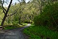
 Road to Hidden Ranch section of Rhododendron Preserve seen from Big Tree Trail 01.jpg 6,000 × 4,000; 13.05 MB
-
 Road to Longmire 01.jpg 4,288 × 2,848; 6.33 MB
-

-
 Roslyn, WA - cemeteries 062.jpg 6,000 × 4,000; 13.41 MB
-
 Sauk Pass (10508232544).jpg 2,048 × 1,536; 905 KB
-
 Sauk Pass (10508237424).jpg 2,048 × 1,536; 816 KB
-

-
 Seahurst Park 08.jpg 6,000 × 4,000; 13.57 MB
-
 Seahurst Park 09.jpg 6,000 × 4,000; 14.06 MB
-
 Seahurst Park 11.jpg 6,000 × 4,000; 13.89 MB
-

-

-

-
 Seaview WA beach approach.jpg 4,032 × 3,024; 3 MB
-

-
 Skate Creek Road - Gifford Pinchot NF - December 2017.jpg 1,200 × 900; 175 KB
-

-
 Snowy country road with wagon tracks, ca. 1910 - DPLA - 77c7db5c88e3b91318169e50fcc8f3bc.jpg 8,330 × 6,236; 3.26 MB
-
 Snowy country road, ca. 1910 - DPLA - f37d14dcc86cf3a617e194f51bddb6b2.jpg 8,581 × 6,236; 4.31 MB
-
 Snowy road near Boundary Dam, 1961 (53408472113).jpg 3,142 × 2,471; 2.81 MB
-
 Snowy road near Boundary Dam, 1966 (51006135348).jpg 3,086 × 2,444; 2.75 MB
-
 Stevens Pass Highway at Grotto, ca 1913 (PICKETT 808).jpeg 768 × 535; 70 KB
-
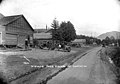
 Street scene at Grotto, ca 1913 (PICKETT 759).jpeg 768 × 578; 68 KB
-
-
 The end of the road - Flickr - brewbooks.jpg 3,264 × 2,448; 3.65 MB
-
 The Freeways in Seattle, 1962 (50044433341).jpg 3,300 × 2,550; 617 KB
-
-

-
-
 Toledo, WA - Kellogg Way curving north out of town center 01.jpg 4,288 × 2,848; 5.46 MB
-
 Toledo, WA - Kellogg Way curving north out of town center 02.jpg 4,288 × 2,848; 5.54 MB
-
 Toledo, WA - Kellogg Way curving south into town center 01.jpg 4,288 × 2,848; 5.53 MB
-
 Town of Grotto on Stevens Pass Highway, ca 1913 (PICKETT 783).jpeg 768 × 544; 77 KB
-
 Two men with rifles posed on the Galena Road, ca 1912 (PICKETT 832).jpeg 408 × 600; 108 KB
-
-
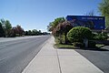
 U.S. Route 2 Between Reardan and Spokane, Washington (50082802608).jpg 3,094 × 2,060; 3.45 MB
-

-
 View of Blewett Pass.jpg 4,320 × 3,240; 5.48 MB
-
-
 View to Pufferbelly Depot.JPG 720 × 960; 221 KB
-
 WA525JctSignRoad (31618896633).jpg 2,400 × 1,600; 1.3 MB
-
 Waiting to board Stehekin shuttle (b090d0327c694152896f79eb3986d538).JPG 4,000 × 3,000; 4.24 MB
-
 Waiting to board Stehekin shuttle (f355a8188f8e4a329fb846fc266afb4d).JPG 4,000 × 3,000; 4.77 MB
-
 WashingtonPassHwy20WA.jpg 3,782 × 2,837; 4.45 MB
-

-
 Wind farms visible from bike paths (3936746606).jpg 1,632 × 1,224; 1.55 MB

.jpg)


.jpg)
.jpg)


.jpg)
.jpg)
.jpg)
.jpg)
.jpg)
.jpg)
.jpg)
.jpg)
.jpg)
.jpg)
.jpg)


.jpg)
.jpg)
.jpg)
.jpeg)
.jpg)


.jpg)


.jpg)
.jpg)

.jpg)


.jpg)

.jpeg)
.jpg)

.jpeg)

.jpg)
.jpg)
.jpg)
.jpg)
.jpg)
.jpg)

.jpg)

.jpg)
.jpg)


.jpg)
.jpeg)
.jpg)


.jpg)
.jpeg)


.jpeg)


.jpg)
.JPG)
.JPG)
.jpg)
.jpg)
.jpg)
.jpg)
.jpeg)
.jpg)
.jpg)


.jpg)


.jpg)
.jpg)
.jpg)
.jpg)

.jpeg)


.JPG)

.jpeg)

.jpeg)
.jpeg)
.jpg)


.jpeg)

.jpg)
.jpg)
.jpeg)


.jpg)
.jpeg)
.jpeg)


.jpeg)


.jpg)
.jpg)
.jpeg)
.jpeg)
.jpeg)

.jpg)
.jpg)


.jpeg)
.jpeg)

.jpg)
.jpeg)


.jpg)
.JPG)
.JPG)

.jpg)
.jpg)
.jpeg)
.jpg)
.jpg)