Category:Roads in Newry and Mourne District Council
Jump to navigation
Jump to search
Media in category "Roads in Newry and Mourne District Council"
The following 69 files are in this category, out of 69 total.
-
-
 Brown Moss Road, Lesk Townland - geograph.org.uk - 1256958.jpg 640 × 480; 44 KB
-
 Cullion Bridge - geograph.org.uk - 1245613.jpg 640 × 426; 95 KB
-

-
 Glenloughan Road - geograph.org.uk - 1095518.jpg 426 × 640; 39 KB
-
 Hairpin bend near Spelga - geograph.org.uk - 1104288.jpg 640 × 373; 85 KB
-
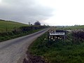
 Irwin's Crossroads, Carrowmannan - geograph.org.uk - 1542650.jpg 640 × 480; 84 KB
-
 Islandmoyle Road - geograph.org.uk - 1371067.jpg 640 × 480; 91 KB
-

-
 Keadybeg Road, Kingsmills - geograph.org.uk - 1542018.jpg 640 × 480; 116 KB
-
 Lesh Road, Lesh Townland - geograph.org.uk - 1256923.jpg 640 × 480; 67 KB
-
 McRory's Road, Knockavannon - geograph.org.uk - 1442918.jpg 640 × 480; 90 KB
-
 Mountain Road in the Townland of Lislea - geograph.org.uk - 1527649.jpg 640 × 480; 101 KB
-
 Mouth of the Drumnascamph Road - geograph.org.uk - 1719498.jpg 1,024 × 685; 99 KB
-
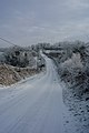 Snow Covered Brae Road - geograph.org.uk - 1654371.jpg 427 × 640; 48 KB
-
 Snow Covered Brae Road - geograph.org.uk - 1654379.jpg 640 × 427; 50 KB
-
 Tamary Road - geograph.org.uk - 753849.jpg 480 × 640; 62 KB
-
 The Ballymageogh Road near Attical - geograph.org.uk - 941151.jpg 640 × 385; 74 KB
-
 The Benagh Road near Kilkeel - geograph.org.uk - 972444.jpg 640 × 388; 61 KB
-
 The Carnbane Road near Newry (2) - geograph.org.uk - 1303713.jpg 640 × 355; 82 KB
-
 The Grange Road near Cranfield - geograph.org.uk - 972422.jpg 640 × 424; 84 KB
-
 The Kilfeaghan Road near Kilkeel (1) - geograph.org.uk - 842203.jpg 640 × 407; 102 KB
-
 The Kilkeel Road near Hilltown - geograph.org.uk - 1104132.jpg 640 × 354; 79 KB
-
 The Moyad Road near Spelga - geograph.org.uk - 1141697.jpg 640 × 367; 65 KB
-
 The new Newry bypass (11) - geograph.org.uk - 718104.jpg 629 × 458; 63 KB
-
 The new Newry bypass (12) - geograph.org.uk - 718147.jpg 640 × 414; 100 KB
-
 The new Newry bypass (13) - geograph.org.uk - 718154.jpg 618 × 419; 80 KB
-
 The new Newry bypass (14) - geograph.org.uk - 718173.jpg 640 × 378; 78 KB
-
 The new Newry bypass (15) - geograph.org.uk - 898394.jpg 640 × 379; 78 KB
-
 The new Newry bypass (16) - geograph.org.uk - 898437.jpg 640 × 390; 73 KB
-
 The new Newry bypass (17) - geograph.org.uk - 898474.jpg 640 × 359; 82 KB
-
 The new Newry bypass (18) - geograph.org.uk - 898502.jpg 640 × 392; 82 KB
-
 The new Newry bypass (20) - geograph.org.uk - 898569.jpg 640 × 390; 102 KB
-
 The new Newry bypass (21) - geograph.org.uk - 898619.jpg 640 × 423; 109 KB
-
 The new Newry bypass (22) - geograph.org.uk - 899087.jpg 640 × 394; 97 KB
-
 The new Newry bypass (23) - geograph.org.uk - 1055307.jpg 601 × 370; 95 KB
-
 The new Newry bypass (24) - geograph.org.uk - 1055326.jpg 640 × 393; 92 KB
-
 The new Newry bypass (25) - geograph.org.uk - 1114327.jpg 640 × 432; 87 KB
-
 The new Newry bypass (26) - geograph.org.uk - 1114381.jpg 640 × 386; 96 KB
-
 The new Newry bypass (27) - geograph.org.uk - 1114438.jpg 640 × 438; 94 KB
-
 The new Newry bypass (28) - geograph.org.uk - 1114848.jpg 640 × 424; 96 KB
-
 The new Newry bypass (29) - geograph.org.uk - 1114878.jpg 640 × 381; 61 KB
-
 The new Newry bypass (30) - geograph.org.uk - 1162199.jpg 640 × 355; 81 KB
-
 The new Newry bypass (31) - geograph.org.uk - 1162232.jpg 640 × 380; 81 KB
-
 The new Newry bypass (32) - geograph.org.uk - 1162264.jpg 640 × 411; 112 KB
-
 The new Newry bypass (33) - geograph.org.uk - 1235136.jpg 640 × 401; 85 KB
-
 The new Newry bypass (34) - geograph.org.uk - 1235366.jpg 640 × 438; 82 KB
-
 The new Newry bypass (35) - geograph.org.uk - 1235387.jpg 640 × 350; 66 KB
-
 The new Newry bypass (36) - geograph.org.uk - 1235433.jpg 640 × 394; 86 KB
-
 The new Newry bypass (37) - geograph.org.uk - 1235574.jpg 640 × 344; 54 KB
-
 The new Newry bypass (38) - geograph.org.uk - 1235645.jpg 640 × 400; 96 KB
-
 The new Newry bypass (39) - geograph.org.uk - 1276764.jpg 640 × 387; 73 KB
-
 The new Newry bypass (40) - geograph.org.uk - 1276807.jpg 640 × 349; 75 KB
-
 The new Newry bypass (41) - geograph.org.uk - 1276834.jpg 640 × 480; 101 KB
-
 The new Newry bypass (42) - geograph.org.uk - 1276866.jpg 640 × 386; 56 KB
-
 The new Newry bypass (43) - geograph.org.uk - 1303063.jpg 640 × 365; 88 KB
-
 The new Newry bypass (44) - geograph.org.uk - 1303096.jpg 640 × 386; 89 KB
-
 The new Newry bypass (45) - geograph.org.uk - 1303130.jpg 640 × 342; 76 KB
-
 The new Newry bypass (46) - geograph.org.uk - 1303171.jpg 640 × 352; 89 KB
-
 The new Newry bypass (47) - geograph.org.uk - 1303282.jpg 640 × 363; 91 KB
-
 The new Newry bypass (48) - geograph.org.uk - 1303332.jpg 640 × 378; 102 KB
-
 The new Newry bypass (53) - geograph.org.uk - 1308686.jpg 640 × 352; 76 KB
-
 The new Newry bypass (88) - geograph.org.uk - 1551382.jpg 640 × 391; 84 KB
-
 The new Newry bypass (89) - geograph.org.uk - 1551408.jpg 640 × 400; 91 KB
-
 The new Newry bypass (91) - geograph.org.uk - 1551484.jpg 640 × 366; 81 KB
-
 The road near Spelga Dam - geograph.org.uk - 971927.jpg 640 × 369; 75 KB
-
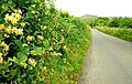
 The Sandbank Road near Rostrevor - geograph.org.uk - 801802.jpg 640 × 381; 100 KB
-

-
 Tunnell Road, Poyntzpass - geograph.org.uk - 779016.jpg 640 × 480; 79 KB


_-_geograph.org.uk_-_1303713.jpg)

_-_geograph.org.uk_-_842203.jpg)


_-_geograph.org.uk_-_718104.jpg)
_-_geograph.org.uk_-_718147.jpg)
_-_geograph.org.uk_-_718154.jpg)
_-_geograph.org.uk_-_718173.jpg)
_-_geograph.org.uk_-_898394.jpg)
_-_geograph.org.uk_-_898437.jpg)
_-_geograph.org.uk_-_898474.jpg)
_-_geograph.org.uk_-_898502.jpg)
_-_geograph.org.uk_-_898569.jpg)
_-_geograph.org.uk_-_898619.jpg)
_-_geograph.org.uk_-_899087.jpg)
_-_geograph.org.uk_-_1055307.jpg)
_-_geograph.org.uk_-_1055326.jpg)
_-_geograph.org.uk_-_1114327.jpg)
_-_geograph.org.uk_-_1114381.jpg)
_-_geograph.org.uk_-_1114438.jpg)
_-_geograph.org.uk_-_1114848.jpg)
_-_geograph.org.uk_-_1114878.jpg)
_-_geograph.org.uk_-_1162199.jpg)
_-_geograph.org.uk_-_1162232.jpg)
_-_geograph.org.uk_-_1162264.jpg)
_-_geograph.org.uk_-_1235136.jpg)
_-_geograph.org.uk_-_1235366.jpg)
_-_geograph.org.uk_-_1235387.jpg)
_-_geograph.org.uk_-_1235433.jpg)
_-_geograph.org.uk_-_1235574.jpg)
_-_geograph.org.uk_-_1235645.jpg)
_-_geograph.org.uk_-_1276764.jpg)
_-_geograph.org.uk_-_1276807.jpg)
_-_geograph.org.uk_-_1276834.jpg)
_-_geograph.org.uk_-_1276866.jpg)
_-_geograph.org.uk_-_1303063.jpg)
_-_geograph.org.uk_-_1303096.jpg)
_-_geograph.org.uk_-_1303130.jpg)
_-_geograph.org.uk_-_1303171.jpg)
_-_geograph.org.uk_-_1303282.jpg)
_-_geograph.org.uk_-_1303332.jpg)
_-_geograph.org.uk_-_1308686.jpg)
_-_geograph.org.uk_-_1551382.jpg)
_-_geograph.org.uk_-_1551408.jpg)
_-_geograph.org.uk_-_1551484.jpg)


_-_geograph.org.uk_-_941666.jpg)
