Category:Roads in New South Wales
Jump to navigation
Jump to search
States of Australia: New South Wales · Queensland · South Australia · Tasmania · Victoria · Western Australia
Internal territories of Australia: Australian Capital Territory · Northern Territory
External territories of Australia:
Internal territories of Australia: Australian Capital Territory · Northern Territory
External territories of Australia:
Wikimedia category | |||||
| Upload media | |||||
| Instance of | |||||
|---|---|---|---|---|---|
| Category combines topics | |||||
| Category contains | |||||
| New South Wales | |||||
state of Australia | |||||
| Instance of |
| ||||
| Named after |
| ||||
| Location | AUS | ||||
| Located in or next to body of water | |||||
| Capital | |||||
| Basic form of government |
| ||||
| Legislative body | |||||
| Executive body | |||||
| Highest judicial authority | |||||
| Head of state |
| ||||
| Head of government |
| ||||
| Inception |
| ||||
| Highest point | |||||
| Population |
| ||||
| Area |
| ||||
| Elevation above sea level |
| ||||
| Replaces |
| ||||
| official website | |||||
 | |||||
Subcategories
This category has the following 40 subcategories, out of 40 total.
A
B
- Bridle Track (6 F)
C
D
F
H
K
M
N
O
Q
- Roads in Queanbeyan (24 F)
R
S
T
W
- Waterfall Way (5 F)
- Wharf Street, Tweed Heads (12 F)
Media in category "Roads in New South Wales"
The following 200 files are in this category, out of 200 total.
-
2007 0810klklk0001.JPG 3,072 × 2,304; 2.24 MB
-
2010-09-19 Wombeyan Caves Road - 08.jpg 2,700 × 1,800; 1.29 MB
-
2010-09-19 Wombeyan Caves Road - 09.jpg 2,700 × 1,800; 1.53 MB
-
2010-09-19 Wombeyan Caves Road - 10.jpg 2,700 × 1,800; 862 KB
-
2010-09-19 Wombeyan Caves Road - 11.jpg 2,700 × 1,800; 1.04 MB
-
2010-09-19 Wombeyan Caves Road - 12.jpg 2,700 × 1,800; 1.6 MB
-
2010-09-19 Wombeyan Caves Road - 19.jpg 2,700 × 1,800; 1.11 MB
-
2010-09-19 Wombeyan Caves Road - 20.jpg 2,700 × 1,800; 973 KB
-
2012-05-29 Monaro Highway Billilingra NSW, Australia.jpg 2,700 × 1,800; 944 KB
-
Afternoon Driving Southern New South Wales (6754395239).jpg 4,174 × 2,783; 4.63 MB
-
Anglican church Nevertire.png 2,385 × 1,401; 5.96 MB
-
Apple tree flat area, tannabutta parish (wellingtom county) north of cudgegong 2.png 1,920 × 2,560; 5.28 MB
-
Apple tree flat area, tannabutta parish (wellingtom county) north of cudgegong 3.png 1,920 × 1,766; 4.33 MB
-
Apple tree flat area, tannabutta parish (wellingtom county) north of cudgegong.png 1,919 × 1,641; 4.79 MB
-
Arrawarra Road.jpg 3,264 × 2,448; 3.88 MB
-
AU-NSW-Goodooga-Langboyd Road dirt-2021.jpg 3,264 × 2,448; 1.75 MB
-
Barry Way Border Plaque.jpg 4,032 × 2,278; 4.65 MB
-
Belangar, (Nevertire) Belban Parish Oxley County NSW.png 2,560 × 1,920; 8.55 MB
-
BellsLineofRoadMountTomah.jpg 5,472 × 3,648; 3.76 MB
-
Berambing Bells Line of Road v2.jpg 2,178 × 1,536; 1.8 MB
-
Berambing Bells Line of Road.jpg 2,178 × 1,536; 1.8 MB
-
Beside New England University.jpg 1,800 × 1,350; 1.09 MB
-
Big River Way, Tyndale, New South Wales, 2021.jpg 3,494 × 2,854; 4.54 MB
-
Bogan River - Sign.jpg 846 × 356; 139 KB
-
Bridletrack, Bridle Track.jpg 448 × 336; 27 KB
-
Brisbane Grove.JPG 3,000 × 2,250; 2.57 MB
-
Broken Hill - Menindee Road. NSW.jpg 2,272 × 1,704; 1.4 MB
-
Cadell Fault.JPG 3,872 × 2,592; 3.63 MB
-
Caerleon NSW 2850, Australia - panoramio.jpg 2,700 × 1,800; 1.29 MB
-
Capertee, (Roxburgh County) NSW.png 2,560 × 1,508; 4.67 MB
-
Capertree township, Badamora Parish (Roxbourgh county) NSW looking south 3.png 2,560 × 1,346; 4.45 MB
-
Capertree township, Badamora Parish (Roxbourgh county) NSW looking south.png 2,554 × 1,209; 4.49 MB
-
Capertree township, Badamora Parish (Roxbourgh county) NSW looking south3.png 2,560 × 1,308; 4.32 MB
-
Carrathool Town Entry Sign North.JPG 5,753 × 3,690; 6.67 MB
-
Castlereagh River (Bandullah Parish Gowen County )Mendoran NSW Australia.png 2,547 × 1,485; 7.19 MB
-
Church building Trangie, Trangie Parish, Narromine County, New South Wales.png 1,920 × 2,560; 8.45 MB
-
Colinton NSW 2626, Australia - panoramio (1).jpg 2,700 × 1,800; 837 KB
-
Colinton NSW 2626, Australia - panoramio (2).jpg 2,700 × 1,800; 999 KB
-
Colinton NSW 2626, Australia - panoramio (3).jpg 2,700 × 1,800; 1.09 MB
-
Colinton NSW 2626, Australia - panoramio (4).jpg 2,700 × 1,800; 763 KB
-
Colinton NSW 2626, Australia - panoramio (5).jpg 2,700 × 1,800; 921 KB
-
Colinton NSW 2626, Australia - panoramio (6).jpg 2,700 × 1,800; 855 KB
-
Colinton NSW 2626, Australia - panoramio (7).jpg 2,700 × 1,800; 909 KB
-
Colinton NSW 2626, Australia - panoramio.jpg 2,700 × 1,800; 881 KB
-
Crackenback NSW 2627, Australia - panoramio (1).jpg 2,700 × 1,800; 966 KB
-
Crackenback NSW 2627, Australia - panoramio (10).jpg 2,700 × 1,800; 1.01 MB
-
Crackenback NSW 2627, Australia - panoramio (11).jpg 2,700 × 1,800; 1,002 KB
-
Crackenback NSW 2627, Australia - panoramio (12).jpg 2,700 × 1,800; 673 KB
-
Crackenback NSW 2627, Australia - panoramio (13).jpg 2,700 × 1,800; 1.16 MB
-
Crackenback NSW 2627, Australia - panoramio (2).jpg 2,700 × 1,800; 739 KB
-
Crackenback NSW 2627, Australia - panoramio (3).jpg 2,700 × 1,800; 1.11 MB
-
Crackenback NSW 2627, Australia - panoramio (4).jpg 2,700 × 1,800; 958 KB
-
Crackenback NSW 2627, Australia - panoramio (5).jpg 2,700 × 1,800; 913 KB
-
Crackenback NSW 2627, Australia - panoramio (6).jpg 2,700 × 1,800; 865 KB
-
Crackenback NSW 2627, Australia - panoramio (7).jpg 2,700 × 1,800; 889 KB
-
Crackenback NSW 2627, Australia - panoramio (8).jpg 2,700 × 1,800; 1.27 MB
-
Crackenback NSW 2627, Australia - panoramio (9).jpg 2,700 × 1,800; 832 KB
-
Crackenback NSW 2627, Australia - panoramio.jpg 2,700 × 1,800; 1.26 MB
-
Crackenback NSW banner.jpg 2,700 × 386; 383 KB
-
Road intersection in Dee Why, NSW, Australia.jpg 3,804 × 2,854; 2.24 MB
-
Driving in the park.jpg 3,024 × 4,032; 5.3 MB
-
Eastern approach to Thirroul Overbridge (9959017584).jpg 2,000 × 1,466; 2.16 MB
-
Gobabla Parish Oxley County NSW (west of Nevertire).png 2,580 × 1,716; 4.49 MB
-
Goldfields Way B85 in New South Wales.jpg 3,903 × 2,927; 3.16 MB
-
Gradys Creek NSW 2474, Australia - panoramio.jpg 2,560 × 1,920; 1.18 MB
-
Greenbah Creek (Wingabutta Parish Gowen County) Mollyan NSW.png 1,906 × 1,633; 4.52 MB
-
Greys creek Airly Parish (Roxbourgh county) Capertree NSW.png 2,560 × 1,480; 4.7 MB
-
Gumin Parish (Gowen County) Tonderburine NSW (Warrumbungle Mountains).png 2,353 × 1,562; 6.66 MB
-
Gumin Parish Gowen County Tonderburine NSW (Warrumbungle Mountains).png 2,311 × 1,405; 5.6 MB
-
Hearne Parish (Roxbough County) New South Wales 2.png 2,560 × 1,920; 7.08 MB
-
Hearne Parish, (Roxbourgh County) New South Wales.png 1,974 × 1,012; 2.12 MB
-
Herons Creek, NSW.jpg 3,840 × 2,160; 1.32 MB
-
Horse flat creek broombee parish (wellington count) Mullamuddy nsw.png 2,559 × 1,481; 3.4 MB
-
Ilford area (Roxbourgh county) NSW.png 2,560 × 1,436; 4.94 MB
-
Ilford, Parish of Warrangunia, New South Wales.png 1,877 × 1,298; 3.89 MB
-
Jack Halls Creek (Running stream area) Roxbourgh county NSW.png 2,560 × 1,158; 4.72 MB
-
Kiama NSW 2533, Australia - panoramio (154).jpg 2,560 × 1,920; 1.73 MB
-
Kianga NSW 2546, Australia - panoramio (1).jpg 2,560 × 1,920; 1.91 MB
-
Kianga NSW 2546, Australia - panoramio (26).jpg 2,560 × 1,920; 1.73 MB
-
Killara, 1908 (2924897313).jpg 467 × 348; 66 KB
-
Kungerbil Parish Oxley County NSW (east of Nyngan).png 2,529 × 1,670; 7.8 MB
-
Lake Eucembene - panoramio.jpg 845 × 634; 80 KB
-
Landscape (wellington county) north of cudgegong.jpg 2,560 × 1,480; 1.05 MB
-
Lane Cove Road, Turramurra (NSW) (7072299261) (3).jpg 1,500 × 1,134; 361 KB
-
Lane Cove Road, Turramurra c.1908 (5536063565).jpg 443 × 346; 90 KB
-
Lane Cove Road, Wahroonga c.1908 (5536063409) (2).jpg 464 × 340; 78 KB
-
Lanscapes (wellingtom county) north of cudgegong.jpg 2,560 × 1,472; 1.04 MB
-
Lawrence Hargrave Drive, Otford.jpg 1,280 × 853; 210 KB
-
Maddens Plains NSW 2508, Australia - panoramio (2).jpg 2,700 × 1,800; 582 KB
-
Maddens Plains NSW 2508, Australia - panoramio (3).jpg 2,700 × 1,800; 534 KB
-
Maddens Plains NSW 2508, Australia - panoramio (4).jpg 2,700 × 1,800; 609 KB
-
Mangwell creek Wongoni (Lincoln county) north of Dunnedoo NSW.png 2,341 × 1,330; 3.62 MB
-
Menindee Road in Broken Hill, NSW.jpg 2,272 × 1,704; 883 KB
-
Meringo Parish Narromine County NSW.png 2,560 × 1,920; 10.22 MB
-
Merrygoen (Lincoln County )Mendoran NSW Australia4.png 2,542 × 1,454; 5.73 MB
-
Merrygoen (Wallaroo Parish Lincoln County )Mendoran NSW Australia5.png 2,554 × 1,538; 4.06 MB
-
Mitchell Highway Nyngan NSW.png 2,551 × 1,409; 5.86 MB
-
Mount Ousley Road, Mount Ousley.jpg 8,000 × 4,779; 11.03 MB
-
Mr. Postman.jpg 4,032 × 3,024; 5.03 MB
-
Mulla Parish Narromine County NSW.png 2,489 × 1,023; 4.74 MB
-
Mullamuddy creek broombee parish (wellington count) Mullamuddy nsw.png 2,551 × 1,469; 3.34 MB
-
Mumbrabah Parish Oxley County.png 2,142 × 1,302; 4.64 MB
-
Mumbrabah Parish Oxley County3.png 2,140 × 1,288; 3.7 MB
-
Mundi Mundi - panoramio.jpg 4,288 × 3,216; 2.74 MB
-
Narromine - Distance with Stormclouds.jpg 1,433 × 505; 210 KB
-
Nevertire NSW.png 2,580 × 1,716; 5.14 MB
-
Newell Highway (Gowen County) Tooraweenah NSW looking North.png 2,555 × 1,581; 6.07 MB
-
Newell Highway (Uragong Parish - Gowen County) Tooraweenah NSW looking east.png 2,558 × 1,758; 5.33 MB
-
Newell Highway (Uragong Parish - Gowen County) Tooraweenah NSW looking North.png 2,558 × 1,758; 7.45 MB
-
Newell Highway Dilly Parish Gowen County Tooraweenah NSW looking North.png 2,558 × 1,542; 4.68 MB
-
NR1-Metroad1.jpg 140 × 312; 10 KB
-
NSWSign.jpg 2,272 × 1,704; 1.35 MB
-
Numinbah Border Crossing - panoramio.jpg 1,408 × 1,056; 332 KB
-
Numinbah Road, Numinbah, New South Wales at the NSW and QLD border crossing.jpg 3,264 × 2,448; 2.67 MB
-
Nyngan Oxley County NSW.png 2,554 × 1,502; 5.84 MB
-
On Jindabyne Road.jpg 1,024 × 743; 425 KB
-
Onus Lane, Richmond Lowlands.jpg 6,000 × 4,000; 14.81 MB
-
Open Road (10096679423).png 1,920 × 1,080; 1.42 MB
-
Orange NSW 2800, Australia - panoramio (20).jpg 2,700 × 1,719; 1.1 MB
-
Oxlely Highway (Urobulla Parish) County of Ewenmar on the road to Collie NSW.png 2,554 × 1,634; 6.56 MB
-
Oxley-Maude Road 001.JPG 6,016 × 4,000; 9.26 MB
-
Painted traffic island centreline Bridge Road Glebe NSW Australia at Rosebank Street.jpg 4,032 × 3,024; 3.36 MB
-
Parkes Billabong Creek Flood Marker.JPG 6,016 × 4,000; 12.27 MB
-
ParramattaRd1938.jpg 736 × 552; 46 KB
-
Pattersons curse Cathundril plains , Meringo Parish Narromine County NSW.png 2,560 × 1,920; 5.26 MB
-
Poplar Trees New England Highway-1=4K (14121751863).jpg 4,060 × 2,727; 1.2 MB
-
Portland NSW 2847, Australia - panoramio.jpg 2,700 × 1,800; 1.22 MB
-
Public school Tooraweenah NSW (Gowen County) looking North.png 2,554 × 1,438; 6.16 MB
-
Putty Road near Wombat Swamp.jpg 1,200 × 899; 200 KB
-
Road to Sassafras Gully, Springwood (4903266905).jpg 1,024 × 779; 176 KB
-
Roadside view in Capertee Valley - Flickr - Lip Kee (1).jpg 800 × 531; 141 KB
-
Running stream area 3 (Roxbourgh County) NSW.png 2,560 × 1,476; 5.4 MB
-
Running Stream area Hearne Parish (Roxbourgh county) Capertree NSW.png 2,560 × 1,318; 4.03 MB
-
Rural New South Wales (3058266840).jpg 621 × 436; 78 KB
-
Sam's Way 1 - panoramio.jpg 2,048 × 1,536; 1.42 MB
-
Sam's Way 2 - panoramio.jpg 2,048 × 1,536; 1.7 MB
-
Sam's Way 4 - panoramio.jpg 2,048 × 1,536; 1.75 MB
-
Shared zone in Sydney.jpg 2,993 × 3,824; 7.39 MB
-
South of Ilford NSW (Rounning stream area) bush fire effected area.png 2,325 × 1,449; 5.14 MB
-
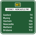
SYDNWCFWY-RD-SYD-NWC.png 400 × 386; 16 KB
-
Tannabar area (Gowen County) north of Mollyan on the mendoran rd,.png 1,911 × 1,665; 5.65 MB
-
The Gap Creek, The Gap Road, The Gap, New South Wales, Australia.jpg 2,304 × 1,536; 1.47 MB
-
The Menindee Plains.jpg 2,272 × 325; 395 KB
-
Tonderburine Parish NSW looking north.png 2,558 × 1,762; 6.36 MB
-
Tweed Valley Drive-3+ (2144933352).jpg 1,628 × 1,095; 1.14 MB
-
Tweed Valley Drive-5+ (2144140589).jpg 1,628 × 1,012; 965 KB
-
Tweed Valley Drive-7+ (2144936366).jpg 1,095 × 1,628; 1.36 MB
-
Uribong creek Merrygoen (Lincoln County) east of Mendoran NSW Australia4.png 2,558 × 1,526; 5.61 MB
-
Us Americans Appreciate the Traffic Help (2678693311).jpg 1,800 × 1,350; 633 KB
-
Wallanthery Mount Grace Road.JPG 6,016 × 4,000; 9.64 MB
-
Wandandian NSW 2540, Australia - panoramio (1).jpg 2,560 × 1,920; 1.89 MB
-
Wandandian NSW 2540, Australia - panoramio (11).jpg 2,560 × 1,920; 1.81 MB
-
Wandandian NSW 2540, Australia - panoramio (12).jpg 2,560 × 1,920; 1.76 MB
-
Wandandian NSW 2540, Australia - panoramio (13).jpg 2,560 × 1,920; 1.89 MB
-
Wandandian NSW 2540, Australia - panoramio (14).jpg 2,560 × 1,920; 2.04 MB
-
Wandandian NSW 2540, Australia - panoramio (15).jpg 2,560 × 1,920; 1.83 MB
-
Wandandian NSW 2540, Australia - panoramio (16).jpg 2,560 × 1,920; 1.9 MB
-
Wandandian NSW 2540, Australia - panoramio (17).jpg 2,560 × 1,920; 1.69 MB
-
Wandandian NSW 2540, Australia - panoramio (18).jpg 2,560 × 1,920; 1.56 MB
-
Wandandian NSW 2540, Australia - panoramio (19).jpg 2,560 × 1,920; 1.83 MB
-
Wandandian NSW 2540, Australia - panoramio (2).jpg 2,560 × 1,920; 1.92 MB
-
Wandandian NSW 2540, Australia - panoramio (20).jpg 2,560 × 1,920; 1.78 MB
-
Wandandian NSW 2540, Australia - panoramio (21).jpg 2,560 × 1,920; 1.56 MB
-
Wandandian NSW 2540, Australia - panoramio (22).jpg 2,560 × 1,920; 1.97 MB
-
Wandandian NSW 2540, Australia - panoramio (23).jpg 2,560 × 1,920; 1.91 MB
-
Wandandian NSW 2540, Australia - panoramio (24).jpg 2,560 × 1,920; 1.61 MB
-
Wandandian NSW 2540, Australia - panoramio (25).jpg 2,560 × 1,920; 1.81 MB
-
Wandandian NSW 2540, Australia - panoramio (26).jpg 2,560 × 1,920; 1.97 MB
-
Wandandian NSW 2540, Australia - panoramio (27).jpg 2,560 × 1,920; 1.82 MB
-
Wandandian NSW 2540, Australia - panoramio (28).jpg 2,560 × 1,920; 2.18 MB
-
Wandandian NSW 2540, Australia - panoramio (29).jpg 2,560 × 1,920; 1.68 MB
-
Wandandian NSW 2540, Australia - panoramio (3).jpg 2,560 × 1,920; 2.03 MB
-
Wandandian NSW 2540, Australia - panoramio (30).jpg 2,560 × 1,920; 1.68 MB
-
Wandandian NSW 2540, Australia - panoramio (31).jpg 2,560 × 1,920; 1.89 MB
-
Wandandian NSW 2540, Australia - panoramio (32).jpg 2,560 × 1,920; 2.02 MB
-
Wandandian NSW 2540, Australia - panoramio (33).jpg 2,560 × 1,920; 2.05 MB
-
Wandandian NSW 2540, Australia - panoramio (34).jpg 2,560 × 1,920; 1.54 MB
-
Wandandian NSW 2540, Australia - panoramio (4).jpg 2,560 × 1,920; 2.14 MB
-
Wandandian NSW 2540, Australia - panoramio (5).jpg 2,560 × 1,920; 1.73 MB
-
Wandandian NSW 2540, Australia - panoramio (6).jpg 2,560 × 1,920; 1.78 MB
-
Wandandian NSW 2540, Australia - panoramio (7).jpg 2,560 × 1,920; 1.78 MB
-
Wandandian NSW 2540, Australia - panoramio (8).jpg 2,560 × 1,920; 2.46 MB
-
Wandandian NSW 2540, Australia - panoramio (9).jpg 2,560 × 1,920; 2.12 MB
-
Wandandian NSW 2540, Australia - panoramio.jpg 2,560 × 1,920; 2.13 MB
-
Waterfall F6 Southern Freeway.JPG 2,560 × 1,920; 1.66 MB
-
Westlink M7 near Cowpasture.jpg 1,580 × 1,214; 425 KB
-
Where Two paths meet, (Five Dock).jpg 505 × 404; 82 KB
-
Yaragrin area (Gowen County) south of Mollyan north of Mendoran4.png 2,560 × 1,920; 4.46 MB
-
YarrawarraRdSigns (cropped).jpg 1,344 × 896; 504 KB
-
YarrawarraRdSigns.JPG 2,160 × 1,440; 1.28 MB
-
Yellow Lines used to contrast snow.png 769 × 454; 528 KB


