Category:Roads in Leicestershire
Jump to navigation
Jump to search
Ceremonial counties of England: Bedfordshire · Berkshire · Buckinghamshire · Cambridgeshire · Cheshire · Cornwall · Cumbria · Derbyshire · Devon · Dorset · Durham · East Riding of Yorkshire · East Sussex · Essex · Gloucestershire · Greater London · Greater Manchester · Hampshire · Herefordshire · Hertfordshire · Isle of Wight · Kent · Lancashire · Leicestershire · Lincolnshire · Merseyside · Norfolk · North Yorkshire · Northamptonshire · Northumberland · Nottinghamshire · Oxfordshire · Rutland · Shropshire · Somerset · South Yorkshire · Staffordshire · Suffolk · Surrey · Tyne and Wear · Warwickshire · West Midlands · West Sussex · West Yorkshire · Wiltshire · Worcestershire
City-counties: Bristol · City of London
Former historic counties: Huntingdonshire ·
Other former counties:
City-counties: Bristol · City of London
Former historic counties: Huntingdonshire ·
Other former counties:
Subcategories
This category has the following 25 subcategories, out of 25 total.
- Bus lanes in Leicestershire (1 F)
- Fords in Leicestershire (23 F)
A
- A512 road (England) (6 F)
B
- B4667 road (England) (1 F)
- B585 road (England) (15 F)
- B676 road (England) (25 F)
D
- Dirt roads in Leicestershire (20 F)
- Driveways in Leicestershire (31 F)
F
- Flesh Hovel Lane (1 F)
G
H
- High Cross, Leicestershire (5 F)
L
- Leicester Inner Ring Road (6 F)
W
Media in category "Roads in Leicestershire"
The following 200 files are in this category, out of 2,542 total.
(previous page) (next page)-
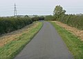
 'Towpath' of Husbands Bosworth Tunnel - geograph.org.uk - 546438.jpg 640 × 480; 153 KB
-
 9 Miles to Leicester - geograph.org.uk - 726404.jpg 640 × 438; 68 KB
-
 A road between Belvoir and Knipton, Leicestershire - Dec 2005 (1).JPG 2,560 × 1,920; 5.22 MB
-
 A road between Belvoir and Knipton, Leicestershire - Dec 2005 (2).JPG 2,560 × 1,920; 5.09 MB
-
 A view along Colston Lane - geograph.org.uk - 949278.jpg 640 × 431; 82 KB
-
 A view along Main Street - geograph.org.uk - 1038540.jpg 640 × 436; 78 KB
-
 A426 Aylestone Road - geograph.org.uk - 3250751.jpg 3,214 × 2,680; 2.6 MB
-
 A427 Harborough Road - geograph.org.uk - 230251.jpg 640 × 480; 67 KB
-
 A453 and Lay by - geograph.org.uk - 165279.jpg 640 × 480; 51 KB
-

-
 A47 at Skeffington Gap, Leicestershire - geograph.org.uk - 213071.jpg 640 × 427; 101 KB
-
 A5 Watling Street - geograph.org.uk - 670084.jpg 640 × 480; 76 KB
-
 A5 Watling Street at Hollow Farm - geograph.org.uk - 672008.jpg 640 × 506; 72 KB
-
 A5 Watling Street near Hinckley - geograph.org.uk - 670103.jpg 640 × 445; 72 KB
-
 A5 Watling Street near Nuneaton - geograph.org.uk - 670122.jpg 640 × 466; 72 KB
-
 A5 Watling Street near Nuneaton - geograph.org.uk - 671997.jpg 640 × 493; 78 KB
-
 A5 Watling Street near Nuneaton - geograph.org.uk - 672012.jpg 640 × 437; 73 KB
-
 A5199 north of Husbands Bosworth - geograph.org.uk - 172890.jpg 640 × 480; 86 KB
-
 A5199 Welford Road towards Welford - geograph.org.uk - 183770.jpg 640 × 480; 72 KB
-
 A5199, Welford Road - geograph.org.uk - 209285.jpg 640 × 427; 134 KB
-
 A6 Bridge - geograph.org.uk - 236479.jpg 640 × 480; 84 KB
-
 A6 east of Market Harborough - geograph.org.uk - 580044.jpg 640 × 475; 97 KB
-
 A6 towards Market Harborough - geograph.org.uk - 203584.jpg 640 × 334; 47 KB
-
 A606 Oakham Road - geograph.org.uk - 772926.jpg 640 × 420; 49 KB
-
 A606 towards Burton Lazars - geograph.org.uk - 149185.jpg 640 × 480; 96 KB
-
 A606 towards Melton - geograph.org.uk - 149074.jpg 640 × 352; 46 KB
-
 A606-Whissendine Road Junction - geograph.org.uk - 149121.jpg 640 × 369; 40 KB
-
 A607 - geograph.org.uk - 142804.jpg 640 × 427; 101 KB
-
 A607 at Thorpe Arnold - geograph.org.uk - 79666.jpg 640 × 427; 74 KB
-
 A607 at Thorpe Arnold - geograph.org.uk - 79679.jpg 640 × 427; 126 KB
-

-
 A607 near Croxton Kerrial - geograph.org.uk - 67715.jpg 640 × 480; 122 KB
-
 A607 near to Frisby on the Wreake - geograph.org.uk - 146637.jpg 640 × 431; 60 KB
-
 A607 near Waltham on the Wolds - geograph.org.uk - 79543.jpg 640 × 427; 163 KB
-
 A607 Rearsby By-Pass - geograph.org.uk - 855435.jpg 640 × 395; 54 KB
-
 A607, Melton Road near Rearsby - geograph.org.uk - 144380.jpg 640 × 427; 98 KB
-
 A607, near Croxton Kerrial - geograph.org.uk - 104599.jpg 640 × 427; 83 KB
-

-
 All Saint's Church, Wigston (geograph 7301744).jpg 1,760 × 1,168; 399 KB
-
 Along Tamworth Road towards Measham - geograph.org.uk - 928978.jpg 640 × 447; 69 KB
-
 Appleby Road in Snarestone - geograph.org.uk - 928937.jpg 640 × 446; 119 KB
-
 Appleby Road towards Snarestone - geograph.org.uk - 928942.jpg 640 × 421; 62 KB
-

-
 Approaching Church Langton - geograph.org.uk - 587204.jpg 640 × 491; 148 KB
-
 Approaching Enderby - geograph.org.uk - 491652.jpg 640 × 499; 142 KB
-
 Approaching Hoby from the west - geograph.org.uk - 1300985.jpg 640 × 514; 112 KB
-

-
 Approaching Narborough - geograph.org.uk - 511772.jpg 640 × 409; 108 KB
-
 Approaching Newton Harcourt - geograph.org.uk - 184848.jpg 640 × 540; 113 KB
-
 Approaching Odstone, Leics - geograph.org.uk - 130893.jpg 640 × 435; 82 KB
-
 Approaching Ratby - geograph.org.uk - 490739.jpg 640 × 501; 117 KB
-
 Approaching the village of Cadeby - geograph.org.uk - 1319974.jpg 640 × 409; 94 KB
-
 Approaching the village of Shoby - geograph.org.uk - 906745.jpg 640 × 422; 78 KB
-
 Asfordby Road towards Hoby - geograph.org.uk - 1242257.jpg 640 × 461; 94 KB
-
-
 Ashby Road enters Hinckley - geograph.org.uk - 961619.jpg 519 × 640; 129 KB
-
 Ashby Road in Hinckley - geograph.org.uk - 961631.jpg 531 × 640; 60 KB
-
 Ashby Road in Newbold, Leicestershire - geograph.org.uk - 916990.jpg 640 × 384; 76 KB
-
 Ashby Road near Stapleton - geograph.org.uk - 941466.jpg 640 × 506; 98 KB
-
 Ashby Road near Stapleton - geograph.org.uk - 941500.jpg 640 × 403; 72 KB
-
 Ashby Road north of Hinckley - geograph.org.uk - 961572.jpg 558 × 640; 68 KB
-
 Ashby Road north of Hinckley - geograph.org.uk - 961609.jpg 640 × 498; 87 KB
-
 Ashby Road towards Norris Hill - geograph.org.uk - 821029.jpg 640 × 430; 72 KB
-
 Ashby Road towards Snarestone - geograph.org.uk - 926647.jpg 640 × 416; 76 KB
-
 Atherstone Road - geograph.org.uk - 931353.jpg 640 × 434; 54 KB
-
 Atherstone Road, Pinwall - geograph.org.uk - 684862.jpg 640 × 464; 115 KB
-
 Autumn along Manor Road - geograph.org.uk - 1039846.jpg 640 × 489; 127 KB
-
 Autumn along the A46 - geograph.org.uk - 1012889.jpg 640 × 407; 43 KB
-
 Autumn colours along Meridian East - geograph.org.uk - 1042121.jpg 640 × 480; 89 KB
-
 B4109 road junction - geograph.org.uk - 568764.jpg 640 × 407; 90 KB
-
 B4668 Leicester Road - geograph.org.uk - 193676.jpg 640 × 440; 78 KB
-
 B585-Osbaston Lane Junction - geograph.org.uk - 159134.jpg 640 × 480; 75 KB
-
 B587 Nottingham Road near Lount - geograph.org.uk - 916953.jpg 640 × 360; 59 KB
-
 B591 towards Copt Oak - geograph.org.uk - 240278.jpg 640 × 480; 93 KB
-
 B591 Towards Nanpantan - geograph.org.uk - 240280.jpg 640 × 480; 111 KB
-
-
 Back Road near Tilton on the Hill - geograph.org.uk - 752741.jpg 640 × 372; 81 KB
-
 Baggrave Road towards Hungarton - geograph.org.uk - 762337.jpg 640 × 444; 105 KB
-
 Barkestone-le-Vale, Jericho Lane - geograph.org.uk - 982351.jpg 640 × 482; 79 KB
-
 Barlestone Road in Newbold Verdon - geograph.org.uk - 1287115.jpg 640 × 401; 74 KB
-

-
 Barrow Road in Sileby, Leicestershire - geograph.org.uk - 860210.jpg 640 × 464; 81 KB
-
 Barrow Road near Cotes, Leicestershire - geograph.org.uk - 551115.jpg 640 × 421; 142 KB
-
 Barwell, Charnwood Road - geograph.org.uk - 941248.jpg 640 × 448; 64 KB
-
 Barwell, Kirkby Road - geograph.org.uk - 941257.jpg 640 × 430; 71 KB
-
 Barwell, The Common - geograph.org.uk - 943335.jpg 640 × 451; 86 KB
-
 Battlefield this way - geograph.org.uk - 158795.jpg 640 × 414; 41 KB
-
 Beaumont Leys Lane, Leicester - geograph.org.uk - 389483.jpg 640 × 374; 85 KB
-
 Beeby Road - geograph.org.uk - 497015.jpg 640 × 616; 111 KB
-
-
 Bend in Normanton Lane - geograph.org.uk - 1046688.jpg 640 × 423; 48 KB
-
 Bilstone Road at Little Twycross - geograph.org.uk - 926125.jpg 640 × 387; 66 KB
-
 Bilstone Road at Little Twycross - geograph.org.uk - 926164.jpg 640 × 428; 85 KB
-
 Bilstone Road near Congerstone - geograph.org.uk - 925033.jpg 640 × 406; 89 KB
-
 Bilstone Road towards Bilstone - geograph.org.uk - 926169.jpg 640 × 455; 98 KB
-

-
 Blocked track - geograph.org.uk - 395686.jpg 640 × 480; 114 KB
-
 Bluebells along Bosworth Road - geograph.org.uk - 1332309.jpg 527 × 640; 129 KB
-

-
 Bosworth Lane near Newbold Verdon - geograph.org.uk - 1300595.jpg 640 × 432; 78 KB
-
 Bosworth Road - geograph.org.uk - 174483.jpg 640 × 480; 79 KB
-
 Bosworth Road at Grange Farm - geograph.org.uk - 875785.jpg 640 × 491; 98 KB
-
 Bosworth Road at Walton Holt - geograph.org.uk - 865302.jpg 629 × 640; 106 KB
-
 Bosworth Road enters Wellsborough - geograph.org.uk - 922425.jpg 640 × 489; 105 KB
-
 Bosworth Road in south Leicestershire - geograph.org.uk - 865293.jpg 498 × 640; 87 KB
-
 Bosworth Road in Wellsborough - geograph.org.uk - 922350.jpg 640 × 435; 66 KB
-
 Bosworth Road near Wellsborough - geograph.org.uk - 922376.jpg 640 × 413; 76 KB
-
 Bosworth Road towards Congerstone - geograph.org.uk - 925029.jpg 640 × 386; 69 KB
-
 Bosworth Road towards Kirkby Lodge - geograph.org.uk - 1331895.jpg 640 × 415; 50 KB
-
 Bosworth Road towards Kirkby Mallory - geograph.org.uk - 1331872.jpg 640 × 462; 45 KB
-
 Bosworth Road towards Kirkby Mallory - geograph.org.uk - 1332286.jpg 640 × 383; 52 KB
-
 Bosworth Road towards Kirkby Mallory - geograph.org.uk - 1332343.jpg 640 × 495; 93 KB
-
 Bosworth Road towards Market Bosworth - geograph.org.uk - 922406.jpg 640 × 493; 88 KB
-
 Bosworth Road towards Wellsborough - geograph.org.uk - 922408.jpg 640 × 418; 67 KB
-
 Brascote Lane at the gravel works - geograph.org.uk - 1320270.jpg 640 × 411; 51 KB
-
-

-
 Brascote Lane towards Newbold Verdon - geograph.org.uk - 1287064.jpg 546 × 640; 106 KB
-
 Braunstone Lane in Leicester - geograph.org.uk - 1060845.jpg 640 × 429; 89 KB
-
 Braunstone Lane in Leicester - geograph.org.uk - 1060859.jpg 640 × 480; 104 KB
-

-
 Breach Hill near Ashby de la Zouch - geograph.org.uk - 797546.jpg 640 × 442; 71 KB
-
 Breedon on the Hill, Worthington Lane - geograph.org.uk - 915720.jpg 640 × 461; 82 KB
-
 Brentingby, near Melton - geograph.org.uk - 68288.jpg 640 × 480; 137 KB
-
 Bridleway near Saxelby Pastures - geograph.org.uk - 212192.jpg 640 × 480; 106 KB
-
 Bridleway to Cosby - geograph.org.uk - 191333.jpg 640 × 480; 95 KB
-
 Brook Farm along Cossington Road - geograph.org.uk - 861609.jpg 640 × 472; 75 KB
-
 Brook Park Offices - geograph.org.uk - 1208413.jpg 640 × 436; 58 KB
-

-
 Brooksby Road in Hoby - geograph.org.uk - 1240707.jpg 640 × 492; 64 KB
-

-

-
 Broughton Road near Broughton Astley - geograph.org.uk - 510808.jpg 640 × 481; 101 KB
-
 Broughton Road, Leicestershire - geograph.org.uk - 511388.jpg 640 × 471; 133 KB
-
 Bruntingthorpe Road - geograph.org.uk - 875135.jpg 640 × 471; 99 KB
-
 Bruntingthorpe Road near Shearsby - geograph.org.uk - 876921.jpg 640 × 498; 114 KB
-
 Building the Earl Shilton Bypass - geograph.org.uk - 941020.jpg 640 × 480; 82 KB
-
 Building the Earl Shilton Bypass - geograph.org.uk - 941027.jpg 640 × 402; 42 KB
-
 Building the Earl Shilton Bypass - geograph.org.uk - 943339.jpg 640 × 345; 58 KB
-
 Building the Earl Shilton Bypass - geograph.org.uk - 943341.jpg 640 × 455; 93 KB
-

-
 Burton Lane south of Wymeswold - geograph.org.uk - 905649.jpg 640 × 408; 64 KB
-
 Burton Road at Annwell Place - geograph.org.uk - 816263.jpg 640 × 428; 91 KB
-
 Burton Road near Annwell Place - geograph.org.uk - 816305.jpg 640 × 470; 96 KB
-
 Bus along Carlton Road - geograph.org.uk - 924788.jpg 640 × 379; 52 KB
-

-
 Carlton in Leicestershire - geograph.org.uk - 924928.jpg 640 × 358; 68 KB
-

-
 Carlton Road near Market Bosworth - geograph.org.uk - 931507.jpg 640 × 348; 51 KB
-
 Carlton Road towards Market Bosworth - geograph.org.uk - 924934.jpg 640 × 593; 96 KB
-
 Carlton, Congerstone Lane - geograph.org.uk - 924978.jpg 640 × 361; 79 KB
-
 Carlton, Main Street - geograph.org.uk - 924961.jpg 640 × 360; 64 KB
-
 Carlton, Main Street - geograph.org.uk - 924970.jpg 640 × 452; 68 KB
-
 Castle View Road - geograph.org.uk - 1039665.jpg 640 × 460; 57 KB
-
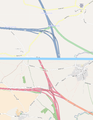 Catthorpe interchange map.png 935 × 1,209; 203 KB
-
 Catthorpe map old.jpg 1,280 × 720; 144 KB
-
 Cattle grid on Cordhill Lane - geograph.org.uk - 785110.jpg 640 × 379; 94 KB
-
 Chapel Lane in Ab Kettleby - geograph.org.uk - 909481.jpg 640 × 423; 65 KB
-
 Chapel Lane in Walton, Leicestershire - geograph.org.uk - 869319.jpg 640 × 473; 63 KB
-
 Charley Crossroads - geograph.org.uk - 188392.jpg 640 × 480; 70 KB
-
 Charley Road towards Swithland - geograph.org.uk - 240281.jpg 640 × 480; 89 KB
-
 Church Causeway towards Church Langton - geograph.org.uk - 587823.jpg 640 × 416; 103 KB
-

-
 Church Lane, Waltham on the Wolds - geograph.org.uk - 800776.jpg 640 × 427; 109 KB
-

-
 Coleorton Lane towards Packington - geograph.org.uk - 790046.jpg 640 × 469; 74 KB
-
 Coleorton Lane towards Packington - geograph.org.uk - 790056.jpg 640 × 431; 72 KB
-
 Colston Lane, Harby - geograph.org.uk - 1314686.jpg 640 × 427; 102 KB
-

-
 Congerstone, Bosworth Road - geograph.org.uk - 925031.jpg 640 × 402; 57 KB
-
 Coronation Lane in Oakthorpe - geograph.org.uk - 797831.jpg 640 × 446; 74 KB
-
 Cossington Lane in Rothley - geograph.org.uk - 861722.jpg 640 × 477; 77 KB
-
 Cossington Lane towards Rothley - geograph.org.uk - 853305.jpg 640 × 434; 58 KB
-
 Cossington Road towards Cossington - geograph.org.uk - 861620.jpg 640 × 480; 72 KB
-
 Country park track - geograph.org.uk - 690235.jpg 640 × 480; 103 KB
-

-
 Country road in east Leicestershire - geograph.org.uk - 783173.jpg 640 × 470; 95 KB
-
 Country road in east Leicestershire - geograph.org.uk - 783174.jpg 640 × 404; 66 KB
-
 Country road in east Leicestershire - geograph.org.uk - 783179.jpg 640 × 502; 78 KB
-
 Country road near Burton Overy - geograph.org.uk - 500120.jpg 640 × 466; 116 KB
-

-
 Crackbottle Road - geograph.org.uk - 540253.jpg 574 × 640; 103 KB
-
 Craftsmans Way enters East Goscote - geograph.org.uk - 853645.jpg 640 × 422; 80 KB
-
 Cross Roads near Barton in the Beans - geograph.org.uk - 768404.jpg 640 × 480; 90 KB
-
 Crossroads near Acresford - geograph.org.uk - 1806378.jpg 640 × 480; 72 KB
-
 Crossroads near Old Dalby - geograph.org.uk - 906799.jpg 640 × 403; 78 KB
-
 Crossroads west of Worthington - geograph.org.uk - 849476.jpg 640 × 399; 58 KB
-
 Cycle crossing on the A50 - geograph.org.uk - 205728.jpg 640 × 427; 82 KB
-

-
 Daffodils, Uppingham Road. - geograph.org.uk - 736483.jpg 640 × 480; 135 KB
-
 Dalby Road towards Melton Mowbray - geograph.org.uk - 5518898.jpg 640 × 414; 63 KB
-
 Dalby Road towards Melton Mowbray - geograph.org.uk - 5518899.jpg 640 × 506; 85 KB
-
 Dean's Lane - geograph.org.uk - 195470.jpg 640 × 480; 117 KB
-
 Denton Lane, Harston - geograph.org.uk - 67681.jpg 640 × 480; 109 KB
-
 Descending towards Merry Lees - geograph.org.uk - 1199896.jpg 640 × 469; 94 KB
-
 Desford Lane, Newtown Unthank - geograph.org.uk - 490843.jpg 640 × 488; 106 KB
-
 Desford Lane, Newtown Unthank - geograph.org.uk - 490846.jpg 546 × 640; 116 KB
-
 Do the splits - geograph.org.uk - 421143.jpg 640 × 480; 139 KB
-
 Dog walker with Great Dane dogs..jpg 5,616 × 3,732; 16.34 MB
-
 Donisthorpe Lane in Moira - geograph.org.uk - 797859.jpg 640 × 530; 77 KB


.JPG)
.JPG)


.jpg)


