Category:Roads in County Louth
Jump to navigation
Jump to search
Wikimedia category | |||||
| Upload media | |||||
| Instance of | |||||
|---|---|---|---|---|---|
| Category combines topics | |||||
| County Louth | |||||
county in Ireland    | |||||
| Instance of | |||||
| Location | Leinster, Ireland | ||||
| Capital | |||||
| Legislative body |
| ||||
| Executive body |
| ||||
| Population |
| ||||
| Area |
| ||||
| official website | |||||
 | |||||
Subcategories
This category has the following 9 subcategories, out of 9 total.
D
- Dirt roads in County Louth (3 F)
N
R
- R166 road Ireland) (1 F)
- R170 road Ireland) (1 F)
- R171 road (Ireland) (2 F)
- R172 road (Ireland) (3 F)
- R175 road (Ireland) (2 F)
- R178 road (Ireland) (2 F)
- Road signs in County Louth (2 F)
Media in category "Roads in County Louth"
The following 93 files are in this category, out of 93 total.
-

-
 Ad hoc measures to combat sea erosion on the coastal road - geograph.org.uk - 5862127.jpg 4,000 × 3,000; 2.22 MB
-

-

-
 Bend in the Omeath back-road - geograph.org.uk - 5131763.jpg 4,000 × 3,000; 3.85 MB
-
 Bend in the Piedmont-Upper Jenkinstown road at Killin - geograph.org.uk - 5555673.jpg 4,000 × 3,000; 4.5 MB
-
 Bend in the R173 at the southern entrance into Omeath - geograph.org.uk - 5129636.jpg 2,669 × 1,998; 3.67 MB
-
 Bend in the Ravensdale Park forest road - geograph.org.uk - 5120145.jpg 4,000 × 3,000; 3.98 MB
-
 Bend in the road at Harestown, Ballinteskin - geograph.org.uk - 5135544.jpg 2,669 × 1,998; 3.41 MB
-
 Bend in the road at Knockagh - geograph.org.uk - 3488151.jpg 1,024 × 768; 214 KB
-
 Bend in the road at Lennonstown - geograph.org.uk - 3488286.jpg 1,024 × 768; 215 KB
-
 Bend in the road at Shelling Hill - geograph.org.uk - 5595837.jpg 2,634 × 1,957; 2.83 MB
-

-
 Bend in the road NW of Lislea Cross - geograph.org.uk - 5698137.jpg 4,000 × 3,000; 2.91 MB
-

-
 Bend in the Slievenatucan forest road - geograph.org.uk - 5142086.jpg 4,000 × 3,000; 4.19 MB
-
 Bend in the Tain Way forestry road - geograph.org.uk - 5113234.jpg 4,000 × 3,000; 3.41 MB
-
 Bend in the Templetown Road - geograph.org.uk - 5596217.jpg 2,668 × 2,000; 3.1 MB
-

-
 Bend on the L7105 - geograph.org.uk - 3488738.jpg 1,024 × 768; 118 KB
-

-
 Bends in the Ballinteskin Road - geograph.org.uk - 5135562.jpg 2,669 × 1,998; 4.06 MB
-
 Bends in the R174 south of Jordan's Corner - geograph.org.uk - 5140764.jpg 4,000 × 3,000; 2.82 MB
-
 Bends in the R174 south of Ravensdale - geograph.org.uk - 5299920.jpg 4,000 × 3,000; 4.15 MB
-
 Bends in the Riverstown road at Cloughmore - geograph.org.uk - 5138975.jpg 2,547 × 1,868; 2.52 MB
-
 Bends in the Templetown Road - geograph.org.uk - 5597117.jpg 3,498 × 2,385; 4.34 MB
-
 Bends in the Templetown Road by Templetown House - geograph.org.uk - 5594840.jpg 4,000 × 3,000; 2.87 MB
-
 Carlingford Priory from R173 2013 09 22.jpg 3,409 × 2,057; 3.77 MB
-
 Carlingford village - geograph.org.uk - 820434.jpg 640 × 416; 95 KB
-
 Castle Roche Cross Roads, Co. Louth - geograph.org.uk - 1281541.jpg 640 × 432; 97 KB
-
 Corderry, Co. Louth - geograph.org.uk - 1281513.jpg 640 × 480; 69 KB
-

-
 Dillonstown Cross, Co. Louth - geograph.org.uk - 954089.jpg 640 × 480; 61 KB
-
 Double line of defences, one on either side of the road - geograph.org.uk - 5862108.jpg 4,000 × 3,000; 2.5 MB
-
 Dummys Lane, Mell, Co. Louth - geograph.org.uk - 1261003.jpg 640 × 427; 129 KB
-

-
 Forestry road descending towards Carlingford - geograph.org.uk - 5692024.jpg 2,668 × 2,000; 3.52 MB
-
 Forestry road used as part of the Tain Way trail - geograph.org.uk - 5696693.jpg 3,996 × 2,994; 7.96 MB
-
 Forestry track approaching the Slieve Foye Woods - geograph.org.uk - 5695383.jpg 3,998 × 2,998; 5.86 MB
-
 Greatwood, Co. Louth - geograph.org.uk - 1038477.jpg 640 × 424; 122 KB
-
 IMG N51road2888.jpg 3,456 × 2,467; 2.53 MB
-
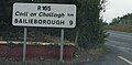 IMG R165road2045.jpg 3,475 × 1,715; 1.32 MB
-
 IMGN33atM1 5109c.jpg 2,589 × 1,293; 635 KB
-
 Lane at Parsonstown - geograph.org.uk - 872151.jpg 640 × 480; 89 KB
-
 Lane at Roadstown, Dunany, Co. Louth - geograph.org.uk - 888943.jpg 640 × 480; 97 KB
-
 M1County Louth.jpg 2,577 × 1,488; 779 KB
-
 Maghereagh Cross, Co. Louth - geograph.org.uk - 1271442.jpg 640 × 480; 64 KB
-
 Minor road in Faughart Lower - geograph.org.uk - 1569594.jpg 640 × 480; 49 KB
-

-
 Motorway Exit 18 Ireland.PNG 150 × 130; 3 KB
-
 Motorway Exit 19 Ireland.PNG 150 × 130; 3 KB
-
 Motorway Exit 8 Ireland.PNG 150 × 130; 3 KB
-
 N1 approaching the Border - geograph.org.uk - 446106.jpg 640 × 480; 65 KB
-
 N1 at Proleek Acres - geograph.org.uk - 446092.jpg 640 × 480; 84 KB
-
 N2 from overbridge at J2.jpg 2,592 × 1,944; 1.1 MB
-
 N51 rcs IE.png 768 × 904; 121 KB
-
 National Border at County Bridge - geograph.org.uk - 16923.jpg 640 × 452; 108 KB
-
 Old road at Ballymacscanlan, Co Louth - geograph.org.uk - 224538.jpg 640 × 426; 154 KB
-
 Plaque on the Clermont Pass road - geograph.org.uk - 773204.jpg 640 × 480; 92 KB
-
 R108 Regional Route Shield Ireland.png 270 × 150; 5 KB
-
 R132 Regional Route Shield Ireland.png 270 × 150; 5 KB
-
 R165 Regional Route Shield Ireland.png 270 × 150; 5 KB
-
 R168 Regional Route Shield Ireland.png 270 × 150; 5 KB
-
 R173 Regional Route Shield Ireland.png 270 × 150; 5 KB
-
 R175 Regional Route Shield Ireland.png 270 × 150; 5 KB
-
 R176 Regional Route Shield Ireland.png 270 × 150; 5 KB
-
 R178 Regional Route Shield Ireland.png 270 × 150; 5 KB
-

-
 Salterstown, Co. Louth - geograph.org.uk - 888807.jpg 640 × 480; 74 KB
-
 Sheds alongside the coastal road West of Ballaghan Point - geograph.org.uk - 6197445.jpg 2,616 × 1,334; 1.45 MB
-
 The Ardee Road south of Newtownbabe - geograph.org.uk - 1757789.jpg 1,024 × 768; 76 KB
-
 The coast road near Salterstown - geograph.org.uk - 451158.jpg 640 × 427; 99 KB
-

-
 The Lower Jenkinstown road junction on the R173 - geograph.org.uk - 5838512.jpg 2,589 × 1,891; 1.87 MB
-
 The road and shore near Salterstown - geograph.org.uk - 478093.jpg 640 × 427; 108 KB
-

-
 Approaching Ardee - geograph.org.uk - 463201.jpg 640 × 480; 101 KB
-
-
 By pass road Dundalk - geograph.org.uk - 517519.jpg 640 × 480; 97 KB
-
 Cattle grid in the Cooley Mountains - geograph.org.uk - 494119.jpg 640 × 480; 65 KB
-
 Dublin Road, Drogheda - geograph.org.uk - 593552.jpg 640 × 480; 116 KB
-
 Entering Southern Ireland - geograph.org.uk - 547764.jpg 640 × 480; 96 KB
-
 Omeath forest - geograph.org.uk - 617857.jpg 640 × 393; 73 KB
-
 Racecourse Road Dundalk - geograph.org.uk - 517509.jpg 640 × 480; 71 KB
-
 Ring of Gullion Way - geograph.org.uk - 494120.jpg 640 × 480; 86 KB
-
 Road at Kileen near Newry - geograph.org.uk - 628500.jpg 640 × 434; 78 KB
-
 Road near Ravensdale (1), Co Louth - geograph.org.uk - 254215.jpg 640 × 426; 155 KB
-
 Road near Ravensdale, Co Louth (2) - geograph.org.uk - 254218.jpg 640 × 426; 157 KB
-
 Steep hill above Killeen - geograph.org.uk - 450799.jpg 640 × 480; 76 KB
-

-
 The descent from the Clermont Pass - geograph.org.uk - 446733.jpg 640 × 480; 61 KB
-
 The Ferry Hill near Omeath - geograph.org.uk - 617892.jpg 640 × 391; 103 KB
-
 Townlands, Mulatee, Co. Louth - geograph.org.uk - 355613.jpg 480 × 640; 295 KB
.jpg)


,_Co_Louth_-_geograph.org.uk_-_254215.jpg)
_-_geograph.org.uk_-_254218.jpg)


