Category:Roads in Coffee County, Georgia
Jump to navigation
Jump to search
Counties of Georgia: Appling · Atkinson · Bacon · Baker · Baldwin · Banks · Barrow · Bartow · Ben Hill · Berrien · Bleckley · Brantley · Brooks · Bryan · Bulloch · Burke · Butts · Calhoun · Camden · Campbell · Candler · Carroll · Catoosa · Charlton · Chatham · Chattooga · Cherokee · Clay · Clayton · Clinch · Cobb · Coffee · Colquitt · Columbia · Cook · Coweta · Crawford · Crisp · Dade · Dawson · Decatur · DeKalb · Dodge · Dooly · Dougherty · Douglas · Early · Effingham · Elbert · Emanuel · Evans · Fannin · Fayette · Floyd · Forsyth · Franklin · Fulton · Gilmer · Glascock · Glynn · Gordon · Grady · Greene · Gwinnett · Habersham · Hall · Hancock · Haralson · Harris · Hart · Heard · Henry · Houston · Irwin · Jackson · Jasper · Jeff Davis · Jefferson · Jenkins · Johnson · Jones · Lamar · Lanier · Laurens · Lee · Liberty · Lincoln · Long · Lowndes · Lumpkin · Macon · Madison · Marion · McDuffie · McIntosh · Meriwether · Miller · Milton · Mitchell · Monroe · Montgomery · Morgan · Murray · Newton · Oconee · Oglethorpe · Paulding · Peach · Pickens · Pierce · Pike · Polk · Pulaski · Putnam · Rabun · Randolph · Rockdale · Schley · Screven · Seminole · Spalding · Stephens · Stewart · Sumter · Talbot · Taliaferro · Tattnall · Taylor · Telfair · Terrell · Thomas · Tift · Toombs · Towns · Treutlen · Troup · Turner · Twiggs · Union · Upson · Walker · Walton · Ware · Warren · Washington · Wayne · Wheeler · White · Whitfield · Wilcox · Wilkes · Wilkinson · Worth
City-counties: Athens–Clarke · Augusta–Richmond · Columbus–Muscogee · Cusseta–Chattahoochee · Georgetown–Quitman · Macon–Bibb · Preston–Webster · Statenville–Echols
City-counties: Athens–Clarke · Augusta–Richmond · Columbus–Muscogee · Cusseta–Chattahoochee · Georgetown–Quitman · Macon–Bibb · Preston–Webster · Statenville–Echols
Subcategories
This category has the following 11 subcategories, out of 11 total.
0
1
2
Media in category "Roads in Coffee County, Georgia"
The following 19 files are in this category, out of 19 total.
-
 Aden's Minit Market, GA158, Douglas.jpg 5,184 × 3,456; 6.07 MB
-
 Ambrose City limit GA268EB.jpg 5,184 × 3,456; 9.51 MB
-
 Atkinson County border, GA64WB.JPG 5,152 × 3,864; 7.93 MB
-
 Bacon County border, GA32EB.JPG 5,152 × 3,864; 7.94 MB
-
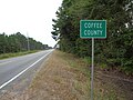 Coffee County border, GA32WB.jpg 5,152 × 3,864; 8 MB
-
 Coffee County border, GA64EB.JPG 5,152 × 3,864; 7.95 MB
-
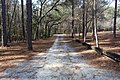 Dirt road, General Coffee State Park.jpg 5,184 × 3,456; 10.44 MB
-
 Douglas trail at GA32.jpg 5,184 × 3,456; 10.67 MB
-
 GA206 Connector EB End.jpg 5,184 × 3,456; 7.71 MB
-
 GA206 end, Douglas.jpg 5,184 × 3,456; 7.73 MB
-
 Georgia State Route 206 268 intersection.jpg 5,184 × 3,456; 9.14 MB
-
 Georgia State Route 268 begin at GA32.jpg 5,184 × 3,456; 9.71 MB
-
 Georgia State Route 64, eastern terminus.JPG 5,152 × 3,864; 7.85 MB
-
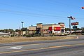 Hardee's, Bowens Mill Rd SW, Douglas.jpg 5,184 × 3,456; 7.57 MB
-
 Old road bed that led to crossing of Ocmulgee River, Coffee County.jpg 5,184 × 3,456; 8.89 MB
-
 Pridgen community US441 NB.jpg 5,184 × 3,456; 9.98 MB
-
 Sims Funeral Home, Douglas.jpg 5,184 × 3,456; 8.36 MB
-
 Telfair County US319NB.jpg 5,184 × 3,456; 6.98 MB
-
 Union Banking Company Building, Douglas.jpg 5,184 × 3,456; 8.31 MB


