Category:Road transport maps of London
Jump to navigation
Jump to search
Subcategories
This category has the following 3 subcategories, out of 3 total.
B
C
S
Media in category "Road transport maps of London"
The following 20 files are in this category, out of 20 total.
-
20-mph-zones-London-2015-03.jpg 1,352 × 988; 114 KB
-
A1 and A1000.png 600 × 433; 53 KB
-
Greater London road network (blank).png 951 × 787; 474 KB
-
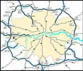
Greater London road network map.png 951 × 787; 527 KB
-
London Motorway Box 1960s Plan.png 3,366 × 2,319; 433 KB
-
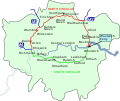
London north-south circulars.svg 2,850 × 2,280; 1.23 MB
-
London Ringway 2 1960s Plan.png 1,699 × 1,220; 201 KB
-
London Ringway 3 1960s Plan.png 1,871 × 1,871; 461 KB
-
London Ringway 4 1960s Plan.png 1,871 × 1,871; 460 KB
-
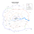
London Ringways Plan.png 8,858 × 8,858; 1.75 MB
-
London Ringways Plan.svg 4,486 × 4,189; 223 KB
-
London to Harwich map by John Ogilby.jpg 1,600 × 1,248; 675 KB
-
M25 London map.png 835 × 798; 1.06 MB
-
M25 London.jpg 3,902 × 3,335; 1.64 MB
-
M25 works.png 762 × 638; 574 KB
-
Proposed inner ring road for London shown in 1945.png 624 × 473; 259 KB
-
Roman Road.png 4,400 × 2,192; 704 KB
-
Route of A12.png 600 × 450; 411 KB
-
Tollgates London 1801.jpg 1,400 × 1,029; 308 KB
-
Westway Overlay Map.jpg 3,540 × 1,365; 4.82 MB


