Category:Road signs in Ohio
Jump to navigation
Jump to search
States of the United States: Alabama · Alaska · Arizona · Arkansas · California · Colorado · Connecticut · Delaware · Florida · Georgia · Hawaii · Idaho · Illinois · Indiana · Iowa · Kansas · Kentucky · Louisiana · Maine · Maryland · Massachusetts · Michigan · Minnesota · Mississippi · Missouri · Montana · Nebraska · Nevada · New Hampshire · New Jersey · New Mexico · New York · North Carolina · North Dakota · Ohio · Oklahoma · Oregon · Pennsylvania · Rhode Island · South Carolina · South Dakota · Tennessee · Texas · Utah · Vermont · Virginia · Washington · West Virginia · Wisconsin · Wyoming – District of Columbia: Washington, D.C.
Guam · Puerto Rico
Guam · Puerto Rico
Subcategories
This category has the following 19 subcategories, out of 19 total.
D
G
J
- Road junction signs in Ohio (1 F)
M
O
P
R
- River name signs in Ohio (5 F)
S
- Speed limit road signs in Ohio (19 F)
- Stop signs in Ohio (9 F)
W
Media in category "Road signs in Ohio"
The following 44 files are in this category, out of 44 total.
-

-

-
 40660 7528262 n (25981033626).jpg 540 × 720; 97 KB
-
 Attica, Ohio as viewed from Main Street.JPG 3,264 × 2,448; 3.45 MB
-
 Bloomdale, Ohio viewed from Main Street-026860.JPG 4,000 × 3,000; 3.33 MB
-
 Bluffton northward along Main Street.jpg 2,576 × 1,920; 2.03 MB
-
 Buttoncopy5.jpg 1,101 × 635; 109 KB
-
 CampusGateway.JPG 1,984 × 1,488; 666 KB
-
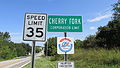 CherryForkOH1.JPG 4,608 × 2,592; 3.53 MB
-
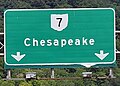 Chesapeake ohio.jpg 418 × 299; 57 KB
-
 Cleveland Innerbelt Bridge Opening (29829275541).jpg 6,000 × 4,000; 530 KB
-
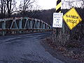 Coshocton County Bridge.JPG 3,648 × 2,736; 4.6 MB
-
 Cville.jpg 1,232 × 1,632; 616 KB
-
 Eastland Road Button Copy near CLE (43528611814).jpg 2,400 × 1,600; 1.5 MB
-
 Economic Recovery sign Clean.png 1,984 × 1,488; 6.25 MB
-
 Economic Recovery sign vandalized.png 1,984 × 1,488; 6.05 MB
-
 Families Belong Together IMG 0884 (29245018158).jpg 2,700 × 2,272; 1.16 MB
-
 Fenn Tower.jpg 1,704 × 2,272; 1.26 MB
-
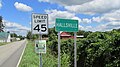 HallsvilleOH1.JPG 4,608 × 2,592; 3.08 MB
-
 I-280 OH at Exit 1B.jpg 3,264 × 2,291; 2.92 MB
-
 I-480 E fence.jpg 1,600 × 1,200; 361 KB
-
 Intersection OH-506 and OH-124 Marshall, Ohio.jpg 1,600 × 1,200; 561 KB
-
 Junction US 30 and Ohio 231.JPG 2,061 × 1,332; 503 KB
-
 Lowell Klinefelter Avenue.jpg 1,600 × 1,200; 595 KB
-
 Motel6Lima.JPG 2,507 × 1,232; 537 KB
-
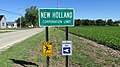 NewHollandOH1.JPG 4,608 × 2,592; 4.37 MB
-
 No Pedestrians.jpg 4,896 × 3,264; 1.89 MB
-
 OH 184 west in Toledo.jpg 3,264 × 2,448; 1.54 MB
-
 Pet Crossing Sign Pike County Ohio.jpg 1,024 × 1,059; 734 KB
-
 Picture III 178.jpg 1,600 × 1,200; 532 KB
-
 PiketonOH1.JPG 4,608 × 2,592; 3.2 MB
-
 Pleasant Valley Road-Bromfield Road intersection - panoramio.jpg 2,080 × 1,544; 505 KB
-
 Red-light-camera-springfield-ohio.jpg 2,210 × 1,885; 467 KB
-
 Road work ahead (28128046114).jpg 3,264 × 2,448; 2.57 MB
-
 Sidewalk access restrictions at Loveland Station Apartments, Loveland, Ohio.jpg 4,032 × 3,024; 3.63 MB
-
 South Main in Lindsey, Ohio.jpg 2,816 × 1,584; 2.19 MB
-
 SR 94 south of Wadsworth.jpg 3,648 × 2,736; 2.08 MB
-
-
 US 127S at OH 118.jpg 640 × 480; 62 KB
-

-

-
 WaverlyOH1.JPG 4,608 × 2,592; 3.05 MB
-
 Woodville, Ohio as viewed from Main Street.JPG 3,264 × 2,448; 3.52 MB
-
 Your GPS is Wrong sign, Villa Podova Drive Northwest, Canton, Ohio.jpg 640 × 640; 192 KB
_just_south_of_High_Street_on_the_border_of_Orangeville,_Trumbull_County,_Ohio_and_South_Pymatuning_Township,_Mercer_County,_Pennsylvania.jpg)
_just_south_of_High_Street_on_the_border_of_Hartford_Township,_Trumbull_County,_Ohio_and_South_Pymatuning_Township,_Mercer_County,_Pennsylvania.jpg)
.jpg)


.jpg)


.jpg)


.jpg)


.jpg)


