Category:Road signs in New Zealand
Jump to navigation
Jump to search
overview of road signs in New Zealand | |||||
| Upload media | |||||
| Instance of |
| ||||
|---|---|---|---|---|---|
| Facet of | |||||
| Location |
| ||||
| |||||
Countries of Oceania: Australia · Fiji · New Zealand · Papua New Guinea · Samoa · Tonga · Tuvalu · Vanuatu
Other areas: French Polynesia · Guam · Hawaii – Partly: Indonesia
Other areas: French Polynesia · Guam · Hawaii – Partly: Indonesia
English: This category is for photographs. For diagrams, see Category:Diagrams of road signs of New Zealand.
Subcategories
This category has the following 41 subcategories, out of 41 total.
C
D
E
G
H
L
M
P
R
S
T
W
Media in category "Road signs in New Zealand"
The following 71 files are in this category, out of 71 total.
-
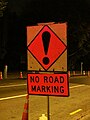 "NO ROAD MARKING" (6948777818).jpg 900 × 1,200; 371 KB
-
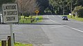 39 degrees south sign in Owhango, looking north, September 2019.jpg 5,312 × 2,988; 2.07 MB
-
 Alison Avenue in Albert Town.jpg 3,295 × 1,871; 3.62 MB
-
 Nelson Street Ramps And CMJ From West.jpg 1,600 × 1,200; 364 KB
-
 Auckland Ambulance SUV Type.jpg 1,600 × 1,200; 1.1 MB
-
 Auckland City Council Main Building.jpg 1,200 × 1,600; 529 KB
-
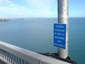 Auckland Harbour Bridge Details 01.jpg 1,600 × 1,200; 1.09 MB
-
 Awatea St Stadium site.jpg 2,048 × 1,536; 1.34 MB
-
 Blackball Community Centre 001.JPG 3,872 × 2,592; 3.83 MB
-
 Cape Reinga SH1 start.jpg 3,264 × 2,448; 1.19 MB
-
 Cashel Mall in 2024.png 5,712 × 3,852; 27.53 MB
-
 Cashel Street looking west.jpg 2,592 × 1,944; 4.24 MB
-
 Christchurch-30kmhZone-HerefordSt.jpg 661 × 480; 101 KB
-
 Christmas Day in the Workhouse (49272249423).jpg 6,000 × 4,000; 12.38 MB
-
 Christmas Day in the Workhouse (49272717126).jpg 4,000 × 6,000; 13.11 MB
-
 Colombo St bridge Avon River.jpg 2,816 × 1,880; 2.24 MB
-
 Defaced roadside sign saying stop 1080.JPG 2,304 × 3,072; 2.71 MB
-
 Digger at Mt Wellington,Auckland New Zealand (12400812444).jpg 6,000 × 2,826; 5.1 MB
-
 DnSouthernMway-NZ.jpg 567 × 466; 168 KB
-
 Driving North From QTown Through Pass.jpg 1,600 × 1,200; 401 KB
-
 Elliot Street Is Almost Finished Now.jpg 1,600 × 1,200; 254 KB
-
 End of the road, Martinborough 2005 (28118579).jpg 2,024 × 2,965; 3.36 MB
-
 Esmonde Road Strange Split Pathways.jpg 1,600 × 1,200; 755 KB
-
 Established Route Point Sign.jpg 980 × 980; 849 KB
-
 Forgotten-World-HWY sign.png 210 × 50; 18 KB
-
 GObusTakeover.jpg 720 × 540; 86 KB
-
 Hamilton Ring Road shield.png 311 × 361; 14 KB
-
 Heading East From Rosebank Road Flyover.jpg 1,600 × 1,200; 234 KB
-
 Highway 94.jpg 621 × 501; 61 KB
-
 Homer tunnel east.jpg 550 × 413; 65 KB
-
 Jackson Bay Main Street 002.JPG 6,016 × 4,000; 9.29 MB
-
 Jervois Quay, Wellington.jpg 1,280 × 960; 269 KB
-
 Kilometre Marker Post Sign.jpg 980 × 980; 831 KB
-
 Knobs Flat sgn.jpg 947 × 506; 79 KB
-
 Lake Rotoehu road sign.jpg 3,780 × 2,520; 9.41 MB
-
 Lorne Street Seen From The South.jpg 1,600 × 1,200; 270 KB
-
 Market St Hastings crop.jpg 508 × 341; 32 KB
-
 Milford Sound Hwy, South Island (483033) (9482283255).jpg 3,852 × 2,164; 1.87 MB
-
 Minweight.jpg 1,604 × 1,604; 267 KB
-
 Motorway in New Zealand.JPG 3,264 × 2,044; 1.15 MB
-
 Mount Victoria Bus Tunnel at Night 02.JPG 4,608 × 3,456; 4.87 MB
-
 Nelson Street Cycleway 038.JPG 5,472 × 3,648; 3.66 MB
-
 New Zealand Post Mailbox.jpg 1,472 × 1,019; 470 KB
-
 New Zealand Toll Road Sign.jpg 60 × 54; 9 KB
-
 North end of Skippers Bridge.jpg 4,896 × 3,264; 7.34 MB
-
 NW Looking East Towards CMJ.JPG 2,304 × 1,536; 905 KB
-
 Okiato - 29592961516.jpg 5,558 × 3,705; 2 MB
-
 Power Board Building In Ponsonby I.jpg 1,600 × 1,200; 363 KB
-
 Queenstown Road Roundabout North I.jpg 1,600 × 1,200; 501 KB
-
 Queenstown Road Roundabout North II.jpg 1,600 × 1,200; 494 KB
-
 Raglan, New Zealand 06.jpg 4,988 × 2,833; 2.54 MB
-
 Rangiora town hall 400x228.jpg 400 × 228; 28 KB
-
 RangioraPresbyterianChurch.JPG 3,500 × 2,412; 1.99 MB
-
 Red-billed Gull, Tikorangi road, New Zealand - panoramio.jpg 1,872 × 2,816; 1.68 MB
-
 Rimutaka Summit Sign (870369400).jpg 640 × 480; 63 KB
-
 Route 52 Road Sign (8539601449).jpg 3,996 × 2,664; 7.39 MB
-
 Route Station Marker Sign.jpg 980 × 980; 702 KB
-
 Runaway Truck Ramp On West Coast NZ.jpg 1,600 × 1,200; 760 KB
-
 SH1 northends.jpg 250 × 800; 137 KB
-
 Share the road 1.5m sign - heading back to Auckland from Cooks Beach (6941598104).jpg 2,592 × 1,728; 505 KB
-
 Shepherding Isn't Romantic Anymore.jpg 1,600 × 800; 276 KB
-
 Signpost at the former centre of State Highway 22.jpg 4,000 × 3,000; 3.74 MB
-
 Slow Down Penguins Crossing.jpg 4,032 × 3,024; 15.79 MB
-
 Taramakau Bridge 154.JPG 5,472 × 3,648; 4.88 MB
-
 Toko, New Zealand.jpg 3,014 × 2,009; 3.53 MB
-
 Town Centre in Te Anau.jpg 4,064 × 1,481; 5.61 MB
-
 Tram tracks.JPG 1,933 × 2,390; 675 KB
-
 Verkehrsschild newzealand 1.JPG 800 × 600; 60 KB
-
 Verkehrsschild newzealand 3.JPG 800 × 600; 40 KB
-
 Wangapeka River with Wangapeka River Rd, Kahurangi, New Zealand.jpg 5,472 × 3,648; 20.79 MB
-
 Wards Brewery 63.jpg 4,000 × 3,000; 4.05 MB
.jpg)


.jpg)
.jpg)


.jpg)


.jpg)


_(9482283255).jpg)


.jpg)
.jpg)


.jpg)


