Category:Road signs in Kharkiv Oblast
Jump to navigation
Jump to search
Regions of Ukraine:
Oblasts: Cherkasy · Chernihiv · Chernivtsi · Dnipropetrovsk · Donetsk · Ivano-Frankivsk · Kharkiv · Kherson · Khmelnytskyi · Kyiv · Luhansk · Lviv · Mykolaiv · Odesa · Poltava · Rivne · Ternopil · Volyn · Zaporizhzhia · Zhytomyr – Cities: Kyiv · Sevastopol – Autonomous Republic: Crimea
Oblasts: Cherkasy · Chernihiv · Chernivtsi · Dnipropetrovsk · Donetsk · Ivano-Frankivsk · Kharkiv · Kherson · Khmelnytskyi · Kyiv · Luhansk · Lviv · Mykolaiv · Odesa · Poltava · Rivne · Ternopil · Volyn · Zaporizhzhia · Zhytomyr – Cities: Kyiv · Sevastopol – Autonomous Republic: Crimea
Subcategories
This category has the following 4 subcategories, out of 4 total.
Media in category "Road signs in Kharkiv Oblast"
The following 9 files are in this category, out of 9 total.
-
 20201118 142206(1) Дорожний знак Крейдянка.jpg 2,448 × 3,264; 2.59 MB
-
 Izium after Russian occupation (2022-09-15) 04.jpg 1,200 × 800; 253 KB
-
 Market, Ruska Lozova(02).JPG 3,888 × 2,592; 4.99 MB
-
 Ukr Kh Zmiy Konst Traffic sign 2011.jpg 3,264 × 2,448; 3.64 MB
-
 Vovchans'k, Kharkiv Oblast, Ukraine - panoramio (14).jpg 2,304 × 3,072; 1.53 MB
-
 Большая Рогань указатель.JPG 3,264 × 2,448; 2.12 MB
-
 Знак на початку села Ємці.jpg 4,608 × 3,456; 6 MB
-
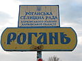 Рогань Харьковской области 2.jpg 3,264 × 2,448; 1.48 MB
-
 Рогань Харьковской области.JPG 3,264 × 2,448; 2.68 MB
_%D0%94%D0%BE%D1%80%D0%BE%D0%B6%D0%BD%D0%B8%D0%B9_%D0%B7%D0%BD%D0%B0%D0%BA_%D0%9A%D1%80%D0%B5%D0%B9%D0%B4%D1%8F%D0%BD%D0%BA%D0%B0.jpg)
_04.jpg)
.JPG)

.jpg)


