Category:Road signs in Finistère
Jump to navigation
Jump to search
Departments of Metropolitan France: Ain [01] · Aisne [02] · Allier [03] · Alpes-de-Haute-Provence [04] · Hautes-Alpes [05] · Alpes-Maritimes [06] · Ardèche [07] · Ardennes [08] · Ariège [09] · Aube [10] · Aude [11] · Aveyron [12] · Bouches-du-Rhône [13] · Calvados [14] · Cantal [15] · Charente [16] · Charente-Maritime [17] · Cher [18] · Corrèze [19] · Corse-du-Sud [2A]† · Haute-Corse [2B]† · Côte-d’Or [21] · Côtes-d'Armor [22] · Creuse [23] · Dordogne [24] · Doubs [25] · Drôme [26] · Eure [27] · Eure-et-Loir [28] · Finistère [29] · Gard [30] · Haute-Garonne [31] · Gers [32] · Gironde [33] · Hérault [34] · Ille-et-Vilaine [35] · Indre [36] · Indre-et-Loire [37] · Isère [38] · Jura [39] · Landes [40] · Loir-et-Cher [41] · Loire [42] · Haute-Loire [43] · Loire-Atlantique [44] · Loiret [45] · Lot [46] · Lot-et-Garonne [47] · Lozère [48] · Maine-et-Loire [49] · Manche [50] · Marne [51] · Haute-Marne [52] · Mayenne [53] · Meurthe-et-Moselle [54] · Meuse [55] · Morbihan [56] · Moselle [57] · Nièvre [58] · Nord [59] · Oise [60] · Orne [61] · Pas-de-Calais [62] · Puy-de-Dôme [63] · Pyrénées-Atlantiques [64] · Hautes-Pyrénées [65] · Pyrénées-Orientales [66] · Bas-Rhin [67] · Haut-Rhin [68] · departmental district of the Rhône [69] · Haute-Saône [70] · Saône-et-Loire [71] · Sarthe [72] · Savoie [73] · Haute-Savoie [74] · Paris [75] · Seine-Maritime [76] · Seine-et-Marne [77] · Yvelines [78] · Deux-Sèvres [79] · Somme [80] · Tarn [81] · Var [83] · Vaucluse [84] · Vendée [85] · Vienne [86] · Haute-Vienne [87] · Vosges [88] · Yonne [89] · Territoire de Belfort [90] · Essonne [91] · Hauts-de-Seine [92] · Seine-Saint-Denis [93] · Val-de-Marne [94] · Val-d'Oise [95]
Overseas departments and regions: Guadeloupe [971] · Réunion [974]
Overseas collectivities: French Polynesia [987]
Overseas departments and regions: Guadeloupe [971] · Réunion [974]
Overseas collectivities: French Polynesia [987]
Subcategories
This category has the following 5 subcategories, out of 5 total.
*
B
M
Media in category "Road signs in Finistère"
The following 80 files are in this category, out of 80 total.
-
 017 Saint Emilion Braz.jpg 4,320 × 3,240; 4.39 MB
-
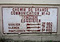 077 Esquibien.jpg 3,085 × 2,148; 3.14 MB
-
 078 Esquibien.jpg 4,242 × 3,134; 5.44 MB
-
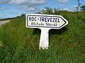 15.Panneau de Roc'h Trévézel.JPG 2,560 × 1,920; 2.48 MB
-
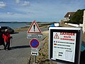
 210 Inondations Châteaulin.JPG 3,648 × 2,736; 4.85 MB
-
 217 Pont-Coblant.JPG 3,648 × 2,736; 4.01 MB
-
 525 Panneau routier Pleyben.jpg 2,631 × 1,634; 1.36 MB
-
 Breizh 5 diwar 5 Gwipavaz.png 270 × 330; 171 KB
-
 Bénodet-Eglise-du-port.jpg 600 × 800; 119 KB
-
 Carantec 01 La chaussée submersible menant à l'île Callot (2).JPG 3,648 × 2,736; 5.25 MB
-
 Chapel Sant-Guido 05.jpg 2,048 × 1,536; 779 KB
-
 Col de Trédudon 20141213-02.jpg 5,472 × 3,648; 13.49 MB
-
 Col de Trédudon 20141213-03.jpg 5,472 × 3,648; 9.45 MB
-
 Col du Ménez-Hom.jpg 6,048 × 4,032; 13.62 MB
-
 Coté mer (RD127).jpg 3,872 × 2,592; 3.74 MB
-
 Crozon-panneau.jpg 640 × 480; 177 KB
-
 Daoulas - Route de Quimper - Panneau routier N170.jpg 4,128 × 2,322; 2.62 MB
-
 Daoulas - Rue Saint-Roch - Panneaux.jpg 2,322 × 4,128; 4.53 MB
-
 Dirinon - Fontaine Saint-Divy - Panneau.jpeg 2,322 × 4,128; 2.63 MB
-
 Dirinon - Rue du Traon - Plaque et panneau Musée.jpeg 4,128 × 2,322; 2.43 MB
-
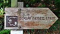 Douarnenez 17km.jpg 1,920 × 1,080; 836 KB
-
 FR29 Finistere.JPG 2,592 × 1,944; 1.63 MB
-
 Gare-de-Kermeur-20.jpg 1,600 × 1,200; 371 KB
-
 Guimiliau - Rue du Calvaire - Panneau Lampaul.jpeg 4,128 × 2,322; 3.94 MB
-
 Ile de Batz 2008 PD 96.JPG 2,272 × 1,704; 863 KB
-
 Kemperle Panelloù.jpg 3,594 × 1,944; 3.25 MB
-
 Kergolaër, Moëlan-sur-Mer le lavoir.jpg 2,048 × 1,536; 2.8 MB
-
 L'Hôpital-Camfrout 28.JPG 2,048 × 1,360; 1,019 KB
-
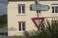
 La Martyre - Poulbroc'h - Panneau.jpg 2,322 × 4,128; 3.33 MB
-
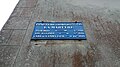 La Martyre - Rue Saint Salomon - Plaque de cocher.jpg 4,128 × 2,322; 4.1 MB
-
 La Roche-Maurice - D712 - Panneau Pont-Christ.jpg 2,322 × 4,128; 6 MB
-
 La Roche-Maurice - Place de l'Église - Panneaux.jpeg 2,322 × 4,128; 3.22 MB
-
 La Vallée du Guillec - Plougoulm - 01.JPG 3,456 × 2,304; 3.78 MB
-
 Lampaul-Plouarzel - Place de l'Église - Arrêt de bus Place du Bourg.jpg 2,322 × 4,128; 3.9 MB
-
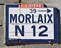 Landerneau - Rue de la Tour d'Auvergne - Plaque Morlaix N 12.jpg 1,316 × 1,028; 770 KB
-
 Landerneau - Rue du Pont - Plaque de cocher - Route nationale n°164.jpeg 3,456 × 2,592; 5.13 MB
-
 Lanvéoc - Panneau indiquant le fort de Lanvéoc et la pointe de Lanvéoc.jpeg 2,322 × 4,128; 7.13 MB
-
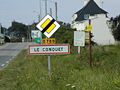 Le Conquet-panneau.jpg 640 × 480; 129 KB
-
 Le Guillec Panneau.jpg 6,000 × 4,000; 14.29 MB
-
 Le port.jpg 3,435 × 1,590; 2.11 MB
-
 Les deux Trédudon.JPG 3,036 × 1,536; 996 KB
-
 Les jumelages de Plomelin.jpg 2,048 × 1,536; 757 KB
-
 Loc-Ildut 9 Panneau routier de l'ancienne RN 164.JPG 3,072 × 2,304; 3.33 MB
-
 Locronan - panneau indicateur.jpg 5,472 × 3,648; 10.36 MB
-
 Lohoden cross.jpg 3,398 × 2,347; 1.75 MB
-
 Loperhet - Hameau de Botquenal - Panneau.jpg 4,128 × 2,322; 4.52 MB
-
 Loperhet - Route de Plougastel - Panneau Église et chapelle Sainte Nonne.jpg 3,024 × 4,032; 5.08 MB
-
 Lopérec 18 Bourg Vieux panneau routier.jpg 3,072 × 2,304; 2.93 MB
-
 Morgat-panneau.jpg 640 × 480; 124 KB
-
 N12 Brest.svg 744 × 1,052; 16 KB
-
 Panneau Michelin monuments historiques A - Guimiliau.jpg 3,463 × 4,231; 9.55 MB
-
 Panneau Michelin monuments historiques B - Guimiliau.jpg 3,373 × 4,531; 10.25 MB
-
 Panneau riviere Isole.JPG 4,320 × 3,240; 4.47 MB
-
 Panneaux-Michelin-Avenue-de-l-Odet-Benodet-byRundvald.jpg 4,032 × 3,024; 11.82 MB
-
 Pencran - Rond-point de Rosquelen - Plaque et panneaux.jpeg 3,456 × 2,592; 5.12 MB
-
 Plaque directionnelle Saint-Pol-de-Léon.JPG 4,608 × 3,072; 10.95 MB
-
 Plomodiern-panneau.jpg 640 × 480; 128 KB
-
 Plonévez-Porzay-panneau.jpg 640 × 480; 127 KB
-
 Plouarzel - Panneau d'entrée.jpg 4,128 × 2,322; 3.84 MB
-
 Ploudaniel - Panneau Saint-Thonan 4.jpg 2,322 × 4,128; 4.17 MB
-
 Ploudiry - Kanndi de Mescoat - Panneau.jpg 4,128 × 2,322; 3.8 MB
-
 Plouescat - Port de Porsguen - Panneau.jpeg 2,322 × 4,128; 2.93 MB
-
 Plougastel-Daoulas-panneau.jpg 640 × 480; 145 KB
-
 Plounéour-Ménez 2008 PD 19.JPG 2,272 × 1,704; 839 KB
-
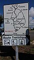 Plounéour-Trez - Panneau Route Touristique.jpeg 2,322 × 4,128; 2.99 MB
-
 Plounéour-Trez - Route de Gaouloc - Piste cyclable et son panneau.jpg 4,032 × 3,024; 4.44 MB
-
 Plourin-Lès-Morlaix.JPG 4,000 × 3,000; 5.85 MB
-
 Ploéven-panneau.jpg 640 × 480; 141 KB
-
 Quimper - Rue Bertrand de Rosmadec - Depuis la place de la Tour d'Auvergne.jpeg 2,322 × 4,128; 4.09 MB
-
 Quimper - Rue des Boucheries - Plaque.jpeg 4,128 × 2,322; 2.68 MB
-
 Road signs bilingual Breton in Quimper.jpg 1,037 × 1,120; 742 KB
-
 Roscoff - Ancienne plaque directionnelle.jpg 5,041 × 3,236; 8.4 MB
-
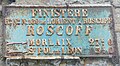 Roscoff 062 Ancien panneau routier.JPG 3,041 × 1,673; 2.55 MB
-
 Roscoff Panneau 617.jpg 4,896 × 3,264; 17.32 MB
-
 Rosnoën 02.jpg 3,072 × 2,304; 3.39 MB
-
 Saint Hernot-panneau.jpg 640 × 480; 128 KB
-
 Saint-Pol-de-Léon - Parc du Champ de la Rive - Panneaux à l'entrée.jpeg 2,322 × 4,128; 2.99 MB
-
 Saint-Pol-de-Léon - Rue Rozières - Plaque et panneaux.jpeg 4,128 × 2,322; 3.74 MB
-
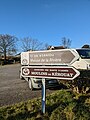 Sizun - Panneaux Maison de la Rivière et Moulins de Kérouat.jpg 3,024 × 4,032; 3.74 MB
-
 Spézet 06.JPG 3,072 × 2,304; 4.33 MB


.JPG)


.jpg)


