Category:Road signs in Colquitt County, Georgia
Jump to navigation
Jump to search
Counties of Georgia: Appling · Atkinson · Bacon · Baker · Banks · Barrow · Bartow · Ben Hill · Berrien · Brantley · Brooks · Bryan · Butts · Calhoun · Camden · Carroll · Catoosa · Charlton · Chatham · Chattooga · Cherokee · Clay · Clayton · Clinch · Cobb · Coffee · Colquitt · Columbia · Cook · Coweta · Crawford · Crisp · Dade · Dawson · Decatur · DeKalb · Dodge · Dooly · Dougherty · Douglas · Early · Effingham · Evans · Floyd · Forsyth · Franklin · Fulton · Gilmer · Glynn · Gordon · Grady · Greene · Gwinnett · Habersham · Hall · Haralson · Harris · Hart · Henry · Houston · Irwin · Jasper · Jeff Davis · Jefferson · Lamar · Lanier · Laurens · Lee · Liberty · Long · Lowndes · Lumpkin · Macon · Madison · Marion · McIntosh · Miller · Mitchell · Monroe · Montgomery · Murray · Peach · Pierce · Pike · Polk · Pulaski · Putnam · Randolph · Rockdale · Schley · Seminole · Spalding · Stephens · Stewart · Sumter · Talbot · Tattnall · Taylor · Telfair · Terrell · Thomas · Tift · Toombs · Towns · Treutlen · Troup · Turner · Upson · Walker · Ware · Wayne · Wheeler · White · Whitfield · Wilcox · Worth
City-counties: Athens–Clarke · Augusta–Richmond · Columbus–Muscogee · Georgetown–Quitman · Macon–Bibb · Preston–Webster · Statenville–Echols
City-counties: Athens–Clarke · Augusta–Richmond · Columbus–Muscogee · Georgetown–Quitman · Macon–Bibb · Preston–Webster · Statenville–Echols
Media in category "Road signs in Colquitt County, Georgia"
The following 46 files are in this category, out of 46 total.
-
 1st Ave SW, S Main St Intersection Moultrie.JPG 3,072 × 2,304; 3.07 MB
-
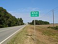 Berlin City Limits, GA 133 NB.JPG 5,152 × 3,864; 7.89 MB
-
 Brooks County limit, GA133SB.JPG 5,152 × 3,864; 7.93 MB
-
 Buck Creek Church Rd RR Crossing, Colquitt County.JPG 4,320 × 3,240; 4.41 MB
-
 Colquitt County border, Branch Rd NB.jpg 5,184 × 3,456; 6.88 MB
-
 Colquitt County border, GA202NB.jpg 5,184 × 3,456; 8.18 MB
-
 Colquitt County Chamber of Commerce.JPG 3,072 × 2,304; 2.83 MB
-
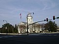 Colquitt County Courthouse SW corner.JPG 3,072 × 2,304; 2.93 MB
-
 Colquitt County limit, Kinard Bridge Rd.JPG 5,152 × 3,864; 7.92 MB
-
 Colquitt County Line, GA 133 NB.JPG 5,152 × 3,864; 7.94 MB
-
 Colquitt Towers (SE corner).JPG 3,072 × 2,304; 3.03 MB
-
 Cook County border, Hempstead Church Rd EB.jpg 5,184 × 3,456; 7.02 MB
-
 Crosland, Colquitt County, US319 NB.jpg 5,184 × 3,456; 7.16 MB
-
 CVS, Moultrie.JPG 4,320 × 3,240; 4.44 MB
-
 Doerun City Limits, GA 133 NB.JPG 4,320 × 3,240; 4.45 MB
-
 Ellenton City Limits, Cool Springs Ellenton Rd.JPG 4,320 × 3,240; 4.53 MB
-
 Ellenton City limits, Ellenton Omega Rd SB.JPG 5,152 × 3,864; 7.85 MB
-
 Ellenton City Limits, S Baker St.JPG 4,320 × 3,240; 4.44 MB
-
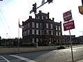
 Friedlander's Building.JPG 3,072 × 2,304; 2.94 MB
-
 GA 133 270 Junction, Doerun.JPG 4,320 × 3,240; 4.38 MB
-
 GA 33 133 Junction, Colquitt County.JPG 4,320 × 3,240; 4.5 MB
-
 GA 37 133 US 319 Junction, Moultrie.JPG 4,320 × 3,240; 4.6 MB
-
 GA111EB terminus at GA33, Moultrie.jpg 5,184 × 3,456; 8.11 MB
-
 GA202NB terminus at GA111, Colquitt County.jpg 5,184 × 3,456; 8.4 MB
-
 GA33 NB Moultrie at US319 GA35.jpg 5,184 × 3,456; 5.74 MB
-
 GA33 NB Moultrie Direction road sign Moultrie Thomasville Tifton.jpg 5,184 × 3,456; 5.35 MB
-
 GA33 NB Moultrie Jct US319 GA35.jpg 5,184 × 3,456; 5.35 MB
-
 GA33 NB Moultrie US319 signage.jpg 5,184 × 3,456; 5.46 MB
-
 GA33 NB, Moultrie city limit.jpg 5,184 × 3,456; 5.08 MB
-
 GA35 MM21, Norman Park.jpg 5,184 × 3,456; 8.6 MB
-
 McDonald St Railroad Crossing, Ellenton.JPG 4,320 × 3,240; 4.4 MB
-
 Med E Spec Inc, Ellenton.JPG 4,320 × 3,240; 4.47 MB
-
 MM 6 GA 133 NB.jpg 5,184 × 3,456; 8 MB
-
 Mother Easter Baptist Church, Moultrie.JPG 3,072 × 2,304; 2.94 MB
-
 Moultrie 1st Ave SE RR Crossing.JPG 3,072 × 2,304; 3.08 MB
-
 Moultrie Banking Company Building (south face).JPG 3,072 × 2,304; 2.94 MB
-
 Moultrie city limit, GA111EB.jpg 5,184 × 3,456; 8.9 MB
-
 Moultrie City Limits, GA 133 NB.JPG 4,320 × 3,240; 4.42 MB
-
 Norman Park city limit Ellenton Norman Park Road NB.jpg 5,184 × 3,456; 7.04 MB
-
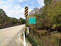
 Reed Bingham State Park Bridge and Colquitt County border.JPG 4,320 × 3,240; 4.44 MB
-
 SR37 Bridge over Little River 7.JPG 5,184 × 3,456; 9.25 MB
-
 Thomas County border, GA202SB.jpg 5,184 × 3,456; 7.45 MB
-
 Tift County N GA35 MM 0.jpg 5,184 × 3,456; 7.55 MB
-
 US319BusGA33SignsRoad (25372798949).jpg 2,400 × 1,600; 2.22 MB
-
 US319nGA33nGA133Signs-Moultrie (22830118628).jpg 2,400 × 1,600; 2.5 MB
-
 Worth County Line, GA 133 NB.JPG 4,320 × 3,240; 4.51 MB


.JPG)


.JPG)


.jpg)
.jpg)
