Category:Road signs in Broward County, Florida
Jump to navigation
Jump to search
Counties of Florida: Alachua · Baker · Bay · Bradford · Brevard · Broward · Calhoun · Charlotte · Citrus · Clay · Collier · Columbia · Dixie · Duval · Escambia · Flagler · Franklin · Gadsden · Gilchrist · Glades · Hamilton · Hardee · Hendry · Hernando · Highlands · Hillsborough · Holmes · Indian River · Jackson · Jefferson · Lafayette · Lake · Lee · Leon · Levy · Liberty · Madison · Manatee · Marion · Martin · Miami-Dade · Monroe · Nassau · Okaloosa · Okeechobee · Orange · Osceola · Palm Beach · Pasco · Pinellas · Polk · Putnam · Santa Rosa · Sarasota · Seminole · St. Johns · St. Lucie · Sumter · Suwannee · Taylor · Union · Volusia · Wakulla · Walton · Washington
Subcategories
This category has the following 2 subcategories, out of 2 total.
Media in category "Road signs in Broward County, Florida"
The following 67 files are in this category, out of 67 total.
-
 - panoramio (2377).jpg 1,600 × 1,200; 627 KB
-
 A1A at FL 844 (39022776920).jpg 2,400 × 1,600; 2.08 MB
-
 A1A North - Fort Lauderdale Beach (40790950022).jpg 2,400 × 1,600; 1.81 MB
-
 A1A North at FL 814 (40790950862).jpg 2,400 × 1,600; 1.7 MB
-
 A1A North at FL 816 (39022774990).jpg 2,400 × 1,600; 1.79 MB
-
 A1A North at FL 870 (39022771580).jpg 2,400 × 1,600; 1.79 MB
-
 Andrews Ave North (40431419371).jpg 2,400 × 1,600; 1.88 MB
-
 As The State Turns (28376931482).jpg 1,200 × 800; 735 KB
-
 Bike Lane, Racquet Club Road, Weston, Florida February 24, 2022.jpg 4,032 × 3,024; 1.57 MB
-
 Bonaventure Boulevard Near Three Village Road, Weston, Florida February 23, 2022.jpg 4,032 × 3,024; 4.43 MB
-
 Broward County, FL, USA - panoramio (6).jpg 1,600 × 1,200; 504 KB
-
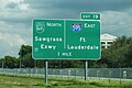
 Cecil B. Sawgrass Signs (6210037040).jpg 2,400 × 1,600; 1.57 MB
-
 CR811nRoadSign-OnBridge (32302329430).jpg 2,400 × 1,600; 1.48 MB
-
 CR912eRoad-JctFL811sign (26560324668).jpg 2,400 × 1,600; 1.8 MB
-
 EndOfRoadSign-Margate.jpg 2,576 × 1,932; 1.46 MB
-
 FL 811 Sign - North of Copans Road (32528585972).jpg 2,400 × 1,600; 1.93 MB
-
 FL 814 East (6214282569).jpg 1,600 × 2,400; 1.46 MB
-
 FL 816 at I-95.jpg 4,608 × 3,456; 6.86 MB
-
 FL 838 End (39022773720).jpg 2,400 × 1,600; 1.69 MB
-
 FL810eRoadSign-NearUS441 (40790947642).jpg 2,400 × 1,600; 1.84 MB
-
 FL823sRoad-RedRoadSplitSigns (33287595324).jpg 2,400 × 1,600; 1.43 MB
-
 FL845nRoad-ToTurnpikeFL869 (40123843124).jpg 2,400 × 1,600; 2.03 MB
-
 FL845sRoadSign-NearFL834 (25961219607).jpg 2,400 × 1,600; 2.01 MB
-
 FL849 North Sign (33636968420).jpg 1,200 × 1,800; 1.35 MB
-
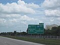
 FL869 South - Exit 18B - US441 South (41326736810).jpg 2,400 × 1,600; 1.2 MB
-
 Fort Lauderdale, Fl.jpg 1,836 × 3,264; 1.54 MB
-
 Bicycle riding prohobited.jpg 2,592 × 1,944; 1.19 MB
-
 Hurricane Evacuation Route.jpg 3,072 × 2,304; 1.16 MB
-
 I-75 Alley Mile Marker 48 - No Exit Sign (6214281663).jpg 800 × 534; 181 KB
-
 I-75 South Exit 19 (28024361170).jpg 1,200 × 800; 492 KB
-
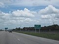
 I-75 South Puffy Clouds (31300284632).jpg 2,400 × 1,600; 1.66 MB
-
 I-75 Temporary End (6210037274).jpg 800 × 533; 204 KB
-
 I75 - Alligator Alley^ - panoramio.jpg 1,792 × 1,312; 689 KB
-
 Int75sRoad-MM20-Int595-FL869OneMileSign (31075221000).jpg 2,400 × 1,600; 2.06 MB
-
 Int95nRampFromInt595-FL842exitRampSign (39414304434).jpg 2,400 × 1,600; 1.75 MB
-
 Interstate 75 - Florida - 6877434084.jpg 2,816 × 2,112; 537 KB
-
 Interstate 75 - Florida - 6877436806.jpg 2,816 × 2,112; 454 KB
-
 Interstate 75 - Florida - 6877437134.jpg 2,816 × 2,112; 476 KB
-
 Interstate 75 - Florida - 6877437232.jpg 2,816 × 2,112; 526 KB
-
 Interstate 75 - Florida - 6877437420.jpg 2,816 × 2,112; 570 KB
-
 Interstate 75 - Florida - 6877437988.jpg 2,816 × 2,112; 467 KB
-
 Interstate 75 - Florida - 7023537037.jpg 2,816 × 2,112; 465 KB
-
 Interstate 75 - Florida - 7023537537.jpg 2,816 × 2,112; 476 KB
-
 Interstate 75 - Florida - 7023540403.jpg 2,816 × 2,112; 539 KB
-
 LyonsRoadNorth-ContraflowLeftTurnLaneForFL869North-Aug2013 (40431421801).jpg 2,400 × 1,600; 1.36 MB
-
 Miccosuke Reservation Sign (6210037180).jpg 800 × 533; 228 KB
-
 Overhead Florida SR 845 signs (5962804020).jpg 1,800 × 1,200; 653 KB
-
 Pompano State Farmers Market Sign (5916779748).jpg 800 × 533; 251 KB
-
 Road Atlas Obscura (10600824935).jpg 800 × 533; 170 KB
-
 Roundabout, Bonaventure Boulevard and Blatt Boulevard, Weston, Florida February 23, 2022.jpg 4,032 × 3,024; 4.93 MB
-
 SawgrassExpressway-MainSign-July1992.jpg 2,848 × 1,988; 1.09 MB
-
 SawgrassSign-CoralRidge-July1992.jpg 2,072 × 2,904; 2.38 MB
-
 SawgrassSignSR817-SR814-May1992.jpg 800 × 533; 210 KB
-
 Six-Key Shields (14260938143).jpg 800 × 533; 353 KB
-
 South on Florida Road A1A.JPG 3,872 × 2,592; 3.33 MB
-
 SR 816 Alternate.jpg 1,900 × 1,426; 162 KB
-
 SR and CR 814 signs (5962248551).jpg 800 × 533; 267 KB
-
 The Abnormal One (28640185761).jpg 1,200 × 800; 780 KB
-
 To Interstate 95 on A1A.png 817 × 615; 817 KB
-
 ToAlligatorAlleyToFL84signs-US27n (30637531343).jpg 1,600 × 2,400; 1.55 MB
-
 Trucks Entering Highway (6209522569).jpg 800 × 533; 306 KB
-
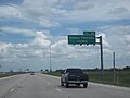
 US 27 North - Near Pembroke Pines (28201927102).jpg 1,200 × 800; 480 KB
-
 US Highway 1 - Florida - 6877510472.jpg 2,816 × 2,112; 550 KB
-
 US Highway 1 - Florida - 7023613017.jpg 2,816 × 2,112; 822 KB
-
 US1nFL838eRoadSigns-Jul2013 (40790948762).jpg 2,400 × 1,600; 1.87 MB
-
 US441 FL7 North - FL834 - August 2013 (40093197672).jpg 2,400 × 1,600; 1.58 MB
-
 US441 South - FL810 East To I-95 FL869 Sign (43910402414).jpg 2,400 × 1,600; 1.73 MB
.jpg)
.jpg)
.jpg)
.jpg)
.jpg)
.jpg)
.jpg)
.jpg)


.jpg)
.jpg)
.jpg)
.jpg)

.jpg)
.jpg)

.jpg)
.jpg)
.jpg)
.jpg)
.jpg)
.jpg)
.jpg)


.jpg)
.jpg)
.jpg)
.jpg)

.jpg)
.jpg)


.jpg)
.jpg)
.jpg)
.jpg)
.jpg)


.jpg)


.jpg)
.jpg)

.jpg)
.jpg)
.jpg)


.jpg)
.jpg)
.jpg)