Category:Road signs along Florida State Road 2
Jump to navigation
Jump to search
Media in category "Road signs along Florida State Road 2"
The following 17 files are in this category, out of 17 total.
-
 Baker County boundary FLSR2SB.JPG 5,152 × 3,864; 7.93 MB
-
 Baker County boundary FLSR2WB.JPG 5,152 × 3,864; 7.96 MB
-
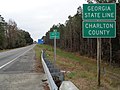 Charlton County boundary GASR94EB.JPG 5,152 × 3,864; 7.87 MB
-
 Clinch County boundary GASR94NB.JPG 5,152 × 3,864; 7.84 MB
-
 Columbia County boundary FLSR2NB.JPG 5,152 × 3,864; 7.8 MB
-
 Columbia County boundary FLSR2SB.JPG 5,152 × 3,864; 7.9 MB
-
 CR 0605 Boring Sign (22851027968).jpg 2,400 × 1,600; 2.63 MB
-
 FL 2 "The Rooftop Route" (15641242199).jpg 1,200 × 800; 491 KB
-
 FL2 EB, Baker County, FL2 signage.jpg 5,184 × 3,456; 4.11 MB
-
 FL2 EB, Baker County, JCT 127.jpg 5,184 × 3,456; 4.18 MB
-
 FL2WB, Baker County CR127 turn left.jpg 5,184 × 3,456; 4.86 MB
-
 FL2WB, Baker County CR127 turn right.jpg 5,184 × 3,456; 5.04 MB
-
 FL2WB, Baker County Road junction CR127.jpg 5,184 × 3,456; 5.1 MB
-
 Florida State Road 2 eastern terminus, Jackson County.jpg 5,184 × 3,456; 6.76 MB
-
 GA94WB, Charlton County, Entering Baker County Florida.jpg 5,184 × 3,456; 4.86 MB
-
 Georgia State Route 91 southern terminus, Seminole County.jpg 5,184 × 3,456; 6.2 MB
-
 Pittman FL Choctawatchee River SR 2 bridge sign01.jpg 3,264 × 2,448; 1.73 MB


.jpg)
.jpg)


