Category:Road maps of Hordaland
Jump to navigation
Jump to search
Subcategories
This category has only the following subcategory.
R
- Road locator maps of Hordaland (42 F)
Media in category "Road maps of Hordaland"
The following 8 files are in this category, out of 8 total.
-
 Bergensprogrammet map.jpg 2,384 × 2,904; 1.36 MB
-
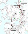
 Hordfast route.png 1,267 × 1,523; 1.45 MB
-
 Riksveier Buskerud Hordaland.svg 1,013 × 666; 276 KB
-
 Riksveier Hordaland Rogaland Telemark Buskerud.svg 1,340 × 1,267; 499 KB
-
 Riksveier Hordaland Sogn og Fjordane.svg 677 × 1,016; 364 KB
-
 Riksveier Hordaland.svg 526 × 554; 197 KB
-
 Riksveier Sogn og Fjordane Hordaland Rogaland.svg 729 × 1,493; 499 KB
-
 Triangle Link map upload.svg 1,480 × 905; 1.1 MB


