Category:Road maps of Andalusia
Jump to navigation
Jump to search
Autonomous communities of Spain: Andalusia · Aragon · Basque Autonomous Community · Castile and León · Castilla–La Mancha · Catalonia · Community of Madrid · Valencian Community · Autonomous cities:
Media in category "Road maps of Andalusia"
The following 35 files are in this category, out of 35 total.
-
 A-381 rec.png 610 × 599; 15 KB
-
 A92g granada.svg 1,052 × 744; 647 KB
-
 Autovia a-480.svg 996 × 681; 1.17 MB
-
 Autovia co32.svg 1,052 × 744; 339 KB
-
 Autovía del Olivar.jpg 2,999 × 2,249; 1.27 MB
-
 Autovía Española A-92-loc.svg 512 × 335; 161 KB
-
 Carreteras de Beas de Segura.svg 512 × 338; 305 KB
-
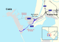
 Carreteras de la Bahía de Cádiz (sector sur).PNG 498 × 404; 68 KB
-
 Carreteras de Martos.svg 512 × 387; 542 KB
-
 Circunvalacion exterior de sevilla.svg 1,052 × 744; 1.23 MB
-
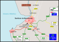
 Comunicaciones del Área Metropolitana de Granada.png 300 × 250; 11 KB
-
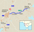
 Itinerario A471.png 816 × 601; 62 KB
-
 Itinerario A491.PNG 1,166 × 599; 54 KB
-
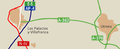 Mapa a-362.PNG 573 × 236; 25 KB
-
 Mapa a-376.PNG 384 × 465; 59 KB
-
 Mapa a-390.PNG 732 × 284; 29 KB
-
 Mapa a-394.PNG 864 × 830; 50 KB
-
 Mapa Autovia A-382.svg 804 × 747; 1.05 MB
-
 Mapa autovia CA-36.svg 1,052 × 744; 856 KB
-
 Mapa ca-33.PNG 424 × 191; 24 KB
-
 Mapa CA-34.png 281 × 357; 24 KB
-
 Mapa de carreteras de Aracena.svg 673 × 458; 276 KB
-
 Mapa de carreteras de San Lúcar de Barrameda.svg 512 × 366; 479 KB
-
 Mapa MA-21 A-7 - hiperronda.png 632 × 585; 70 KB
-
 Mapa n-443.PNG 276 × 155; 21 KB
-
 Mapa SE-20.svg 512 × 173; 37 KB
-
 Mapa se-30.PNG 439 × 434; 77 KB
-
 Mapa SE-30.svg 3,090 × 2,448; 654 KB
-
 Mapa se-40.PNG 494 × 449; 105 KB
-
 MapaCA-32.svg 1,052 × 744; 497 KB
-
 MapaDe se-30.PNG 439 × 434; 79 KB
-
 MapaJerez-rota.svg 1,052 × 744; 412 KB
-
 MapalocalizacionGR-30.svg 822 × 631; 1.18 MB
-
 Segura-Cazorla 1976 61.jpg 934 × 635; 737 KB
-
 Vícar (Carreteras).svg 512 × 577; 498 KB


.PNG)


.svg)