Category:Road bridges in Auckland
Jump to navigation
Jump to search
Subcategories
This category has the following 21 subcategories, out of 21 total.
A
- Albany Busway Bridge (4 F)
G
H
- Hopetoun Bridge (11 F)
I
- Ian McKinnon Drive Flyover (17 F)
M
- Mangere Bridge (1983) (9 F)
- McClymonts Road Bridge (3 F)
N
- Ngāpipi Estuary Bridge (3 F)
O
- Opanuku Bridge (6 F)
- Oratia Bridge (8 F)
- Ormiston Road Bridge (3 F)
P
- Paremuka Bridge (4 F)
R
S
- Second Tamaki River Bridge (2 F)
T
- Tāmaki Bridge (2 F)
U
- Upper Harbour Bridge (6 F)
V
- Victoria Park Viaduct (10 F)
Media in category "Road bridges in Auckland"
The following 67 files are in this category, out of 67 total.
-
 Aklbusway16.jpg 2,557 × 1,395; 1.01 MB
-
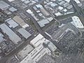 Sylvia Park Seen From Northwest Above.jpg 1,600 × 1,200; 1.39 MB
-
 Auckland CMJ Southern End.jpg 1,600 × 1,200; 273 KB
-
 Bad Gravel Track To Underwood Walmsley.jpg 1,600 × 1,200; 1.36 MB
-
 Bearing The Load Cantilvers For State Highway 1.jpg 1,600 × 1,200; 441 KB
-
 Blockhouse Bay Road Bridge Avondale.jpg 1,600 × 1,200; 1.09 MB
-
 Boston Road Train Station In 2007.jpg 1,600 × 2,400; 2.71 MB
-
 Central Motorway Junction AK.jpg 1,600 × 1,200; 355 KB
-
 Complex New Layout At Princes, Wellesley East.jpg 1,600 × 1,200; 1.13 MB
-
 Former Road Overbridge At Orakei.jpg 1,600 × 1,200; 380 KB
-
 Grafton Train Station, Double Tracking IV (cropped) (1).jpg 568 × 542; 224 KB
-
 Grafton Train Station, Double Tracking IV (cropped).jpg 1,039 × 960; 717 KB
-
 Grafton Train Station, Double Tracking IV.jpg 1,600 × 1,200; 1.36 MB
-
 Grafton Train Station, Double Tracking V.jpg 1,600 × 1,200; 1.2 MB
-
 Grafton Train Station, Finally Finished I.jpg 1,600 × 1,200; 1.11 MB
-
 Hobsonville Deviation Eastern Bridge I.jpg 1,600 × 1,200; 1.2 MB
-
 Hobsonville Deviation Eastern Bridge II.jpg 1,600 × 1,200; 1.09 MB
-
 Hobsonville Deviation Eastern Bridge III.jpg 1,600 × 1,200; 1.34 MB
-
 Huruhuru Stream Creek Old Road Bridge.jpg 1,600 × 1,200; 1.14 MB
-
 Looking East Towards Oakley Creek Estuary.jpg 1,600 × 1,200; 357 KB
-
 Looking North At Symonds Street Cemetery.jpg 1,600 × 1,200; 495 KB
-
 Looking Northwest Under Newton Road.jpg 1,600 × 1,200; 232 KB
-
 Looking Over Towards Suffolk Reserve II.jpg 1,600 × 1,200; 361 KB
-
 Looking Over Towards Suffolk Reserve III.jpg 2,000 × 1,500; 637 KB
-
 Looking South Over Pt Chevalier Interchange I.jpg 1,600 × 1,200; 312 KB
-
 Looking West Over Upper Queen St Bridge.jpg 1,600 × 1,200; 253 KB
-
 Lower Nihotupu Dam Spillway II.jpg 1,600 × 1,200; 1.28 MB
-
 Manurewa Train Station.jpg 500 × 375; 69 KB
-
 Massively Wide Overbridge, North Epsom.jpg 1,600 × 1,200; 1.35 MB
-
 May Road Overbridge In The Pouring Rain.jpg 1,600 × 1,200; 265 KB
-
 McCormick Green Reserve, Te Atatu.jpg 1,600 × 1,200; 391 KB
-
 Motorway South, Symonds Street Overpass 568175885.jpg 3,195 × 2,167; 1.68 MB
-
 New Lynn.jpg 1,500 × 1,000; 1.87 MB
-
 Ngapipi Drive Tamaki Drive Intersection II.jpg 1,600 × 1,200; 148 KB
-
 North Auckland Line Near Kumeu.jpg 1,200 × 1,600; 952 KB
-
 Northwestern Cycleway Newton Rd Bridge.jpg 1,600 × 1,200; 1.34 MB
-
 NW Motorway Looking East.JPG 576 × 384; 78 KB
-
 Owen G. Glenn Building University Auckland.jpg 1,600 × 1,200; 1.07 MB
-
 Panmure Train Station Trenching.jpg 1,600 × 1,200; 1.07 MB
-
 Patiki Road motorway exit.jpg 4,032 × 2,268; 329 KB
-
 Sel Peackock Road Bridge And Mill I.jpg 1,600 × 1,200; 355 KB
-
 Sel Peackock Road Bridge And Mill II.jpg 1,600 × 1,200; 419 KB
-
 SH20-SH1 Flyover South To Westbound.jpg 1,600 × 1,200; 1.01 MB
-
 SH20-SH20A Interchange In Mangere.jpg 1,600 × 1,200; 1.37 MB
-
 Sign On Grafton Road Overbridge Over State Highway 1.jpg 1,600 × 2,133; 661 KB
-
 Silvia Park Mt Wellington Interchange.jpg 2,400 × 1,800; 2.96 MB
-
 Sky Tower On Hobson Street View.jpg 1,200 × 1,600; 1.16 MB
-
 State Highway 1 From Claremont Street.jpg 1,600 × 1,200; 1.01 MB
-
 Substandard Parts Of Twin Streams Cycleway, North End II.jpg 1,200 × 1,600; 430 KB
-
 Suffolk Reserve Auckland Near Cycleway.jpg 1,600 × 1,200; 1.3 MB
-
 Suffolk Reserve In West Newton Suburb From Cycleway.jpg 1,600 × 1,200; 489 KB
-
 Tamaki Drive Sweeping Close To Water.jpg 1,600 × 1,200; 206 KB
-
 Tamaki River With The Two Bridges 01.jpg 1,600 × 1,200; 1.34 MB
-
 Tamaki River With The Two Bridges 02 (cropped).jpg 1,464 × 779; 845 KB
-
 Tamaki River With The Two Bridges 02.jpg 1,600 × 1,200; 1.35 MB
-
 The Absurd Glory Of Khyber Pass Road II.jpg 1,600 × 1,200; 968 KB
-
 Train On Auckland's Suburban Network.jpg 1,600 × 1,200; 1.38 MB
-
 Under Symonds Street Bridge Construction I.jpg 2,048 × 1,536; 713 KB
-
 Victoria Park Viaduct Roadside.jpg 1,600 × 800; 274 KB
-
 View Over Western Spaghetti Junction Lanes.jpg 1,600 × 1,200; 353 KB
-
 Waterview Connection,Mt Albert End (8) (9765966974).jpg 3,488 × 2,616; 3.08 MB
-
 Waterview motorway tunnel 9106 (9369979828) (3).jpg 1,600 × 1,067; 1.02 MB
-
 Waterview motorway tunnel 9160 (9367192721) (3).jpg 1,600 × 1,067; 1.4 MB
-
 Wellesley Street East Under Symonds Street I.jpg 1,600 × 1,200; 1.27 MB
-
 Wellesley Street East Under Symonds Street II.jpg 1,600 × 1,200; 1.09 MB
-
 Wellesley Street East With Princess Street I.jpg 1,600 × 1,200; 1.01 MB
-
 Wooden Bridge In West Waitakere Ranges.jpg 1,600 × 1,200; 163 KB


.jpg)


_(9765966974).jpg)
_(3).jpg)
_(3).jpg)


_(1).jpg)
.jpg)