Category:Road bridge over the Rákos Stream (Rákóczi utca, Isaszeg)
Jump to navigation
Jump to search
| Object location | | View all coordinates using: OpenStreetMap |
|---|
Media in category "Road bridge over the Rákos Stream (Rákóczi utca, Isaszeg)"
The following 2 files are in this category, out of 2 total.
-
 A Rákos-patak feletti közúti és vasúti híd, 2019 Isaszeg.jpg 1,600 × 1,200; 513 KB
-
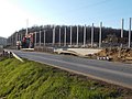 Road and railway bridges over the Rákos stream, rail reconstuction, 2019 Isaszeg.jpg 1,600 × 1,200; 551 KB

