Category:Road II/347 (Czech Republic)
Jump to navigation
Jump to search
road in Czech Republic    | |||||
| Upload media | |||||
| Instance of | |||||
|---|---|---|---|---|---|
| Location |
| ||||
| Transport network | |||||
| Has part(s) | |||||
| Length |
| ||||
| Partially coincident with |
| ||||
| |||||
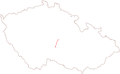
Čeština: Silnice II/347: Habry – Světlá nad Sázavou – Humpolec – Zachotín
Subcategories
This category has the following 3 subcategories, out of 3 total.
H
P
Media in category "Road II/347 (Czech Republic)"
The following 2 files are in this category, out of 2 total.
-
 II-347.png 232 × 144; 5 KB
-
 SilniceII347.svg 370 × 219; 4 KB