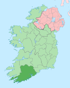
Category:Rivers of County Cork
Jump to navigation
Jump to search
Wikimedia category | |||||
| Upload media | |||||
| Instance of | |||||
|---|---|---|---|---|---|
| Category combines topics | |||||
| County Cork | |||||
county in Ireland | |||||
| Instance of | |||||
| Location | Munster, Ireland | ||||
| Capital | |||||
| Legislative body |
| ||||
| Executive body |
| ||||
| Official language | |||||
| Population |
| ||||
| Area |
| ||||
| official website | |||||
 | |||||
Subcategories
This category has the following 17 subcategories, out of 17 total.
A
- Awbeg River (2 F)
B
- Ballydonegan River (2 F)
- River Bride, Munster (3 F)
F
- River Feale (12 F)
G
K
- Kealincha River (3 F)
L
M
O
R
- Reen River (2 F)
- River Ilen, County Cork (12 F)
- River Stick (6 F)
- River Sullane (6 F)
W
Media in category "Rivers of County Cork"
The following 40 files are in this category, out of 40 total.
-
Ahanegavanagh Stream - geograph.org.uk - 1752990.jpg 3,456 × 2,304; 4.71 MB
-
Ahanegavanagh Stream - geograph.org.uk - 1753019.jpg 2,304 × 3,456; 1.28 MB
-
Arigideen Estuary - geograph.org.uk - 6057099.jpg 1,024 × 614; 54 KB
-
Arigideen Estuary - geograph.org.uk - 6057142.jpg 1,024 × 681; 95 KB
-
Blarney River in Blarney Castle's Grounds - geograph.org.uk - 596612.jpg 640 × 480; 158 KB
-
Boatyard on the Ilen - geograph.org.uk - 4807192.jpg 1,600 × 901; 591 KB
-
Chimneyfield River - geograph.org.uk - 574713.jpg 640 × 346; 89 KB
-
Cooleenlemane River - geograph.org.uk - 249971.jpg 640 × 480; 94 KB
-
Coomhola River - geograph.org.uk - 2007049.jpg 1,024 × 698; 480 KB
-
Coomhola River - geograph.org.uk - 2007057.jpg 1,024 × 687; 267 KB
-
Crossing the estuary - geograph.org.uk - 3566291.jpg 640 × 429; 211 KB
-
Disused road bridge - geograph.org.uk - 1396066.jpg 640 × 480; 298 KB
-
Durras River - geograph.org.uk - 14901.jpg 640 × 480; 268 KB
-
Estuary at Cannawee - geograph.org.uk - 3566245.jpg 640 × 427; 206 KB
-
Flash flood of the river Stick in Riverstick - geograph.org.uk - 3014505.jpg 1,024 × 768; 199 KB
-
Footbridge over Ross River - geograph.org.uk - 3574816.jpg 1,024 × 683; 299 KB
-
Glen Valley, The Glen, Cork city.jpg 3,264 × 2,448; 2.56 MB
-
Low tide on the Ilen - geograph.org.uk - 4958616.jpg 4,167 × 3,125; 2.27 MB
-
Mealagh River - geograph.org.uk - 5809091.jpg 640 × 360; 99 KB
-
Muddy waters - geograph.org.uk - 4958624.jpg 4,319 × 2,222; 1.37 MB
-
Mudflats near Carrigaline - geograph.org.uk - 5006807.jpg 1,024 × 768; 145 KB
-
Pastoral Inishbeg - geograph.org.uk - 5230350.jpg 1,600 × 901; 658 KB
-
River Arigideen - geograph.org.uk - 5984714.jpg 1,024 × 768; 135 KB
-
River Arigideen - geograph.org.uk - 5984716.jpg 1,024 × 768; 112 KB
-
River Ilen - geograph.org.uk - 4958604.jpg 4,320 × 3,240; 3.01 MB
-
River Ilen - geograph.org.uk - 6418780.jpg 1,024 × 681; 184 KB
-
River Ruagagh - geograph.org.uk - 3556935.jpg 640 × 427; 237 KB
-
Seat by the Owenabue - geograph.org.uk - 1854775.jpg 3,456 × 2,304; 2.45 MB
-
The Coomhola River, near Currakeal - geograph.org.uk - 756393.jpg 480 × 640; 181 KB
-
The Old Bride Bridge - geograph.org.uk - 565885.jpg 640 × 480; 154 KB
-
Travara River - geograph.org.uk - 264357.jpg 640 × 480; 127 KB
-
View of Glen River Park, Cork city.jpg 3,264 × 2,448; 2.46 MB
-
Boggy land on the Slaheny River - geograph.org.uk - 756346.jpg 640 × 480; 70 KB
-
Coom River - geograph.org.uk - 574714.jpg 640 × 480; 130 KB
-
Dairy pasture at Firmount - geograph.org.uk - 575182.jpg 640 × 480; 137 KB
-
Donemark Falls - Bantry - geograph.org.uk - 654419.jpg 509 × 800; 631 KB
-
Gortloughra River, Gortloughra - geograph.org.uk - 750117.jpg 640 × 480; 126 KB
-
The Glashaboy River - geograph.org.uk - 575166.jpg 640 × 480; 106 KB


