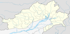
Category:Rivers of Arunachal Pradesh
Appearance
States of India: Andhra Pradesh · Arunachal Pradesh · Assam · Bihar · Chhattisgarh · Goa · Gujarat · Haryana · Himachal Pradesh · Jharkhand · Karnataka · Kerala · Madhya Pradesh · Maharashtra · Manipur · Meghalaya · Mizoram · Nagaland · Odisha · Punjab · Rajasthan · Sikkim · Tamil Nadu · Telangana · Tripura · Uttar Pradesh · Uttarakhand · West Bengal
Union territories: Dadra and Nagar Haveli and Daman and Diu · Delhi · Jammu and Kashmir · Ladakh · Puducherry
Former states of India:
Former union territories: Daman and Diu ·
Union territories: Dadra and Nagar Haveli and Daman and Diu · Delhi · Jammu and Kashmir · Ladakh · Puducherry
Former states of India:
Former union territories: Daman and Diu ·
Wikimedia category | |||||
| Upload media | |||||
| Instance of | |||||
|---|---|---|---|---|---|
| Category combines topics | |||||
| Arunachal Pradesh | |||||
region administered by India as a state | |||||
| Instance of |
| ||||
| Location | India | ||||
| Capital | |||||
| Legislative body | |||||
| Executive body |
| ||||
| Head of state |
| ||||
| Head of government |
| ||||
| Inception |
| ||||
| Population |
| ||||
| Area |
| ||||
| Replaces | |||||
| Different from | |||||
| official website | |||||
 | |||||
Subcategories
This category has the following 14 subcategories, out of 14 total.
D
- Dikrong River (4 F)
- Dirang River (5 F)
- Dri River (13 F)
K
- Kameng River (27 F)
- Kamlang River (2 F)
N
- Noa Dehing River (4 F)
P
- Pakke River (11 F)
S
- Siyom River (1 F)
T
Y
- Yargap Chu (3 F)
Media in category "Rivers of Arunachal Pradesh"
The following 28 files are in this category, out of 28 total.
-
Arunachal Pradesh rivers and their basins.png 2,212 × 1,166; 1.87 MB
-
Arunachal rivers and basins.jpg 1,130 × 589; 1.01 MB
-
Arunachal Pradesh 1.jpg 4,128 × 2,322; 4.63 MB
-
Arunachal Pradesh 3.jpg 4,128 × 2,322; 6.5 MB
-
Arunachal Pradesh 4.jpg 4,128 × 2,322; 4.6 MB
-
Arunachal Pradesh.jpg 4,128 × 2,322; 5.23 MB
-
Dihing River.jpg 1,396 × 640; 121 KB
-
East Siang, Arunachal Pradesh - panoramio.jpg 2,400 × 3,200; 2.83 MB
-
Emuli village and village leader. (7453891984).jpg 1,816 × 1,229; 1.33 MB
-
Farms and Forest, Martali village, Eastern India 2012.jpg 1,816 × 1,229; 1.28 MB
-
Gandhi Bridge, Jenging, Arunachal Pradesh.jpg 4,000 × 3,000; 9.67 MB
-
Jp photograpy.jpg 3,264 × 2,448; 3.21 MB
-
Kimin, Arunachal Pradesh.jpg 2,048 × 1,536; 1.11 MB
-
Landscape Namdapha Aparajita Datta.jpg 3,008 × 2,000; 718 KB
-
Magoni river.jpg 3,264 × 2,448; 342 KB
-
Mountain, rivers and dams.jpg 4,032 × 3,024; 1.5 MB
-
Mountains and vegetation in Taflagam, Arunachal Pradesh 08.jpg 590 × 1,280; 152 KB
-
Mountains and vegetation in Taflagam, Arunachal Pradesh 09.jpg 607 × 1,280; 216 KB
-
Mountains and vegetation in Taflagam, Arunachal Pradesh 11.jpg 590 × 1,280; 168 KB
-
Namdapha from the air Aparajita Datta.jpg 2,048 × 1,536; 229 KB
-
Namdapha river-Dihing river Valley at Firmbase Aparajita Datta.jpg 2,048 × 1,536; 1.31 MB
-
Nature click by JP.jpg 3,264 × 2,448; 3.46 MB
-
Nongkon stream (10.1371-journal.pone.0147283) Figure 3.tiff 1,739 × 1,306; 1.46 MB
-
Nyamjang Chu and Tawang Chu rivers mapped by Morshead and Bailey, 1913.jpg 1,121 × 1,837; 934 KB
-
Park-USF boundary at Deban in Namdapha.jpg 2,048 × 1,536; 1.39 MB
-
River in north east.jpg 4,320 × 3,240; 3.2 MB
-
Track from Anini (7453897042).jpg 1,816 × 1,229; 1.2 MB


